Bear Creek
near Wilbur Hot Springs to Cache Creek Conf.

| Difficulty | IV |
| Length | 12.2 mi |
| Avg Gradient | 50 fpm |
| Gauge | Bear C Ab Holsten Chimney Cyn Nr Rumsey Ca |
| Reach Info Last Updated | November 6, 2023 |
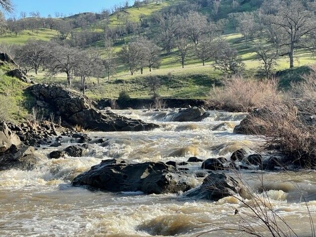
Perhaps the trickiest intermediate Class III/IV section in NorCal to chase for an ideal flow window. Bear Creek spikes and drops quickly, and many a boater have been known to cowboy camp and kill time around Cache Creek waiting for just the right amount of water to chase the Ursas (ask me how I know, as Trent Pearce would say). The main features of the run are 4-6 ledges known as the Ursas, most of which you can scout from roadside pull-outs and/or short walks.
As a tributary to Cache Creek, you can expect the same oak woodland/chaparral landscape you'd find there.
Those wanting a Class II/III run can also get out before the Ursas and walk along the road to meet up with your braver friends.
A shorter run can be done be using the alternate put-in below, which gives you a 5 mile run with 73 fpm average gradient. For a longer run, combine this with the Rumsey run of Cache Creek.
Other information sources:
Mar 15, 2023
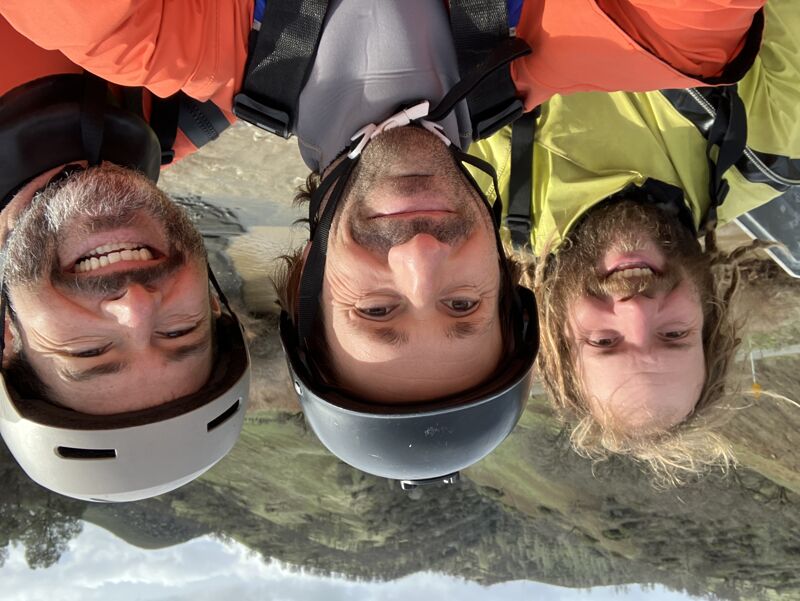
My buddy and I ran this section at 560 cfs in a Sabertooth (12' raft) and it was pretty awesome for a quick run, but definitley a timing game to hit the flow window. The gorge section between the road bridges was especially fun with really cool rapids.We got done with the full run, including a couple scouts plus lunch break in about 2.5 hours.
For flows in rafts, definitely thought this was on the low side, but pretty ideal for ease. Something a little higher like 600-900 cfs on the gauge at put in might be perfect for rafts.
Once you get past the second bridge (where the High Bridge Trail parking is) the very next left turn has a nasty eroded rock seam in the middle of the river. If there was a little more water, we probably could have easily gone far left or far right, but wiht those flows we couldn't easily get to either. The middle had some vertical undercut rocks seams probably from the recent storms. We pushed hard to river left to intentionally to get hung up on the shallow rock to avoid these seams and to scout. Thereafter we worked our way down the small left side drops before a final ledge leading back into the main current. See pics below. Please be aware that this seam looked perfect size for sticking a tube of a raft or a full kayak and I would strongly recommend avoiding. We did not expect this rapid as there is really no mention of it and cant see it from road scout.
There is another pretty stompy surprise hole in a river wide horizon line about 0.5-1 mile further downstream that you dont really see from the road either. Left side is a steep drop into a stompy hole but with more water you can probably run center ski jump/boof line or even far right boof line as well.
We Put-In just upstream of the top Bridge (~ a mile downstream of Cowboy Camp). We took out at Cache Creek River Access which is the next take out after the confluence of Cache Creek.
PS: Cache was cranking at 5,500 CFS and had some solid waves in it if you have more time to paddle further downstream adn enjoy the wave-trains.
Jan 8, 2023
It's pretty up in here. We did this section while waiting for the lower section to drop to a safer level but ended up only doing this due to some leaks we had to repair. If you time it right, you could do this upper gorge right after a rain, skip the middle flatter section, and go run the Ursas for more thrills.
Jan 1, 1900
River spikes fast during heavy rains.