Geddes Creek
Groveland Rd to the Tohickon Creek Confluence
| Difficulty | IV |
| Length | 1.9 mi |
| Avg Gradient | 200 fpm |
| Reach Info Last Updated | November 28, 2011 |
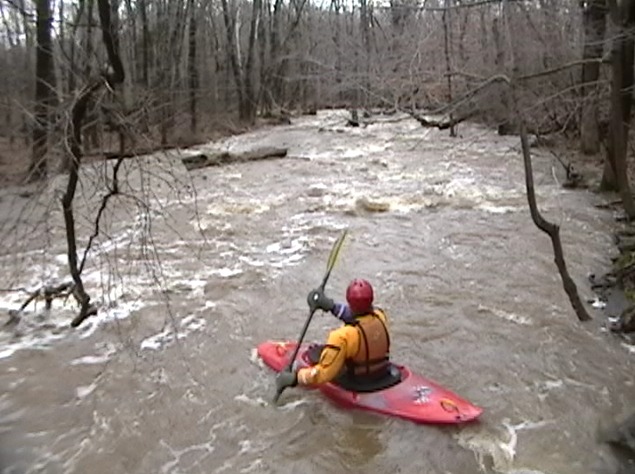
Geddes is a shallow fast creekbed. A roll almost always means grazing a rock while upsidedown. The run may be done as a 2 mile or 1 mile run. The first mile is easier and a bit less continuous. The upper mile ends at the closed steel bridge (on tollgate road) where a tributary comes in on river right. At times this is a very significant merge of water. You can easily hike back to the 2 mile putin by the river left side on tollgate road.
Many boaters like to warm up in the upper wider and thus scratchier mile but the creeker that wants the best goods often drives Tollgate rd to the closed bridge (1 mile putin) and runs laps from there. Note the road that parallels the lower mile is closed due to the road falling into the creek gorge (without creek obstruction). There is very limited parking at both the 1 mile putin and even less at the 2 mile putin. Pack it in as best you can. Whatever you do, DO NOT BLOCK the land owners driveway on the narrow road right at the 1 mile putin on Tollgate road.
Geddes is known as a very difficult creek to get on because it flashes out very quickly. Unless the water is Very High I wouldn't even bother driving from the takeout to the 2 mile putin if the rain is still not falling. The paddler that drives to the creek before the Tohickon Gauge rises will get on Geddes. By the time the Tohickon rises Geddes is often gone. It is frequent that the creek will fluctuate half a block during your run plus/minus . The Wick guage across the river in NJ rises as quickly as Geddes and is the key to know when to drive to the Geddes putin. If the Wick spikes and the rain event isn't expected to end soon drive and likely get your Geddes run.
AREA Creeking: In the way of utilizing the rain the best, you get on Geddes 1st, then the Wick in NJ (to covered bridge) followed by the Lock in NJ for the best local triple crown day. Don't run the whole Wick (lower)...its not on par with the
...
Upper Putin @ Groveland Road
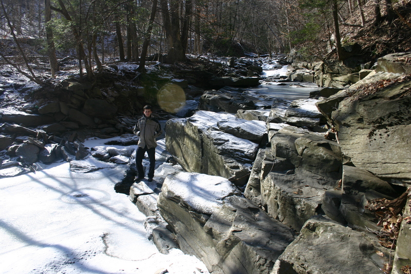
This is the 2 mile run putin. Very limited ditch parking best for a truck or subaru 4x4. Putin on river right downstream of the bridge. The Bobsled ride takes off slow give it a bit. Expect it to be a shallow scrapy start. You'll get back near tollgate road in about a half mile.
The immediate scratchy start at the 2 mile putin. The gauge read about 6.25 blocks at the takeout. The rain had stopped. We left for shuttle reading aprox 6.25 exposed 5 minutes before this picture was taken. Geddes dropped roughly 10' to 6.75 blocks exposed by the time we finished. 6.75 is a doable ELF level if the creek is not dropping but the creek is usually never stable just rising or falling.

Major Left bend rapid. There is an eddy at the top and the creek distinctly narrows picks up with a more committing feel bouncing over random small boulder rock formations. Most boat scout from the eddy.
There will be a small eddy for your group on river Left but already you'll appreciate an eddy where your whole group fits. From the eddy you can see most of what is going on in this small ledge drop. Its just big enough you want to pop up and take a peek that there is no wood hiding in it. A very straight forward sluice to skip through. You are now very close to Tollgate road just on the otherside of the house. The land owners sometimes talk to the boaters. Be quite in their back yard if you get out of your boat. If anyone needs to walk out, do so just downstream of the property in the woods. Below this drop the creek ramps up again and flumes along. Strainers have been an issue for the next 4 tenths of a mile down to the Steel Bridge. Getting out and finding those emergency half boat eddies has been an issue in this stretch, but not usually for the hardened class 4-5 creeker.
The closed steel bridge putin is called 1 mile putin as well. This putin gives you the best bang for the buck and is a quick run to lap. Boat abuse is less as well starting here.
Note that there is room for 6 cars tightly parked on the river left sided on tollgate road. Across the closed bridge there are 3 other spots are available should you need it. If you change clothes at this putin you will be within 10 feet of the house....Please don't do it. Change at the takeout first.
go to the left or the right depending on wood being absent.

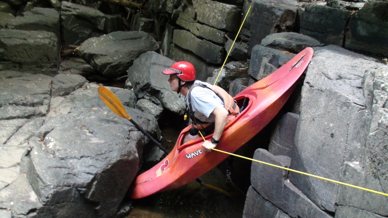
About 200 yards downsteam of the closed steel bridge Putin is the biggest ledge drop (6ft) on the river with the biggest hazard, it's known as the Hairy Clam Shell AKA Stone Trap. The read and run line leads directly into the pinning rock. Boof on the Left of Center has worked well and sneaking far left at high water is common. Portage if needed on Left. There isn't a super eddy on left but slow water makes a quick jump out of the boats very possible when you spot a distinct horizon line.
Note that there is the start of significant fluming going on * getting\* to the Hairy Clam drop that would be a named rapids elsewhere....I leave it out intentionally. Bigger and faster bobsledding lay downstream.
There are few larger eddies for several boats. Look for a large eddy on Creek Left where 4+ boats could get out fairly easily. In this eddy you should be able to see the biggest horizon line yet seen on Geddes. Scout it on Left. If this is Stone Trap it will present as a creek wide ledge 4-6 feet high. Note the unusual Triangle Point Rock on the pour over lip. Its marks off about 1/3 of the creek's width, in from river left. On River Left (Left of Triangle Point Rock) is a sneak stepping down some smaller ledges. This is the safest playboat line. The main hazard on Geddes is in this drop just right of center. There is a vertical pin block that is about 5 feet wide and will trap your bow especially the bow of a shorter play boat with low bow volume. Most creek boats seem to glide over the 'Clam shell' pin block. This block is not visible at 6 blocks exposed on the gauge and will be undetectable during a scout.
Funny thing is that the Stone block is near a perfect rectangle block and not a clam shell at all.
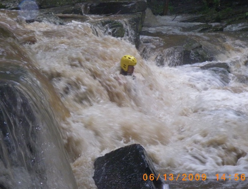
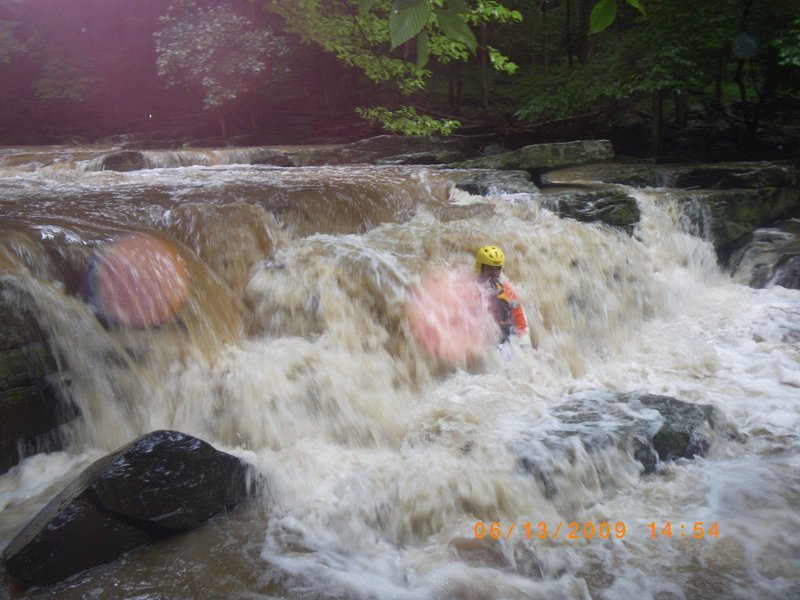
Paddlers who finish the Tohickon during a big rain see creekers ready to jump on geddes. They opportunistically think they can jump on geddes with a playboat just fine. Very good Play boaters should have someone 'In the Know' to keep them out of this vertical pin line. At high levels (less than 6 blocks exposed) the pinned boater would be in a head underwater pin situation.(see photos) 'Don't take a knife to a gun fight.....take the playboat somewhere else or have a very good guide. My first day on this creek Nils and crazy rick told me 5 out of 5 playboats they saw do that pin line pinned and one guys was breathing out of an air pocket with water crashing over his head.
The next big spot is Ass F***K Falls. It sports a natural low head dam effect on the river Left with a power tongue on the right. The tongue wants to slam you into and under a huge river right root ball. Under there is roots, fins of rock and its real nasty on the downstream side of this rootball. Its been getting more erroded and actually cleaner as time goes on. Many class 4-5 boater have had a swim at this spot. The hot read is to go left to cheat the line dealing with the root ball....leading over the low head dam pour over. Without driving strokes you can end up in the strong hole. Make sure your group knows that you can duck down and swim out the side of a hole underwater with the out flow. It is particularly helpful in this spot.....the site of my first class 4 swim. (Wayne Gman)
Read and run leads right into this pin with a nasty piton. Extremely Low Flow but boatable. Healthy flows make this a very difficult situation. (click on the pic details for specifics)
SEE the gallery for pics of this hazard Dry.
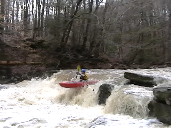
This is the rapid that is so unique to Geddes. The right down to left tilt of the broken slab riverbed creates a sloshing flume of water with loads of character crashing on left periodicly (key on sloshing). A very fast flume of water. Strainers will be unavoidable so scout the long rapid first. The Bobsled ride ends in a big hole at a big eddy for Geddes.
Work right over the last horizon line of BobSled rapid to setup up the right side punch though of the hole. If you get too greedy on right you'll be grabbed by the stronge eddyline and be forced fed into the hole that will quickly make you its girlfreind. If done right the whole paddle group can regroup a safe distance from the hole in the river right eddy.
The Mile Marker for this rapid is VERY guestimated but is just placed for relative to other rapids use. There are other features on the creek that would get names elsewhere....be on your toes.
Once the most feared rapid on the creek causing a startling number of swims and lost boats. The hazard is a uniform ledge on river left to the middle of the creek that caused a LOW HEAD DAM effect. Either rock fell in or part of the dam wall has blown out since 2006 and it is much less the keeper these days.
The line was a good boof over the Left ledge or a cool 'S' move around the ledge hole and very close to river right under an ugly erroded tree rootball with roots that would grab at the paddle and fins of rock partially exposed in the mud wall under 'in there' that would seem to 'come at you' like knives if you got pushed against the wall into the mess. The river bends to the left in this whole mess. At low water it's pretty easy to stay center and miss it all.
Mileage of the rapid is very guesstimated and only represents relative position to other named rapids.
The Rapid with the first river right creekside house is a good one with a good view. Look ahead at the bottom right bend. Look for wood as it tends to pile up here.
True to the other rapid descriptions here there are features being left out that would have names on other creeks. In general note that strong boated lines on the river left side tend to be favored thoughout the run. Finish the run in good style over quite a few more ledge drops.
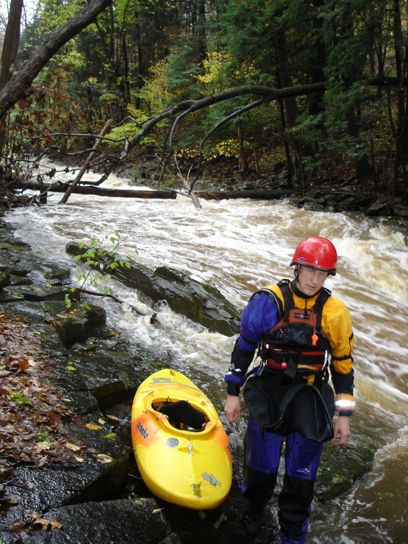
Check the tohickon hill guage and see how much the creek dropped during your run.
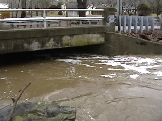
Take out at the confluence with the Tohickon. 5 car parking
Apr 2, 2017
Got on the Geddes March 31 2017. No strainers from toll gate put in to tohickon take out
https://vimeo.com/211133767 long edit
https://vimeo.com/211138670 theatrical version
Nov 28, 2011
Just too low to run as an Elf run paddlers work the concept of line assited wading/crossing
Nov 3, 2011
Perfect Boof line for all levels on this 6' ledge drop @6.5 blocks exposed on the gauge. About 6 feet to the river right of the paddler is the 'clam shell' pinning rock. Particularly an issue for playboats.