| Difficulty | I-II(III) |
| Length | 2.4 mi |
| Avg Gradient | 15 fpm |
| Gauge | Chattahoochee River at Buford Dam, Near Buford, Ga |
| Flow Rate as of 30 minutes | 636 cfsrunnable |
| Reach Info Last Updated | March 2, 2015 |
River Description
This attractive run, appropriate for giving beginners a taste of whitewater or a bit of low-pressure intermediate for non-release flows.
When the dam is releasing the difficulty increases to Class III+.
A siren sounds prior to opening the gates as warning to flow start. New boaters call ahead to check releases so you don't get caught. See Will Gosney's narrative below for more details.
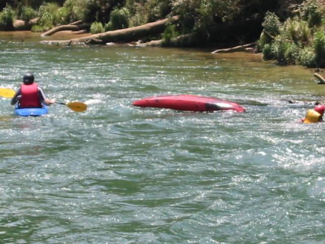
The water quality is much better than 30 miles downstream; trout can be seen swimming along the bottom. It's COLD, since they intake the nice clear water 40 or 50 feet below the lake surface. The only hazards are strainers and the water temp. Although surrounding development has been heavy over the last decade, the river corridor there is still pristine, thanks to the Chattahoochee NRA and the efforts of the Chattahoochee Riverkeeper organization.
Put-in is just below Buford Dam at the southern end of Lake Lanier near Buford, GA. Drive across the dam to its western end and immediately hang a left through a gate onto a steep dirt road that winds downhill to a nice park on the west bank just below the dam. There's lots of free parking, picnic area, boat ramp and restrooms. This area typically gets gated shut at dark or 5PM, with remaining cars towed away, so plan your trip accordingly.
Half a mile or so below the put-in the river is split by Bowman's Island. You can run right or left; either side takes you down a quarter mile of Class I-II shoals until the flows merge again at the southern end of the island. There's lots of big, rounded, mossy rocks to keep things interesting. Good place to practice rockspins, ferrying and midstream eddying.
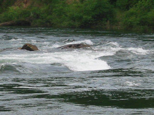
Another mile or so beyond this point the river disappears around a left-hand turn marked by a large gravel bar on river left. Around that bend is the best whitewater feature on this section, where a rock ledge extends across the river. Most of the water bangs into a big obvious truck-sized boulder (the 'Hump')
...River Features
Put In
Access PointDistance: 0 mi
The Hump
Access PointPlayspotClass: II+Distance: 2.5 mi
Rock ledge extending from left bank with 2 chutes. Right chute is an S-turn; left pours into a hole.
Trip Reports
Log in to add a reportRP
Play wave @ the hump - Robert Pope
Sep 9, 2022
The wave at the hump is sick! 3 of us had a party surf going for like 30 minutes straight. Plenty of room for 3 full slices to throw down. We hiked up from the new parking area at Hw 20. When we got there the river was completely covering the hump rock and then within about 30 minutes features began to show as they stopped releasing water. We had at least an hour and a half of ever changing features including several different waves and eddy lines. Great after work spot. Make sure to call ahead for release info.
SK
Sullivan Keel
Jun 25, 2009
Did this run yesterday at dam release at just around 1300 cfs. We went from buford dam to abbotts bridge around a 15 mile run. It took about 4-5 hours. First 8 miles or about 2 hours was great. We didn't have to paddle until we met the occasional rapid and would float quite swiftly down the river. We only went through one good rapid I believe between our 2nd and 3rd mile which was a class III which was a blast. The last two hours of the trip however we had to continuously paddle to move at a descent rate. Had a great time and would recommend only at dam releases. Also there are no rental places that are allowed to rent you a kayak or canoe 2 hours before dam release.