Piscataquog, North Branch
Lake Horace to Everett Reservoir
| Difficulty | II-III+(IV) |
| Length | 6.9 mi |
| Avg Gradient | 42 fpm |
| Gauge | South Branch Piscataquog River Near Goffstown, Nh |
| Flow Rate as of 51 minutes | 20 cfsbelow recommended |
| Reach Info Last Updated | June 18, 2025 |
On a Saturday in mid-October, approximately 450 cubic feet per second (cfs) will be released into the North Branch of the Piscataquog River from the Horace Lake Dam in Weare.
This release starts at 8 AM and will be reduced to near normal levels by 4 PM that same day. The level may drop earlier if there is not enough water in the lake. DES reminds people that canoeing and kayaking have inherent risks, and paddling the state’s lakes and rivers is at the paddler’s own risk.
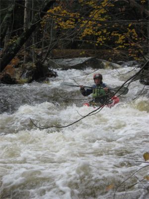
This is a 7+ mile, class III-III+ combination of technical drops, swiftly moving water and flat water through woods and scenic countryside. The river is narrow, less then 20' wide in many spots, providing a tight-but-passable run with many branches and blow downs that can protrude into the river. At times a paddler has to move carefully and occasionally pull off to scout or to portage an obstacle.
Here is a recent video of the entire run to Peaslee Rd.
https://youtu.be/NWc6OGufgqI?si=VgnhsFkV9FT0\_oab
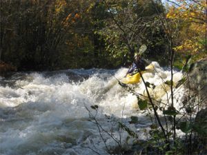
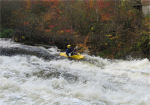
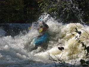
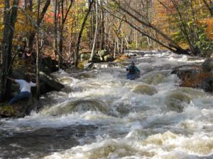
The river starts with a bang in swiftly moving water, channels through the trees, and few eddies. It quickly takes paddlers to the first class III drop, Slab City Ledge, and short-but-intense abrupt drop visible from the second bridge. Most paddlers opt to paddle center or far-left just kissing the wave-hole along the edge. The right side is full of rocks.
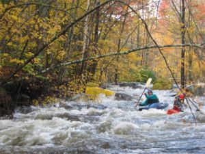
The next drop, Woodbury, offers a technical slide for the canoers and a creeky side run for the kayakers. It's followed by a number of smaller rapids.
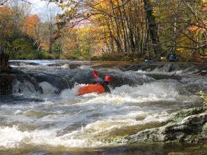
About half-way down the river is the 'Big One', a big wide-open double-ledge slide-drop at the remains of an old mill. It starts with a slight drop over the remains of a dam, down the double-ledge slide, then a run-out through more rapids and holes. Most paddlers follow the curler down a rocky bouncy route and then through some holes at the bottom. The river is sh
...
This is the site of a former dam. The drop is about 8 vertical feet and is best run slightly river left of center right into a ski jump roostertail. If you run too far right of center you will piton off a piece of protruding ledge. Just below the drop there is a good eddy on river left right beside a great play hole/wave (Slab City).
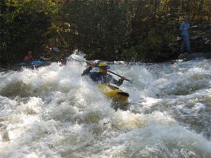
Great play spot just downstream of the First Drop Ledge. Eddy out river left to access the hole/wave.

The gage is painted on the downstream side of the river-right bridge abutment on the John Conner Road bridge.
Four-tenths of a mile after the gage the river passes under the New Hampshire Route 114 bridge. Shortly thereafter at mile 1.5 is the start of Chase Mill Rapid. Named after the mill site that once occupied this stretch of river. Chase Mill is rather straight forward with multiple routes through broken ledge and boulders. Be careful here since strainers are common.
Another quarter mile paddle will bring you up to Woodbury Rapid. Once again this is another mill site that washed out in the great flood of 1938, there is evidence of the former mill buildings on river left of the rapid but be respectfull of the current landowners property here. The rapid starts out with a small constricted ledge drop at river center and continues through a series of holes and drops right up to the Woodbury Road bridge. Keep in mind that this rapid is also notorious for collecting strainers.
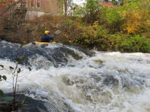
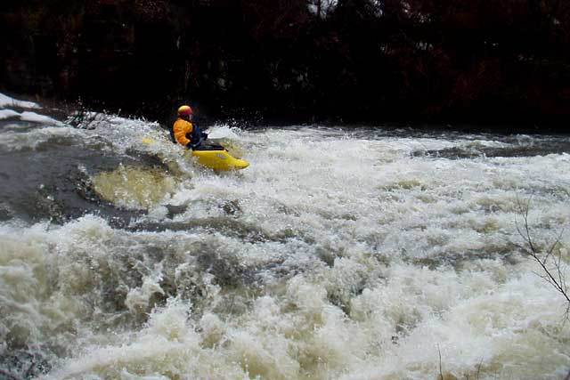
At a hard left turn you will come up to the most visually impressive drop on the North Branch. The Big One is the site of yet another former mill dam. At the very top of the drop is a nice playable river wide hole/wave but be aware of the chaos that awaits you below. Since the river is fairly wide here it takes a lot of water to keep you from scraping your hull. The most fluid run is just left of center over a couple good ledge drops then continues another 50 or so yards over a gradual downhill slide. The water here is shallow and chaotic. Near the bottom there is a large hole jutting out from river right that is easy to punch through. Far river left there is a smaller hole jutting out from river left that can be very sticky at certain levels.
After 'The Big One' you will pass under the New Hampshire Rt 77 Bridge. Another mile or so of class IIish water will bring you up to a rusty steel truss bridge that carries River Road. Just under the bridge is the top of Buzzell Hill Rapid. This rapid is fairly long with a series of ledge drops each followed by a hole. A competent boater should be able to boat scout the entire drop. At the bottom there is a nice recovery eddy.
A little less than half a mile from Buzzell Hill you will encounter Turnover Ledge. This is a fairly straight forward double ledge drop with a rather sticky but playfull hydraulic at the bottom on river right. This hole is quit dynamic and will flip boaters end to end hence lending its name... Turnover.
The first take-out is where the river passes under Peaslee Road. There is limited parking here and no privacy. The river below this point is class II-III with quickwater and some flatwater between each rapid.
The middle take-out is where the river passes under East Weare Road (dirt), a quarter-mile from the main road (called Barnard Hill Road on some maps). This road is full of deep potholes and water hazards due to beavers. It is sometimes gated on both ends requiring a long carry to your car.
The lower take-out is another 1.5 miles down East Weare Road from the middle take-out; or from Route 77, turn right on South Sugar Road, drive to the end, then left and a short distance to the take-out. This is just above where the river flows into Everett Lake.
Oct 16, 2021
Lazy GPS address for the put-in: 43.107801702340964, -71.77100479602814 Roughly near the corner of E. Shore, Nichols, and Resevoir
And for the Peaslee Road takeout (respect driveways and private property near there).
10 Peaslee Rd, Weare, NH
43.108299082681896,-71.70909404754639
Apr 26, 2019
The dam inflow information page on the flow page seems to be down. This page also has information under the project status information at the bottom https://reservoircontrol.usace.army.mil/NE/pls/cwmsweb/cwms\_web.cwmsweb.cwmsindex
Nov 10, 2018
Three weeks after the last release there are now two portages needed for river wide strainers. Boat scout carefully and check buzzell's during the shuttle.