Todd Fork
Middleboro Road to Pike Street
| Difficulty | I-II |
| Length | 8.5 mi |
| Avg Gradient | 20 fpm |
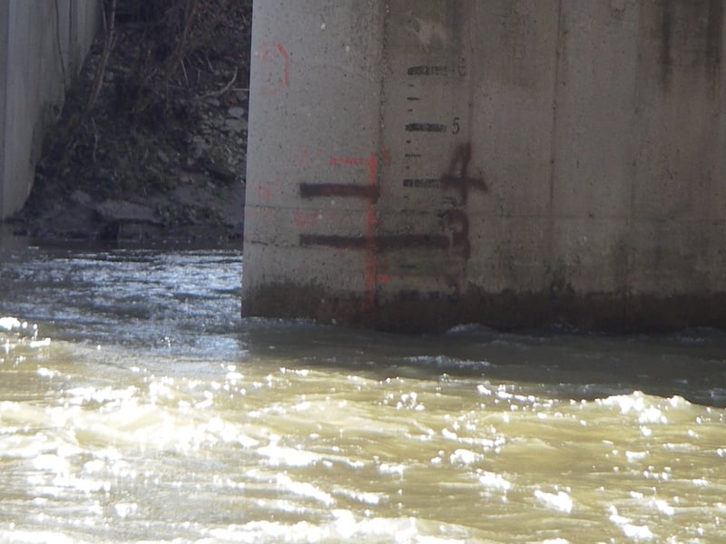
| Gauge | Little Miami River at Milford Oh |
| Flow Rate as of 24 minutes | 5.22 ftbelow recommended |
| Reach Info Last Updated | August 28, 2017 |
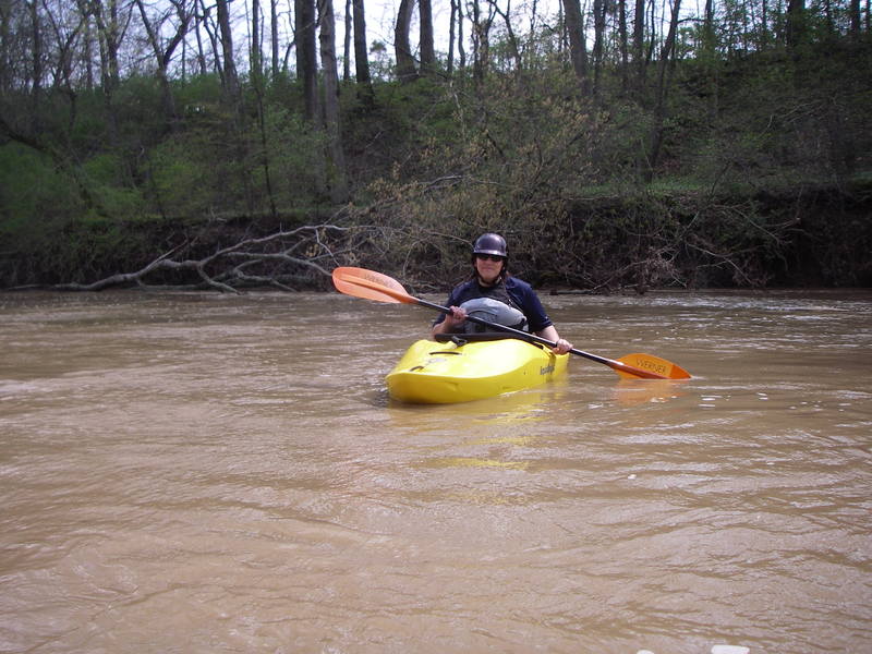
Todd Fork is a fun run on which to learn or refine basic whitewater canoe and kayak skills, with relatively frequent rapids, some having technical merit (e.g., strainer avoidance, some maneuvering in rapids to avoid rocks, etc.). Some local outfitters put canoes on Todd Fork when their primary choice (the Little Miami) is too high.
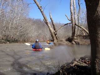
Strainers are a random but recurring concern. Toward the end of the run, near Morrow, one river-left channel (having more flow than the river-right channel, thus seeming the preferred route) had two strainers in rapid succession, which could not be seen very much in advance by boat scouting. A downed tree extended most of the way across from river-left, and a root ball took up the river-right third about twenty feet downstream. The tree was duckable in a kayak (at 3' level on the gauge), but had not enough clearance for a canoe. The river right channel looked uninviting with a choked-off entry, but was clear afterward. Many side channels which are only runnable at higher levels can not be river scouted and often contain blocking strainers. Large rains move large debris into and out of rapids. Bottom line, if you can not see well-down it, you should probably not enter into it!
At 1' to 3' on the painted Middleboro Bridge gauge (approx. 6.0' - 8.8' on the Little Miami), Todd Fork is runnable in open canoes and recreational kayaks. Some experience is recommended. Levels from 3' to 6' on the Middleboro Bridge gauge (approx. 8.8' - 12' on the Little Miami), require a bit more skill, but are not unduly hazardous. Intermediate skills are suggested at these levels and beyond.
Some rapids rate II+ in higher water due to maneuvering requirements and the possibility of unpleasantly long swims. The most difficult features for novice boaters may be two right-turns (close to Morrow) where the main flow runs into river-left banks. These features are easily visible (for anyone looking downriver attentively), and sneak routes are avai
...Feb 27, 2018
Todd Fork is running. It's flat with some riffles, which is good if you're not looking for any whitewater. A word of caution about the put in: DON'T PARK ON RIVER RIGHT UPSTREAM SIDE! This is the obvious place to put a vehicle, but the shoulder is way too soft and steep. Don't park there. Drop the boats and then go back down the road a ways to a more solid berm or go up to Clarksville and put in there. This will add probably a couple of miles to the trip.
Jul 20, 2010
gauge on this page little miami guage in milford was 6.5 ft and river was NOT RUNNING...... guage should read @ LEAST 7.5ft
IDEAL level is 9ft plus
May 6, 2009
Team Hobo here again, We just got done running the strech from Clarksville Rd. Inlet to Morrow, Outlet. Aprrox 8miles and 3 hours or under. Ran it a estimated 5-6 feet which seemed low considering the drop in elevation at points, We see the real potential here, was even fun at the lowest possible lvl to run our humble opinion, Can't wait to run it at 10ft or more boy would it really rock them. Plan on doing Paint Creek when water level is right, Team Hobo Out! Happy Creek running and water action, stay safe!
Feb 22, 2008
After you go in at Middleboro RD the first tressel you come to is where my family's property begins and goes to the next tressel. I have spent the biggest part of my life on that part of the river and find it to be one of the most beautiful places on earth. When the river is high enough I would suggest it to anyone. I used to have a farm party with live bands and go-cart racing all day and night. If you're floating down the river and hear music stop in and say hi.
Jeff Pence http://201frontstreet.com