Mill River
2) Clarendon Gorge(Rt. 103-Rt. 7b)
Mar 10, 2024
We ran the Mill / Clarendon Gorge 3/9/24. Previous high water events have changed some of the river features. The very first lead-in rapid is a little different, but no more difficult than it used to be. Also, the second to last feature in the lower gorge, there used to be a large flake rock that created a hole on river right. This flake cantilevered on a smaller rock, and has now collapsed reducing the size and power of the hole. Lines on the right now have fewer consequences, but there is a large tree on river right just below the drop that one of our crew got tangled up with. It's best to scout this one on river left just to eyeball a line.
The 2100cfs level (Otter Creek gauge) we had made for a perfect medium level.
May 24, 2019
Ron and Linda Evans appear to still be battling the very few boaters who run this stretch of navigable river. The property was up for sale a few years ago, but they now appear to be cashing in on the AirBnB trend. Good grief.
In short, they cannot prevent a paddler from scouting (below the high water line) or running the Mill Rapid. Just like every waterway in Vermont, the water is owned by the people of the state.
If confronted (and you will, because busy bodies), and can no longer ignore Ron, be polite, and know your rights before you put on. Bring copies of the law if needed. They don't want paddlers running the mill rapid since it's the only LEGAL way past their property (and into their private swimming hole) which Ron and Linda are all too proud of in their real estate listing. Copied below for posterity.
'While possible flooding is a downside, those in Rutland County know the mill’s location is special. It used to be a popular swimming spot, until it became too troublesome to manage and the couple decided to deny public access. The contentious issue resulted in at least one encounter with an angry local wielding a weapon, Evans says.
Because there's no public access, the new buyers will have their own private swimming spot.'
Apr 27, 2019
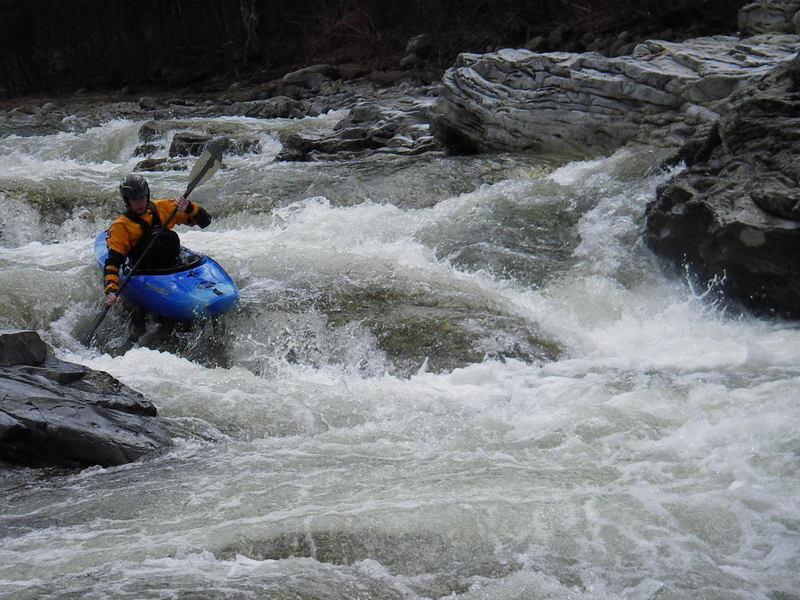
Ran the lower gorge in April 2019, seal-launching off the cliffs 10' into the pool below the large waterfall. The run was class IV at 2400cfs on the AW gauge, super pushy and fast, a few big holes that were sticky, and one log jam on river right halfway down that needs to be avoided by staying left.
Side note - I had a run-in last year with the folks who live next to the Mill rapid, it was late summer and extremely low, too low to boat and we were in the literal middle of the river walking down the rocks exploring. They came out and told us they owned that section of river, and that we needed to walk around it. As we hadn't been on the shore on either side (we started the swing bridge and walked and swam down the middle of the river to the swimming hole at route 7) it didn't really seem reasonable of them, and now see I'm not the only one to have this issue there.
Nov 7, 2018
Sorry to hear the dispute over the Mill rapid is still going on as late as 2016 as reported below. The Evan's claim to own the river bed under the water at the drop, because the deed to that property was drafted when the property was an actual mill, not a private residence. It's probable they own land on river left as well as river right, but they do not own the water way. I find it's best to simply not acknowledge their presence if confronted. Just scout and keep moving.
Stay off the left and right banks below the high water mark, which was up as high as the first floor of their home during Hurricane Irene.
They may call the police, but they're not in the right if you're below the high water mark.
This run is rarely paddled, and mostly by those with class IV ability. I seriously doubt their concern for safety is the main motivator, especially when stringing barbed wire across the rapid was mentioned as a potential deterrent. This is about keeping locals out of 'their' stretch of river.
Jun 28, 2018
The (new) gauge correlation seems off. I look for Otter Creek between 800 (and rising) -1200.
N
May 15, 2016
Hi folks,
We had an interesting conversation with the owners of the house at the 'Mill Drop' - just upstream of the covered bridge. They own the land on river right and the land on river left as well (the rocks that are best for scouting and portaging). They have seen enough people getting hurt in this rapid that they really are anxious about folks getting out to scout or set safety. Apparently they do not mind (or at-least realize it is legal) folks just paddling through.
Chandler was diplomatic enough to ask them what they would prefer paddlers who do not wish to run the rapid to do. They suggested folks take out by the boat house and walk past their house and down the stone steps on river right. It also looks like it is possible to portage through the woods on river left. Here is what I'd recommend:
Scout the drop ahead of time from the covered bridge. If the Evans are home when you are paddling, its best not linger on the rocks - portage through the woods or by their boat house, past their house, and down the set of stone steps. If you do decide to set safety or scout from the rocks, expect to be confronted.
As an aside, I am pretty sure that boaters have the right to not only boat the river, but to also portage obstacles. Federal case law seems to grant to the public a right of way between the low and high water marks for navigable rivers. In Vermont, rivers are navigable if they are boatable. And the right to portage navigable rivers has been established in federal courts. But this argument has not been tested in a Vermont court. And certainly not the right to 'set safety' which I doubt people did in the turn of the century when a lot of these cases were held.
The Evans said that a local state trooper said he would be willing to come and make someone leave their land if they asked to. So while I suspect the right to portage and scout would ultimately be upheld by the state's courts, until we as a boating community are willing to invest the time and energy into having a ruling on this, it may be best to stay off the rocks by this particular drop.
Apr 5, 2006
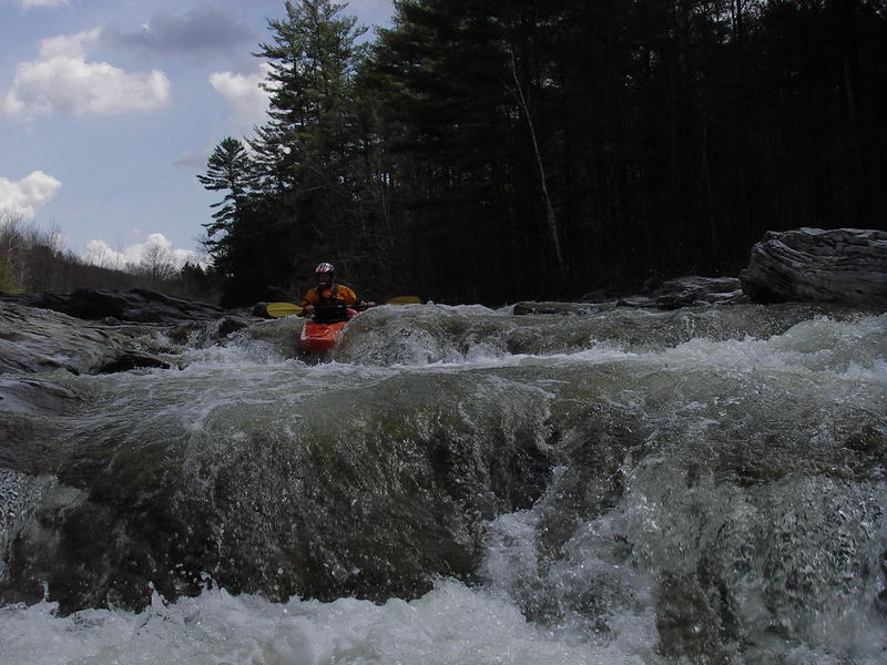
On this picture you can see the pot hole to the right..
Max did a great job of making this drop look easy..
We determined the top halve is still unrunnable although rumour is that it has been run in the past??
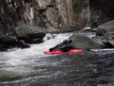
Apr 5, 2005
Max Decided that the top was unrunnable, but the last drop was. Here he is sat ready to run the last section. What can't be seen here is the nasty pot hole to the right of the drop and the horrible looking hole at the bottom.