Merced
6) Briceburg to Bagby
| Difficulty | IV |
| Length | 13.8 mi |
| Avg Gradient | 20 fpm |
| Gauge | Merced River Near Briceburg |
| Reach Info Last Updated | February 25, 2015 |
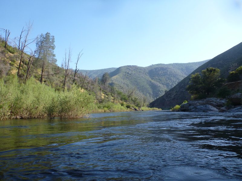
The headwaters of the Wild and Scenic Merced River begin in the iconic Yosemite National Park. The river pools and cascades through the stunning scenic landscape — glaciated peaks, lakes and alpine and subalpine meadows — to McClure Reservoir, created by New Exchequer Dam. The South Fork and mainstem [...]Read More
This section of the Merced is usually done as a continuation of the upstream 5) Redbud to Briceburg section. However, if continuing all the way to Bagby, the logistics get very different. Instead of a fine highway along the whole length, there is only a dusty gravel road for part of the ways below Briceburg. There is a long and big Quarter Mile Rapid, followed immediately by a big portage at North Fork Falls. Then there are easy rapids leading into flat water paddling on Lake McClure. Shuttle requires driving up highway 140 into Mariposa, then down highway 49 to Bagby Recreation Area on Lake McLure.
BRICEBURG TO RAILROAD FLAT, the end of road access from upstream
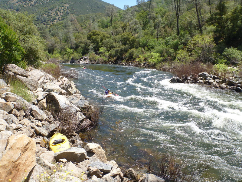
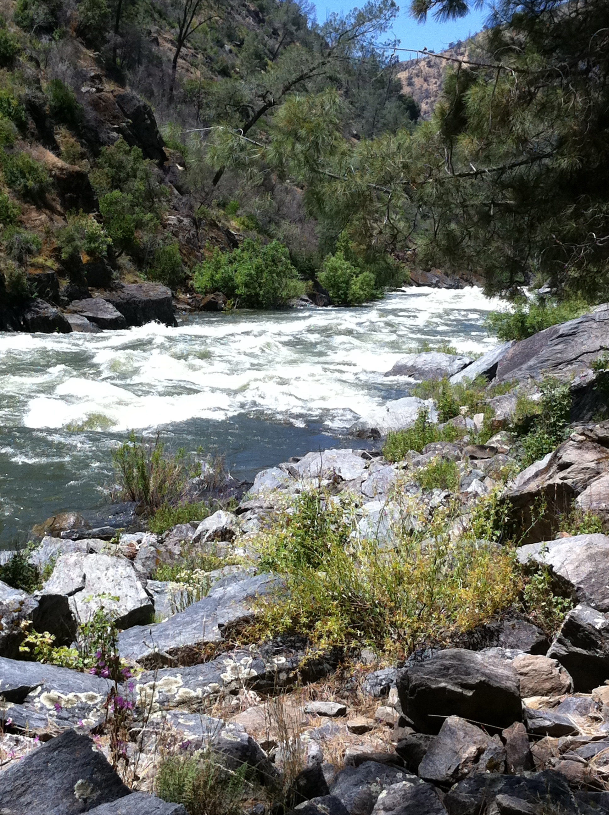
This section is very different from the Merced River upstream of this point. It still has continuous road access, but on a dirt road along the river right side. The banks are steeper with more short rocky faces, the channel is narrower, and the rapids more pool-and-drop style than the long continuous boulder fields upstream. It stays more enjoyably paddle-able at the lowest flows.
The first mile and a half or so are relatively flat, with only a couple of constrictions and/or turns forming easy (class 2+/-?) rapids. Around this point, you can see some large metal plates in the right(road) bank; on the road, there may be some large metal plates visible depending upon how much dirt is around. This is the siphon/pump station that provides the town of Mariposa with its municipal water supply, and also the site and reason for the flow gauge 'below Briceburg.' There is a good beach here at low/moderate flows.
Below this point, the river starts to accelerate until it reaches a couple of class 3 rapids close to McCabe Flat. If not careful, the first of two class 4 rapids, 'Split Rock', can sneak up on the unwary. At low/moderate flows, this shouldn't be a problem as the route is pretty
...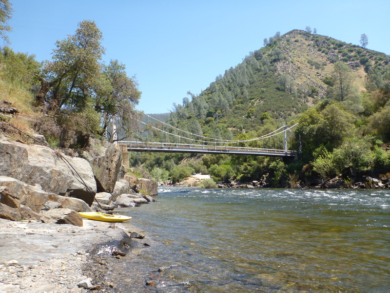
There is a big parking area with toilets. Carry boats over bedrock to the river. There is a BLM visitor center in the old Briceburg buildings. The bridge is just downstream and makes an obvious landmark.
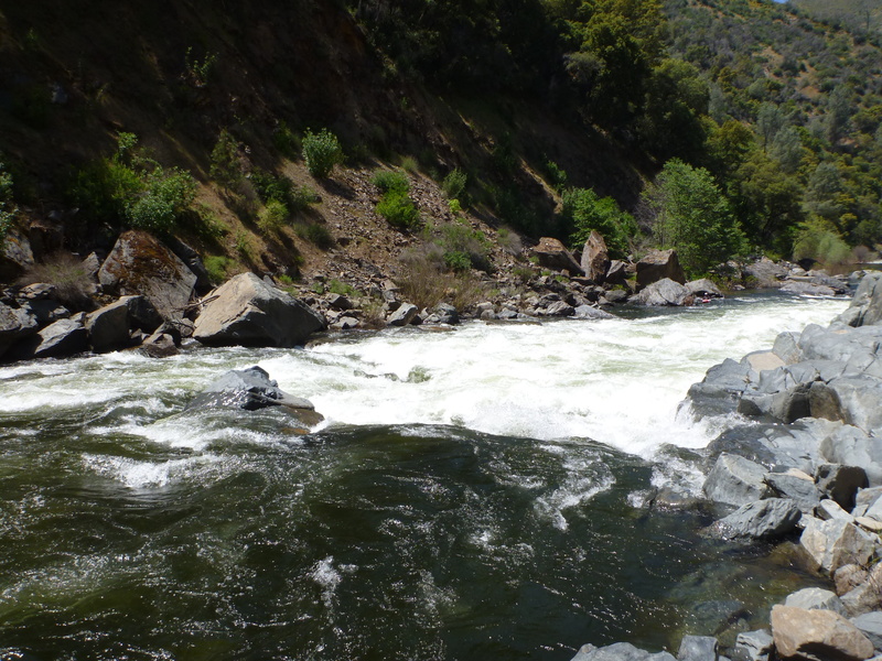
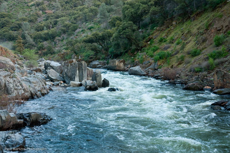
Split Rock can sneak up on the unwary. At low/moderate flows, this shouldn't be a problem as the route is pretty much straight down the middle in the tongue. At moderate/higher flows, some scary holes can form, and this rapid becomes essentially one with the next rapid, a somewhat harder (at most flows) rapid called 'Corner Pocket' for very good reason.
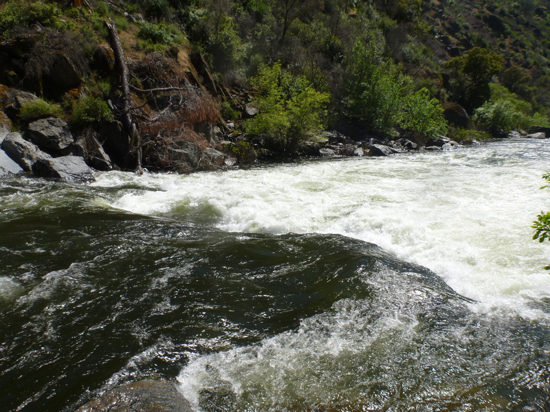
Corner Pocket can be scouted and portaged at the campground on river right, McCabe Flat. It is a rocky angular pore-over several feet tall, at the bottom of a rocky lead-in. If one enters or gets pushed too far to the left, you end up in the Corner Pocket at the bottom, river left. The first time I saw this feature, I watched six kayaks follow into this like lemmings. All six ended up swimming out, with the boats tumbling in the pocket for later retrieval. The current below the pore-over splits, and the left flow goes up against a flat wall that forms a very strong recirculating eddy. Bank access on this side is not as easy as it could be, and like everything else along this reach, infested with poison oak.
It is common to take out at the campground immediately below Corner Pocket.
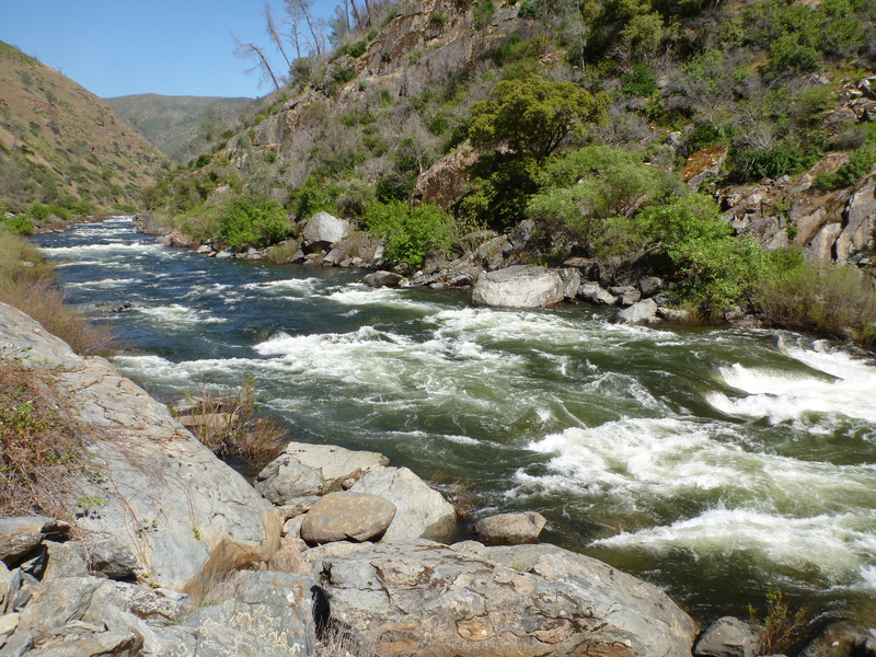
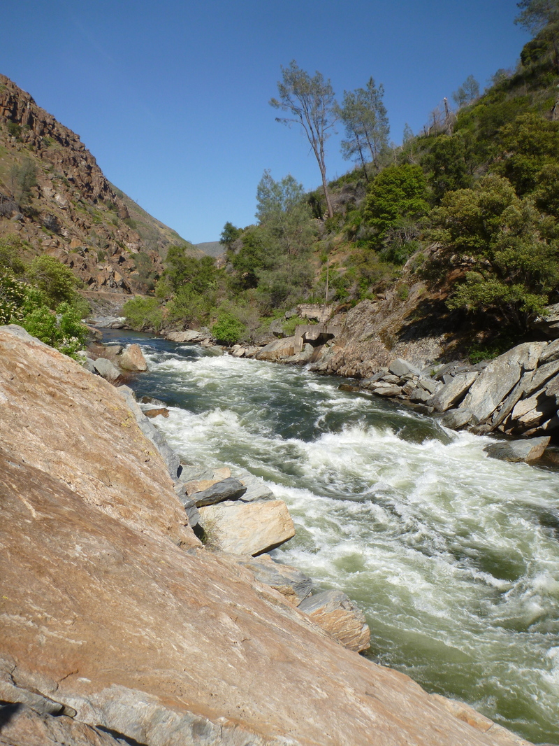
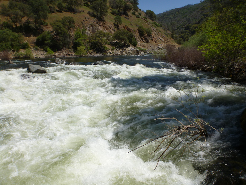
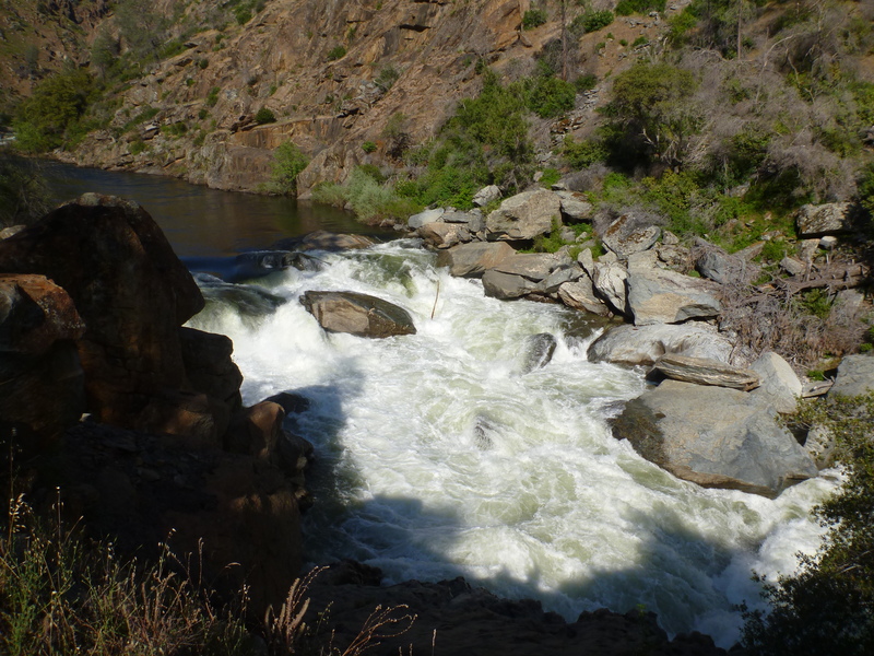
Quarter Mile Rapid has a tighter channel with continuous pool and drop features that can be boat scouted along the way, eddy hopped and dropped with continuous amusement at low to moderate flows. The actual length of the rapid is about 1/2 mile. At higher flows, the drops blend together and there is the great danger of being swept into North Fork Falls.
Mandatory Portage on River Right:
300 yards past the end of Quarter Mile is an impassible Class 6 called North Fork Falls. The North Fork of the Merced joins the Main Merced just below. At the base of the falls, there are several very large flat and blocky boulders. Much of the river flows UNDERNEATH these BOULDERS! If there is even the slightest chance of missing this mandatory portage, don't boat the rapids above it!
At North Fork Falls, there is a pipe skid rig up the right side for rafter use.

House Bill HR 869, submitted in 2011 will amend the Wild and Scenic Rivers Act to allow filling McClure Reservoir to an elevation of 877 feet. This will extend the reservoir into the Wild section and past the FERC project boundary.
The FERC boundary for McClure reservoir is a short ways past NF Falls and upstream of the reservoir full pool elevation. River elevation at this line is approximately 876 feet.
The maximum elevation of the reservoir is 867 feet. If the reservoir is full, flat water will back up to this point on the river. The river is declared Wild down to this point in the Wild and Scenic Rivers Act amendment: Public Law No: 102-432 enacted on 9/29/1992
Bagby Recreation Area is operated by Merced Irrigation District. There is a $7 per vehicle day use fee.
River will reach this far when the reservoir is down to 800 feet in elevation.
The river will reach this far if the reservoir is at 700 feet elevation.
During times of drought, the reservoir can drop very low. If it drops to 600 feet, the river change to reservoir here.
May 12, 2012
The last two drops are significantly harder. At our flow it was Class V.