Pack
2) Upper: The Slides
| Difficulty | III-IV+(V) |
| Length | 2.3 mi |
| Avg Gradient | 150 fpm |
| Gauge | Pack River Nr Colburn Id |
| Reach Info Last Updated | April 12, 2022 |
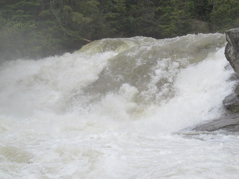
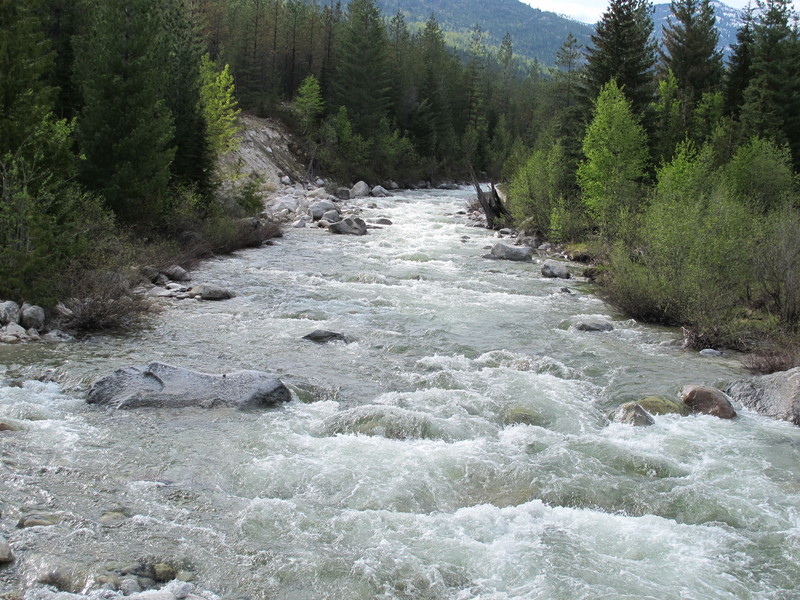
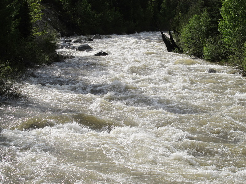
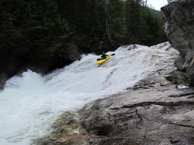
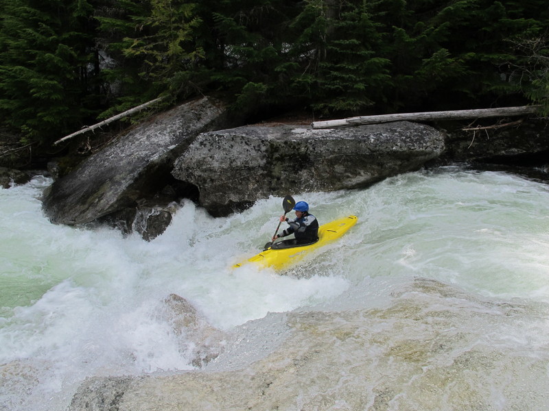
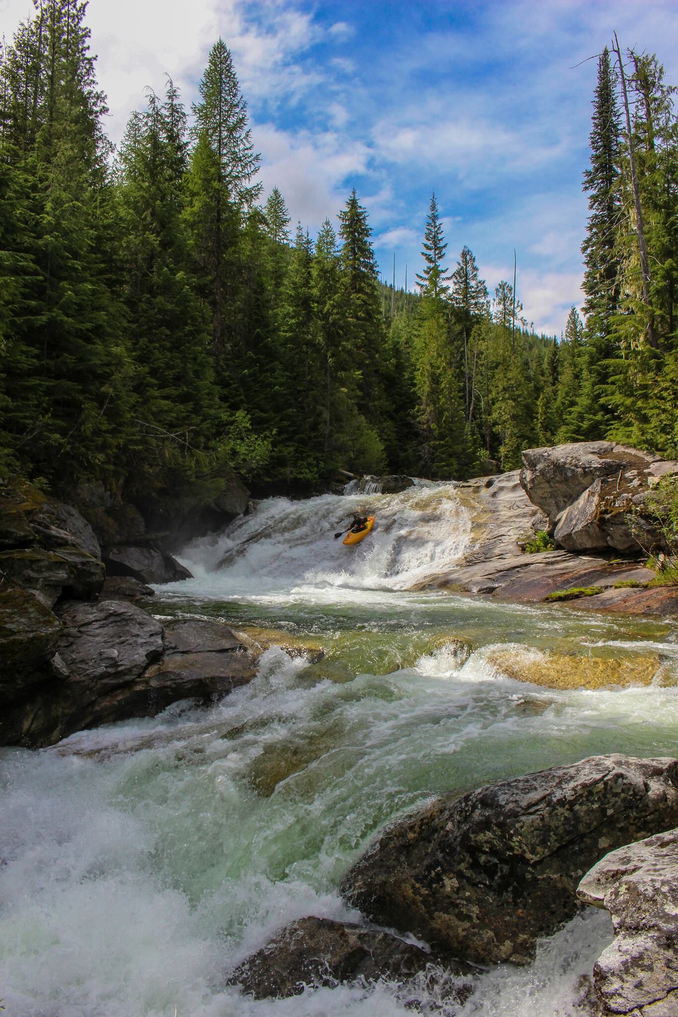
The Slides starts with a mile or so of technical, continuous class III-IV boulder drops. A jumble of large boulders constricting the channel marks the beginning of the steeper, bedrock rapids. Here the whitewater changes character as the continuous boulder drops are suddenly replaced by a series of clean four- to five-foot ledges punctuated by two clean rock slides (15 to 20 feet high and 30 to 60 feet long, both quite easy) that are separated by the section's crux rapid, the Guillotine. Longer and more technical than the other ledges and rock slides, the Guillotine is the only rapid within the Slides section that approaches, class V and it is easily portaged. After the final slide, the bedrock disappears for good and the river turns back into fun continuous class III-IV boulder drops for the final 1.5 miles to the take out. The Slides section is probably the most popular section of the Pack , in part due to its easy-to-portage nature. It enables non-expert paddlers to experience beautiful, alpine, steep creeking with out having to run committing rapids. You can end your day after the Slides or continue to the Gorgette.
Directions:
Directions:
The Upper Pack is easy to find. Drive North from Sandpoint towards Canada on Hwy 2 and turn left on the Pack River road just after you see the meandering and well marked Lower Pack pass under the highway (this is where the USGS Gauge is located). 4.7 miles after turning off Hwy 95 you will cross the Pack River for the first time since turning off Hwy 95, 4.2 miles after this first bridge is a convenient take out option for the Gorgette on the right, though there are other options both upstream and downstream while the road is close to the river.
Keep following the Pack River road upstream, when you come to a second vehicle bridge you have come to the put-in for the
...Jun 13, 2012
We chose not to attempt this section on this day. The drops flowed quickly from one to the other without recovery pools. We put in lower and enjoyed some pushy boulder gardens instead.
Jun 13, 2012
This photo is taken looking upstream from the bridge at the end of The Slides and the start of The Gorgette. The rock with a saddle in it in the bottom left of the photo is a visual gauge. This level is Low, slides were fun, gorgette would have been good with mank above and below, and I'm told the grottos would have been lowish mank at this level. When a little water is trying to go through the saddle it's medium and the grottos are good, slides are getting bigger but still fun, and the gorgette drop itself starts showing some holes. When the rock is making a hole, guess...