| Difficulty | IV |
| Length | 12 mi |
| Avg Gradient | n/a |
| Gauge | Lamoille River at Johnson, Vt |
| Flow Rate as of 45 minutes | 148 cfsbelow recommended |
| Reach Info Last Updated | July 21, 2026 |
This is a great run with multiple sections that make it suitable for a variety of groups. It also can be run a variety of levels offering everything from class III to V depending on the level and section chosen as each level.
Bog Section
Putting in at the Bog is best done when the water is high (Montgomery Bridge gauges is 2.75+). Here the river meanders through a bog before entering the forest and slowly building from class II to IV by the time you reach Belvidere Center. Most everything is boat scout-able, but at higher flows there are some holes and the last 1/2 mile in Belvidere center can go pretty quick with some exciting class IV river running as you come back along the road. The last rapid after Basin Brook enters on river left is the steepest and contains a great wave train when levels are high. From here the river cross back under 109 which will now be on river left. Several miles of moving water lead to the largest rapid on this stretch. The horizon line is obvious with a covered bridge visible downstream. This rapid most commonly run down the right slide and as such is best scouted from river right. Depending on flows you may want to explore the multi-stage drop on river left, in which case a ferry across may be necessary. Another 3/4 of a mile downstream are a handful of fun ledges before you pass yet again under 109. From here it is approximately 1 mile of moving water to the Gorge Put in - indicated by large flat fields on river right behind Waterville Elementary School
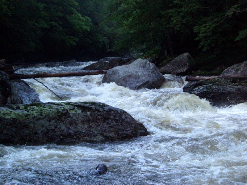
NBL Gorge
The gorge is the highlight of this run and contains just under a mile of continuous boulder rapids. It is essentially one long rapid. Class III at lower flows, this becomes a non-stop gauntlet with big holes at levels above 3.5'. The end of this section is marked by passing under a covered bridge with a fun rapid shortly after. A second covered bridge with the painted gauge on river right is the takeout for the Gorge section.
Wat
...Park in the dirt lot to the right of the school and walk across the fields to the river. Be mindful of changing here, it is an elementary school
Apr 15, 2020
This is not really a good gauge to be using. Check out flow of the Lamoille at Johnson (USGS gauge 04292000 - https://waterdata.usgs.gov/vt/nwis/uv?site\_no=04292000) and word on street is that the N.B. is probably flowing if it is 1000cfs and rising or 2000cfs and falling.
Jul 21, 2008
right after Grayson smacked his head off the log