| Difficulty | I-II |
| Length | 11 mi |
| Avg Gradient | 14 fpm |
| Gauge | Red Clay Creek Near Kennett Square, Pa |
| Flow Rate as of 44 minutes | 7 cfsbelow recommended |
| Reach Info Last Updated | January 11, 2024 |
River Description
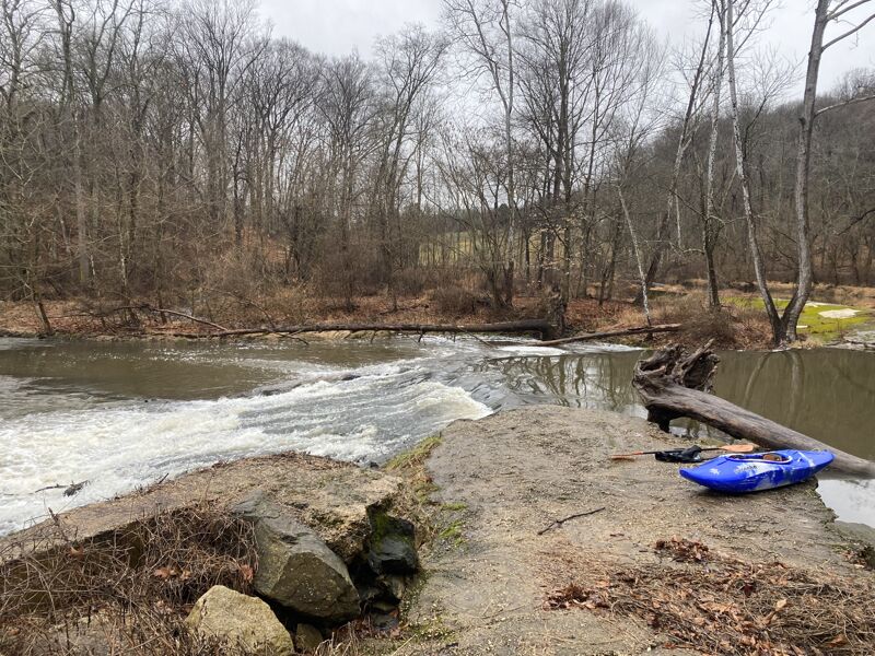
A small stream similar in character to its larger neighbor the Brandywine. Both rivers have an abundance of dams, the result of Delaware's early reliance on waterpower to jump start its industries. Most of the 7 dams on this section however are runnable at proper flow.
Put in in PA at the confluence of the East and West Branches of Red Clay Creek. The run takes you through Yorklyn, and down a pleasant valley with Rt. 82 running parallel a good deal of the way. The takeout is at a bridge 200 yards above 41. There is a park here that was the site of Delaware's old prison.
There is some whitewater below this section, but there are also the last 2 dams and very trashy conditions.The final takeout is at a small park at the end of Netherfield Rd. near the mouth of the river. Below here, tides become a problem.
Railroad tracks that parallel the river as well. These are still in use as the Wilmington & Western, a scenic steam train ride. The terminal is very near the takeout. You could probably do some good scouting from the train!
River Features
Put In
Access PointDistance: 0 mi
Take Out
Access PointDistance: 10.5 mi
Trip Reports
Log in to add a report?
Untitled
Jan 23, 2023
January 23rd 2023. Put in at the dam in auburn state park. 3.8ft on the Kennet gauge (the lowest I would recommend for this run) still a bit scrapey in spots. Ran every dam clean and the creek is mostly strainer free. One river wide log had to be portaged in the flat water before S tressle dam. The rapid on river left of the dam had a lot of wood collected by a broken pipe on the far left after the chute and would be extremely dangerous at higher flows. Make sure to scout. There is a very shallow low head dam right before rt 48 bridge that could be dangerous at higher flows. Other then that this creek and it's dams are good to go
JB
Jason Blevins
Dec 23, 2005
Some of the Dams on this run are sloping and can be run. Very Scenic and interesting classII run with enough water. I'd say 4' on the guage is the minimum for a clean run down.