Waubonsie Creek
Oswego: Stone Gate Park to Fox River (0.54 - 2.2 miles)
| Difficulty | II |
| Length | 2.2 mi |
| Avg Gradient | 11 fpm |
| Gauge | Waubonsee Creek Near Oswego, Il |
| Flow Rate as of 5 hours | 13 cfsbelow recommended |
| Reach Info Last Updated | March 3, 2025 |
Quick Facts:
Location: Oswego, IL (just south of Aurora, IL).
Shuttle Length: commonly 0.4 miles / 3 minutes drive, plus 0.25-0.3 mile walk (or up to 1.8 miles / 7 minutes drive)
Character: An short and sweet run on a small intimate stream in an urban setting.
Uppermost likely put-in is approximately 645' elevation.
Take-out is approximately 598' elevation.
Thus total elevation change is approximately 47', making overall gradient of 21.36 FPM.
Drainage at gauge: 19.1 square miles
Drainage at uppermost put-in: 20.43 square miles
Drainage at most likely used put-in: 27.5 square miles (Thus actual flow at this point could be 1.44 times gauge reading.)
General Overview
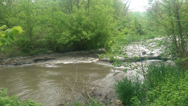
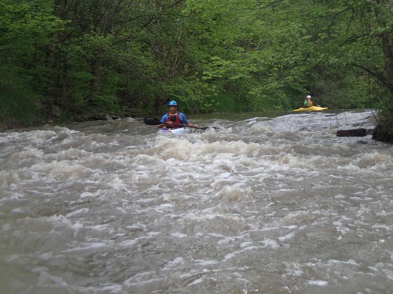
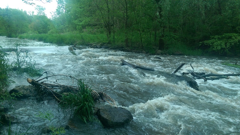
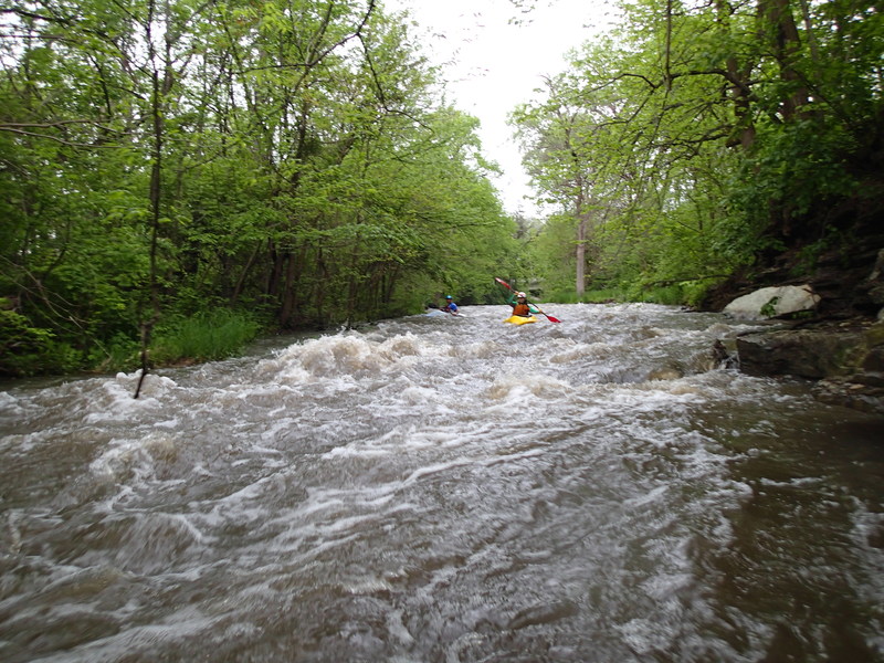
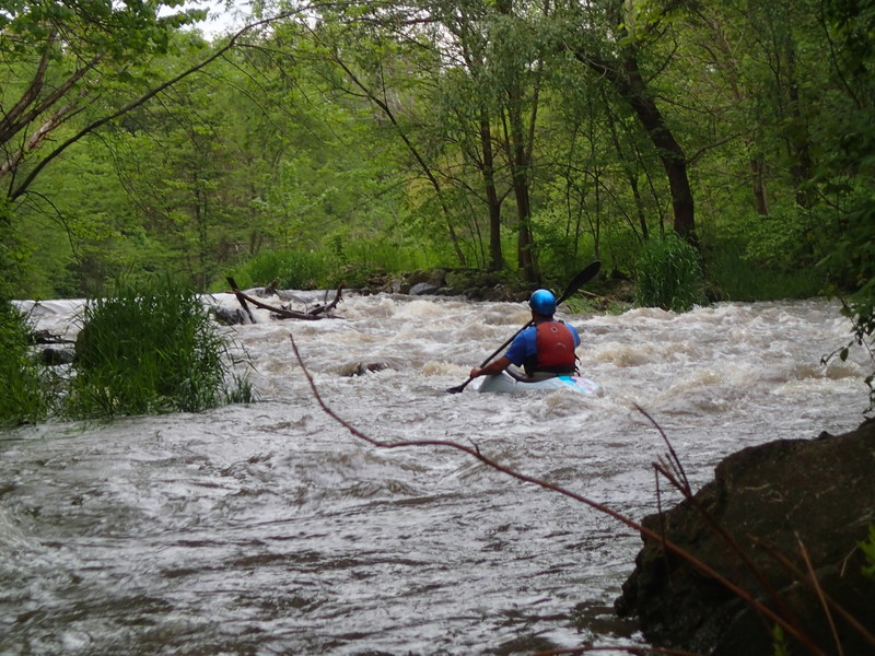
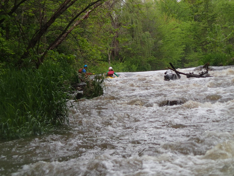
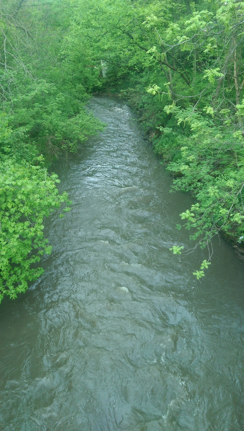
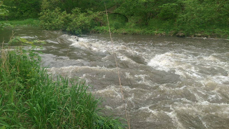
The Waubonsie is a small creek in Oswego which (with adequate water) comes up to a class II-III run. Upstream of Hwy.25 (AKA N.Madison Street), there are several distinct drops or rapids. Below Madison Street, especially at moderate-to-high flows, the gradient picks up making the final quarter-mile or so into almost continuous action.
Before we go further, a note about the name ... there seems to be discrepancy as to whether it is Waubonsie or Waubonsee. I've seen both spellings (looking across various maps and websites).
We also have minimal (and sometimes conflicting) information about the access points (and consequently the length) for the usual run. (See 'River Features' for more complete discussion.)
Craig Carlson provides (2006-10-22):
The third of the four drops in Stone gate, when the water is up develops a nice little hole with good eddies on ether side. The fourth drop should be scouted before running. Depending on the water level, there may be several large rocks just under the surface and the chance of logs or large branches that tend to gather throughout the drop. Below the last drop, the creek makes a slight right turn with some riffles and a co
...
A neighborhood park (greenspace and a kids play area) provides convenient access to the river at this location. (Though we are unsure of how well boaters may be received here. You will be virtually in the back yard of some fine homes.) The spillway/dam for the lake appears to be capable of creating some interesting waves. We have no specific reports of anyone who has tried boating ths location, so we cannot provide details on whether this 'promise' is fulfilled or futile.
Anyone with information regarding legality or possible access issues, and actual playability and recommended levels) is welcomed to help out your fellow boaters by using the 'Comments' tab.
Some maps show this location as being the Oswego Police Department. However, more recent information (and Google Streetview) indicates it is now the Oswego Senior and Community Center. Additionally, a stub of the Waubonsie Trail starts/ends in the parking lot here, suggesting public parking is likely permissible here.
As soon as you pass under Hwy.34 (AKA Walter Payton Memorial Highway), you will be in the Fox Bend Golf Course, operated by the Oswego Park District. Within this course lie a couple areas of swifts (and at least one good drop), as well as seven golf cart bridges.
Do the golf cart bridges allow passage at various boatable flows? Do the rapids become playable features or wicked reversals at some flows? Are there any other impediments to passage (such as irrigation pipes, fences, or deadfall)? How aggressive are golfers and/or personnel from the course regarding boater presence on the water? (Obviously you would almost certainly be challenged if you were out of your boat anywhere within the golf course.)
(If you have boated the section through the golf course, help your fellow boaters with a Trip Report listing gauge reading, whether all bridges have clearance, and the difficulty or fun-factor of the drop(s) through there.)
At high flows, golf cart bridges are likely to be problematic, making the upstream put-in inadvisable (since portaging within the golf club is very likely to be highly contested), and making this location the upstream-most reasonable put-in.
There is no parking in this vicinity, so you might need to have a shuttle buddy/bunny drop you off, and then drive to take out to wait for you there, or get creative in some other fashion to be able to launch from here. (Also likely need to do a 'commando-raid' style put-in: be all suited up, ready to grab your gear and go, to reduce risk of 'interference'.)
Dunno about particulars here ... is it possile (permissible) to park in the cemetery and access the creek? Some cemeteries are gated off (this does not appear to be), and fenced in (this has a short fence at the entrance ... does that go all the way around it?).
Can anyone provide some description and/or photos for these drops?
It appears it may be possible to access the creek at this location. Unsure about legality of parking roadside (on the grass), but this is also adjacent to a Kinder Care and a Walgreens.
Can anyone provide some description and/or photos for these drops?
From Kendall County GIS information, it would appear that the upstream-most edge of the Stonegate Park property is about at this location.
We do not have awareness whether the paved path (or otherwise trodden footpath) extends this far.
(First drop from Stonegate Park put-in.)
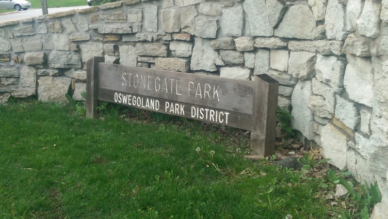
Most boaters opt to just put in from Stonegate Park, hiking as far up the trail as is allowed.
The Oswegoland Park District website lists this as a 2.0 acre natural area. (Another site lists it as 3.6 acres?)
It has just three parking spaces, a picnic area, an asphalt path with sitting areas, and fishing (catch and release only). They go on to say:
'In the fall of 1999, the Oswegoland Park District removed the damaged Waubonsie Creek dam and installed fish-friendly improvements, including riffles and fish lunkers.' 'In 2010, the U.S. Army Corp of Engineers partnered with the Illinois Department of Natural Resources to restore fish passages along two areas of the Waubonsie Creek, as well as to correct erosion along the creek’s shores.'
On Oct 17, 2010 a warning was posted regarding a cable spanning the creek under the Madison Street Bridge. We strongly suspect that was a temporary barrier (to trap sediment and debris during aforementioned construction) which was likely was removed soon after that work was completed. (Can anyone confirm, so we can remove that 'Alert' and the photo?)
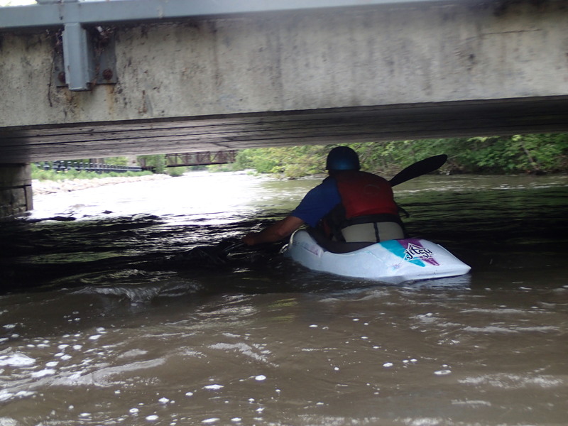
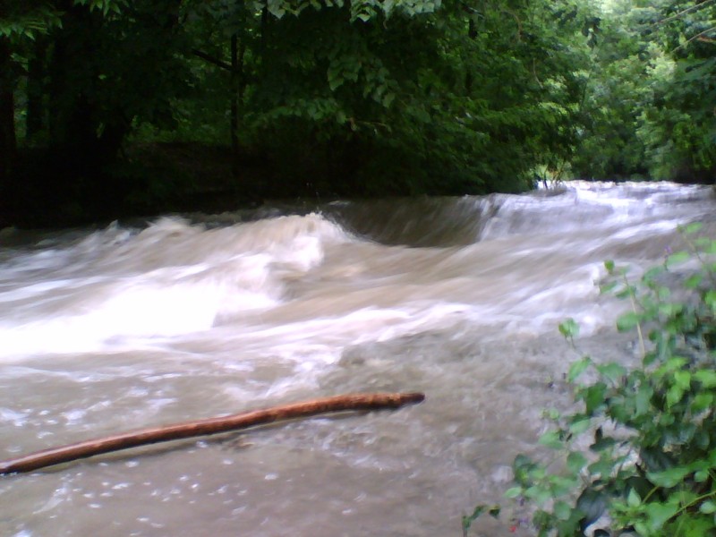
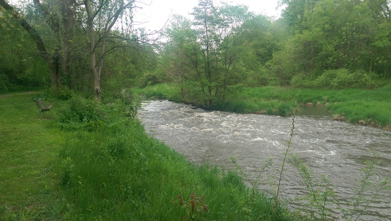
Immediately after passing a railroad bridge you come to Adams Street Bridge. At best boatable flows, this bridge will have little (or no) clearance. (Photo is at 100 cfs on USGS gauge.)
At flows over 150-200 cfs, make certain to scout this from the take-out before putting on so you'll be aware of conditions here and have your strategy planned. Eddies exist above the bridge (on either side) but current is strong and it will take agressive paddling to be sure to catch them if you need to.
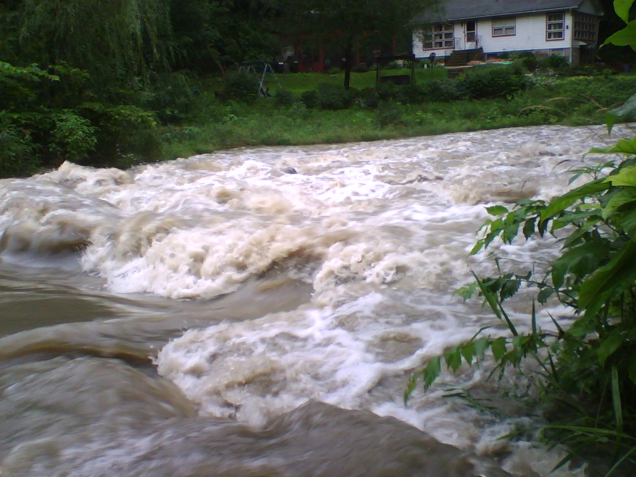
(My only run of this predated the gauge on Waubonsie, so a gauge on Mill Creek was the best reference at the time. With that gauge showing 320 cfs, there was NOT sufficient clearance to comfortably pass under this bridge. Mill Creek has 27.6 sq.mi. at its gauge, whereas Waubonsee has only 19.1 at its gauge, so (assuming a direct correlation, which may or may not be valid) that might correspond to a reading of ~220 cfs on the Waubonsie gauge. The only way to get through might have been to flip under, maybe count to ten, then roll up, but we weren't comfortable trying that.)
The take-out and confluence with the Fox River is just about 120 yards downstream, so (if you need to exit to get around Adams Street) you can decide whether to bother getting in your boat, or just keep your boat on your shoulder to walk to your vehicle(s).
Just prior to confluence with the Fox River, a bridge for the Fox River Trail spans the river. Take out here and carry to the parking lot.
There is a park with good parking and convenient low banks (or submerged flooded banks!) for your take-out.
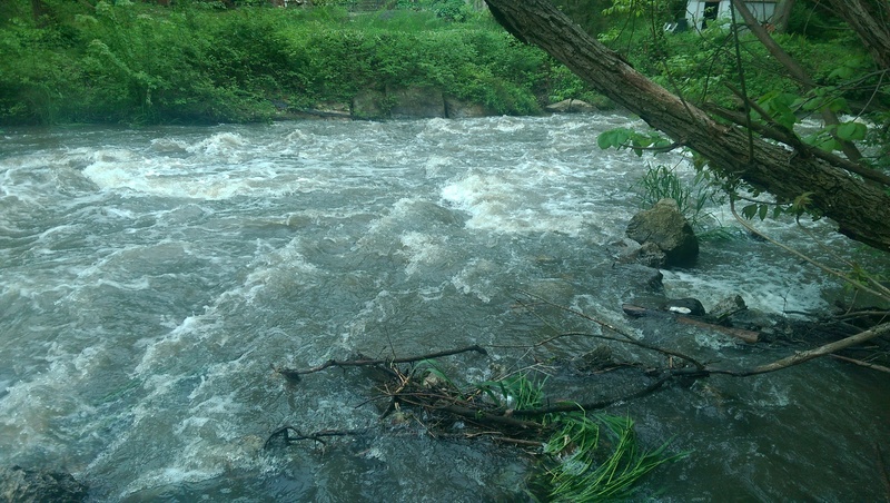
~100cfs