Lamprey
Upper Lamprey
| Difficulty | IV |
| Length | 3.9 mi |
| Avg Gradient | 49 fpm |
| Gauge | Lamprey River at Langford Road, at Raymond, Nh |
| Flow Rate as of 51 minutes | 1.75 ftbelow recommended |
| Reach Info Last Updated | September 30, 2008 |
The Upper Section of the Lamprey River is a delightful class III/IV creek located in south-central New Hampshire. It's close location allows for short-notice paddling after work on weekdays. Be aware that the river rises and falls quickly with rain so one must act fast to catch it up. Additionally care
is required because of strainers which can be plentyful on narrow creeks thru
the woods like this.
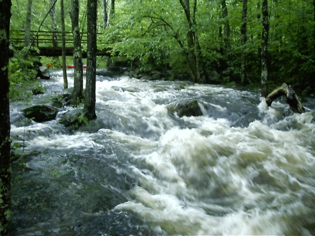
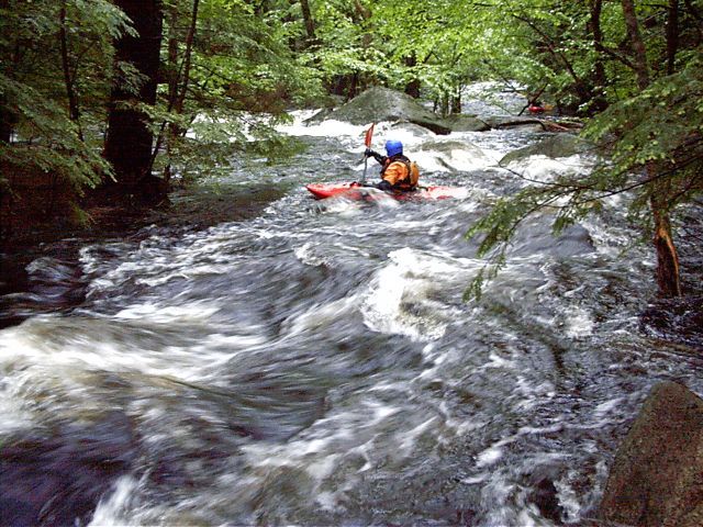
There are six major drops on this section of the Lamprey; the majority of them class IV. In between the river varies from quickwater to class II/III.
A typical run takes one and a half to two hours.
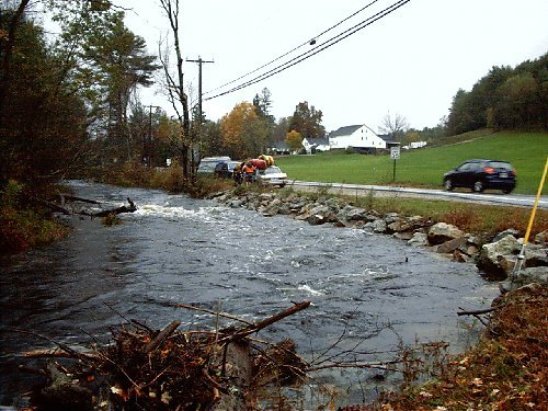
The whitewater section of the Lamprey is located in Deerfield, NH (just northwest of Raymond, and about halfway between Manchester and Rochester). It's
about a 20-25 minute drive from Manchester.
From Manchester take route 101 east to exit 3. Follow route 43 north to the takeout at the southern juncture of routes 43 and 107.
From Portsmouth take Route 101 west to exit 5. Take route 102 north then route
107 west to the takeout at the juncture of routes 43 and 107.
The put-in is about three-and-one-quarter miles north on 43/107 where the road
crosses over the river where Lamprey exits the dam on Freeses Pond.
A second put-in is at the first major drop; 0.6 miles south just off 43/107,
where James City Road (also called Nottingham Road) crosses over the river.
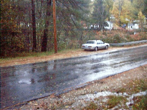
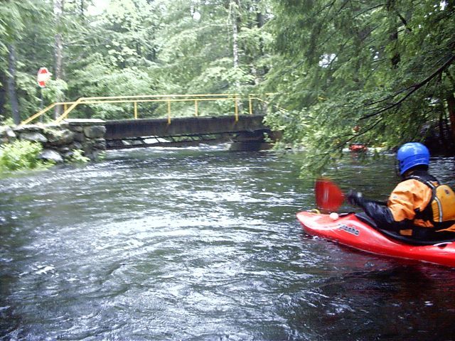
The upper put-in (location 43' 09.048', -71' 14.027') has plenty of room for parking plus a reasonable amount of privacy for changing.
Put on the river just below the dam. The river starts fast, there is a short but enjoyable wave train plus a surfing wave or two. Afterwards there is a half-mile of quickwater before the first drop (allowing the boater a decent warm-up time).
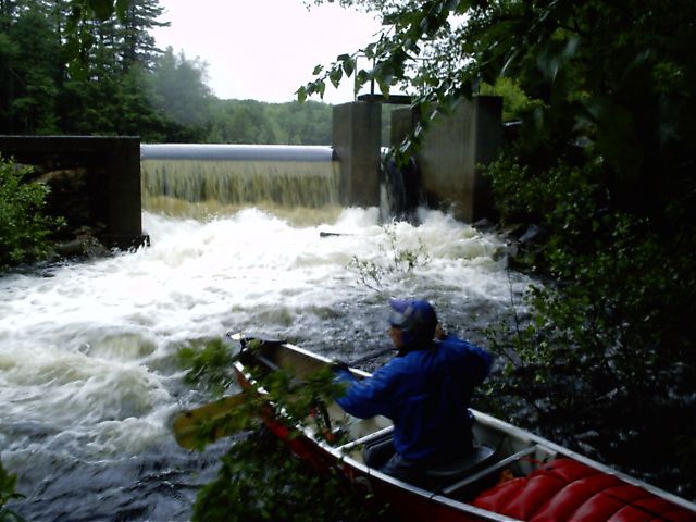
The first major drop is found at the remains of what looks to be an old mill just above the lower put-in (43' 08.573', -71' 13.942'). If there is enough water here then the entire run is boatable.
The second put-in is just off routes 43/107 where James City Road (also called Nottingham Road) crosses over the river (location 43' 08.573', -71' 13.942'). Park on either size and walk along upstream along a path and put on either above or below the first drop. This is also a great place to stop and scout the first drop or just check water levels. [The paddlers' gage will be painted here on the upstream left bridge abutment.]
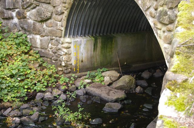
The Paddler's Gage is located on the upstream side of the river-left abutment wall of the bridge at the lower put-in. This is a new gage so levels are still being calibrated.
The second major drop (location 43' 08.446', -71' 13.837') starts as a right-then-left jog turn. Only the first turn is visible from the river; scout the drop if you are unsure. Run the top of the drop along the right dropping into an eddy along the left half way down. A route through the eddy on the right is also possible at some water levels.

One-half mile below Double Drop you enter a wetlands area with a lazy current that lasts 0.4 miles.
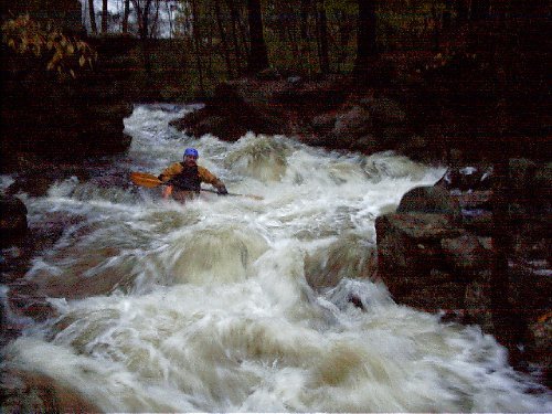
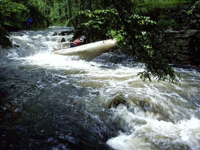
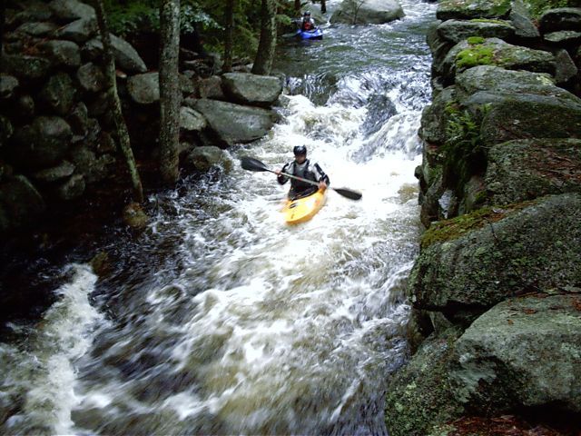
The third major drop (location 43' 07.775', -71' 13.812') starts as a left turn as you come thru the forest. The river gets very steep and narrow with two ledges on the right and a swift narrow channel on the left with big waves. Halfway down the river makes an abrupt hairpin turn to the right. A river right route into an eddy between the two ledges is recommended otherwise you may to get swept into the trees by the swift current on the left at high water. Exit the eddy at the edge of the second ledge letting the hole help you navigate the hairpin turn and finish the rapid. Scouting this rapid is recommended (either side is OK); portaging is easily done along a path on river right.
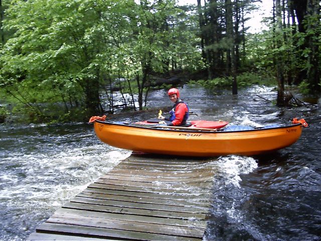
A mandatory portage is at a small bridge (location 43' 07.623',-71' 13.891') where the supports extend down to the water level. A short rapids starts immediately below. This bridge is accessible from the main road by following a private road behind a construction company (remember to ask permission).
A short enjoyable rapid (location 43' 07.623', -71' 13.891'). At high levels you may want stay left, since the main tongue goes straight over a pourover.
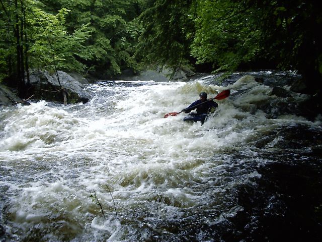
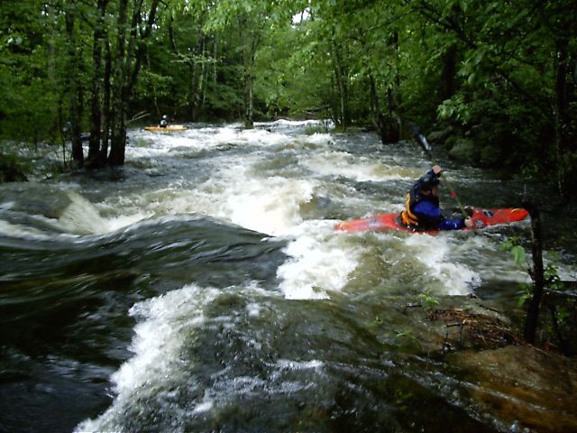
Eddy out on river left directly above a small bridge for a look down the length of the longest rapid on the river. It's a reasonably straightforward run; stay mostly right-of-center with some quick maneuvering a number of rocks, holes, and waves. Watch out for a large tree growing in the center of the rapid about 2/3's of the way down.
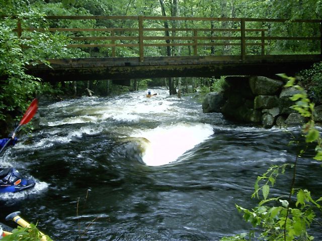
Eddy out on the left just above a bridge which signals the entrance to Miller Time (43' 07.342', -71' 13.981'). From there the run thru the entire rapid is visible. The entrance to the top of the rapid (immediately under the bridge) can be tricky with two wide overlapping holes at higher water. At higher water the difficulty of this rapid approaches a class IV level.
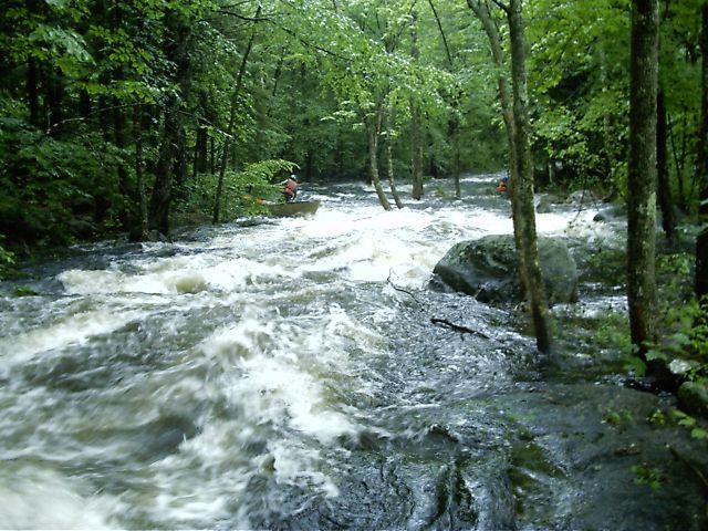
Miller Time is a fun run, it's the longest rapid on the river. However be aware there are numerous trees growing in the middle of the current that need to be avoided.
The river narrows and steepens at the remains of an old mill (location 43' 07.256', -71' 14.057').
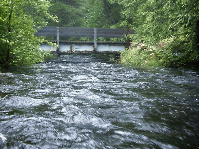
Another low bridge can be paddled under in all but the highest levels. It is unknown if this bridge can be easily accessed from the main road.
A snowmobile bridge (location 43' 06.729', -71' 14.334') is usually under water and provides probably the only experience where a paddler normally passes *above* the bridge. At low and medium levels a portage is required.
The last major drop is located just above the takeout (43' 06.603', -71' 14.431'). It's named for the stone wall along the river. It can be easily viewed by stopping on the main road just above the bridge near the takeout. There is a small path into an overlook where the majority of the rapid is visible. [ Note: As of June 2006, a large tree has fallen across the bottom of the drop, leaving just barely enough room to duck under. Care and scouting are recommended since it are not obvious from the top of the rapid.]
The take-out is at the southern juncture of routes 43 and 107, right along the road (43' 06.499', -71' 14.489'). A reverse shuttle may be recommended if you are using the lower put-in since there is more parking here.
Jul 30, 2014
Original USGS-1073319 guage was frozen for 23 days. Removed and updated with hads-RAYN3 gauge. Maintained original flow ranges in updated gauge feed. -Clinton
Aug 1, 2009
Ran Upper Lamprey today 6.15 to 6.99 feet on AW posted guage information. Was scratchy at best, passable mostly - a real boat groover! Strainers
Jul 9, 2009
Ran the upper lamprey a couple of times this year. I would advise that with the new gauge in Raymond that we raise the runnable level to 4.5 feet using this new gauge. It is much closer than the Newmarket gauge.
Fine runs both times, one at 4.5 and one at 5.0 on the gauge. One big strainer near fast moving water below the third bridge, it is a big tree and will be there a long time to come.