Hazel Creek
Appalachian Trail to Fontana Lake(Hike Up Hazel Creek)
Feb 10, 2018
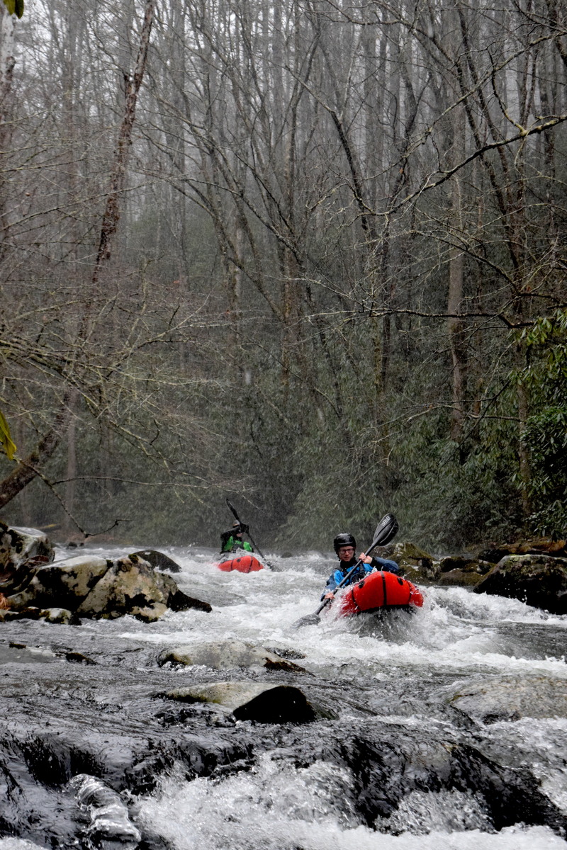
We paddled across the reservoir aound 5 miles in sea kayaks, hiked up around 5 miles with packrafts, packrafted back down the creek, and then sea kayaked back across. It was a really fun day trip of high quality backcountry travel!
Jul 29, 2009
I've run Hazel Creek a few times now and it remains one of my favorites. It's very secluded with the occasional fisherman or hiker, pristine water quality (some of the cleanest waters you'll ever find), and has some very nice ledges and a few drops. This is an intermediate level run with few consequences at normal levels. Contrary to the description here on AW database, there are no class IV's at normal levels and the III's are mostly clean and drop into calm pools every time. As the water rises some holes can be pushed to class IV and lines become more important than ever. There are very few places to sneak rapids and the general rule is to 'go with the flow'. Even at normal levels some places are scrappy you'll get a nice workout trying to get through them. The biggest threat on this creek is wood in some very inconvenient spots and the limited access means any rescue is likely more than 6 hours away (You must be shuttled across Fontana lake and hike up several miles to put in generally above the upper falls). This run is only worth it if you camp at the Proctor campsite near the lake and drag boats up to do laps and make stops along the way to paddle certain sections a few times. A nicely balanced cart system is really the only way to go here.
Aug 21, 2007
ive got a couple good mules and a pack saddle when we get a hurricane lets do it peace. I like mules. Do you like mules?
Aug 7, 2007
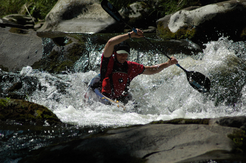
I ran this stretch with a friend and a well-balanced cart system and everything was runnable. If you've never been here and want a gauge you are out of luck. USGS used to have a gauge here, but have removed it. Generally if the area has had a decent rain and there are still puddles on the walk up then you will be clear. The wide trail follows the creek closely, so be sure to scout rapids on the walk up. Watch out for lots of wood. While the gradient listed is similar sounding to Wilson Creek or other relatively steep runs, I'm not sure it is entirely accurate. At high water the lower falls and upper falls would turn into Class IV's, but generally if water isn't rushing over entire bottom ledge at lower falls (recognize this as the first and only small waterfall you come to, about 7-8 foot drop) then you're still in class III territory. I've run the drop the a few times and it seems to be totally clean and deep at the bottom. My suggestion is to run it backwards.
Jul 21, 2007
Like described in the initial description by the person who created the page for Hazel Creek, this creek requires treking up a trail to put-in. This spot is just past the 4th bridge you cross over the creek on the trail.
Like described in the initial description by the person who created the page for Hazel Creek, this creek requires treking up a trail to put-in.
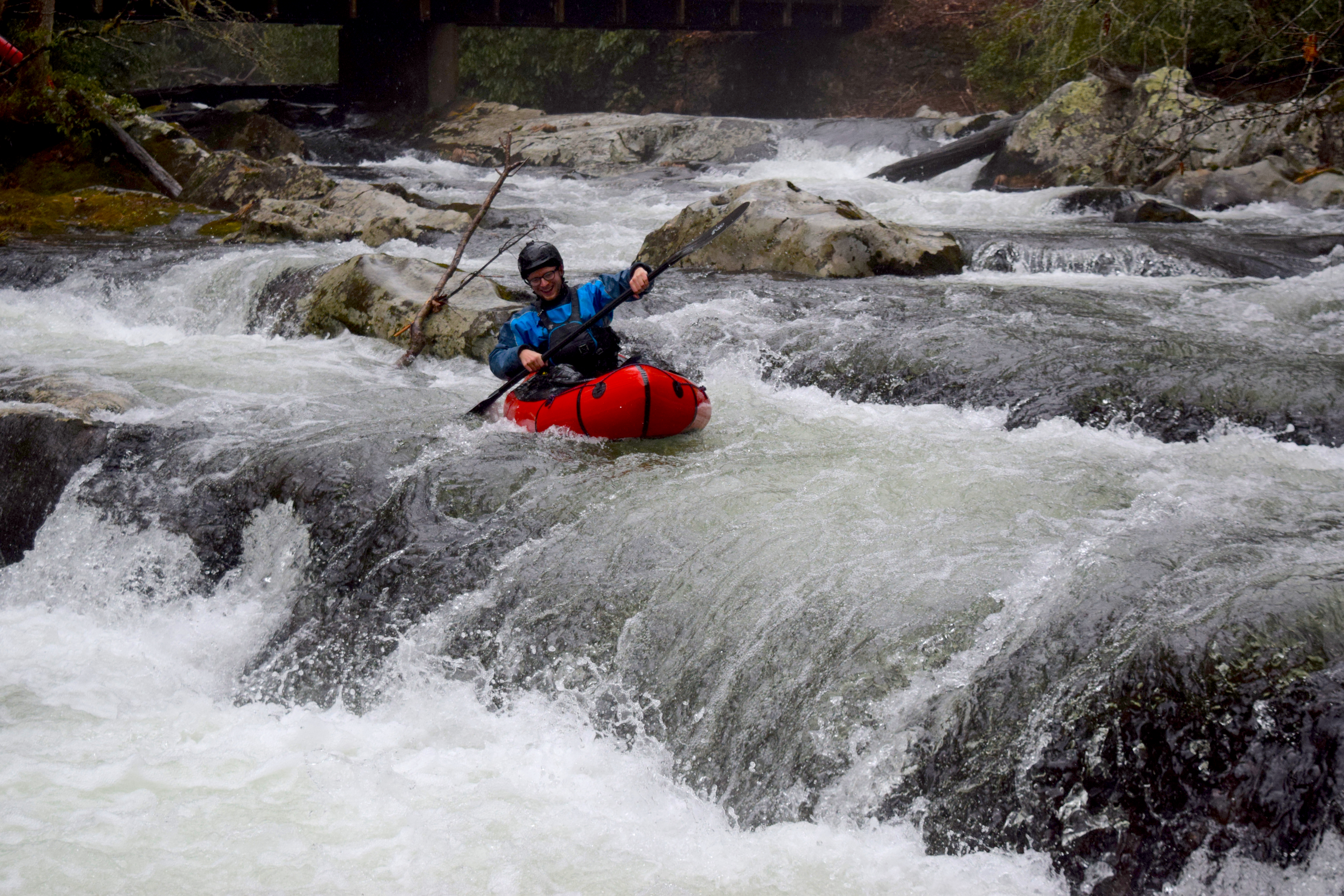
The creek has a few drops, some ugly / some clean, this one is the biggest that you will encounter below the 4th bridge up the trail. It is located about halfway between the second and third bridges along the trail. It is roughly 8 feet and seemed pretty clean. You'll still want to scout from the trail on river-left.
Mar 11, 2006
This creek is known as the 'Crown Jewel' of trout fishing in GSMNP. It is a large creek, unusual for the park in that it has a gravel road for at least5(maybe 7 miles upstream. Carts are allowed.I'd say that with a lot of water, it'd be a great class3-4 run, with some 4+ drops.in the lower 5 mi.(There are some nice Sluice-type drops. Have not been up past 5.6 miles, where Bone Valley Creek comes in. A couple miles up from there, on the main stream, is a falls of some extent. Put on your heavy hiking boots(that gravel is tough on the feet.) Get a good cart.)Don Kirk's popular book 'Smoky mountains Trout Fishing Guide can give you more trail info. I'd like to fish way on up the trail-but without a helicopter, or someone to carry a big open boat for me, ddoubt that I'll be fortunate enough to paddle it! Check it out.Catch a fish. I imagine that the water is fishable no matter how high the water. Hopefully someone will have the gumption to boat across Fontana, get their boat 5-7++? miles up the stream, and write a paddlin' report. I'll buy you a beer! A horse and a Kayak or C-1 might actually get you way up there.(Documentary material!) Gradient shows 100ft./mi. for the lower 5 mi.