| Difficulty | II+ |
| Length | 7.1 mi |
| Avg Gradient | 22 fpm |
| Gauge | South Fork of Little Red River at Clinton, Ar |
| Flow Rate as of 1 hour | 4.27 ftbelow recommended |
| Reach Info Last Updated | January 25, 2009 |
River Description
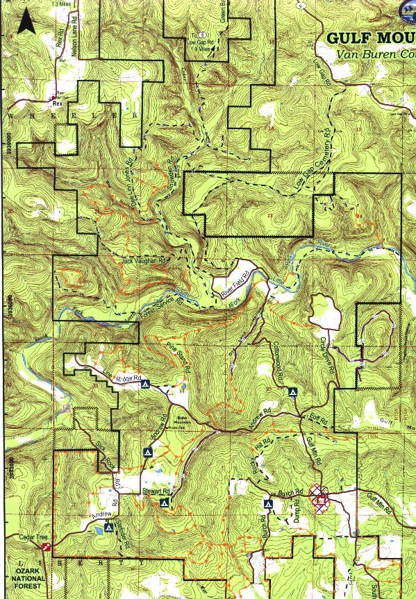
This section is pool and drop and offer good scenery as is flows through the Gulf Mountain Wildlife Management Area. Around mile 5, as the river turns left, the Root Wad rapid, with it's snag waiting for you at the bottom is located at N35 33.877 W 092 41.390 and can be trouble.
Put-in: National Forest Road 1342 Crossing below Koone Hollow at lower end of Brushy Fork (4wd only) or about a mile downstream on Forest Road 1307 (Slick Rock Road). This road has recently been improved and offers better access for vehicles.
Take-out: Low water bridge on Cottonwood Rd in the Gulf Mountain Wildlife Management Area. Warning, the large culverts can trap you at the higher levels.
For extended trips, you can combine with the top portion of the Middle Section. Please note the access issues with the Low Gap Road bridge.
River Features
Put In
Access PointDistance: 0 mi
Take Out
Access PointDistance: 7 mi