Apalachee
4 - Price Mill Road to Hwy 441
| Difficulty | I-II |
| Length | 6.1 mi |
| Avg Gradient | n/a |
| Gauge | Apalachee River Near Bostwick, Ga |
| Flow Rate as of 1 hour | 135 cfsrunnable |
| Reach Info Last Updated | July 5, 2021 |
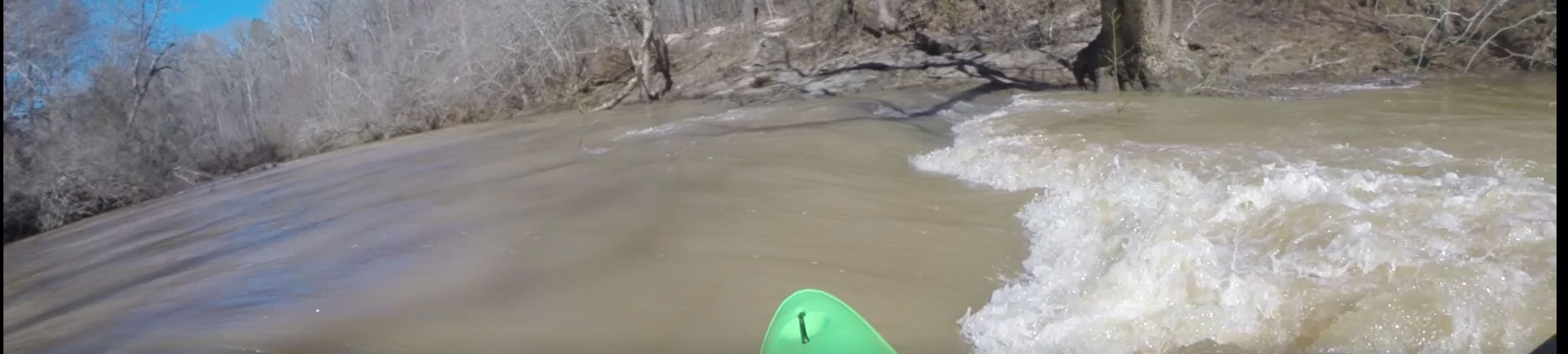
Section 4 of the Apalachee is a scenic float with numerous rock outcroppings and beaches to enjoy. Rocky shoals and small drops populate the first few miles. For the remaining miles the river flattens out and the current slows, with the occasional shoals. Watch for fallen trees crossing the river. Frequent maneuvering is required for most of the 7 miles so allow for ample time (4-6 hrs) and resources to complete the run. Gar are frequently seen. They are not dangerous but really impressive to see.
Access is not easy but is well worth the effort. Put-in at Price Mill Road, just below Price Mill Shoals. There is not an established access trail or parking lot. Best option to date is to park along the road on river left (north east of the bridge). Then find the least steepest way to drag/hike the boats to the river. Hopefully we can establish a trail here some day.
Takeout under the 441 bridge on either river right or left. On river right there is small parking area on the upstream side of the bridge that allows for a relatively short jaunt to the vehicles.
River can be floated as low as 90 cfs at the Bostwick gage though this makes for tight lines in many of the rapids.
Put-in at Price Mill Road, just below Price Mill Shoals. There is not an established access trail or parking lot. Best option to date is to park along the road on river left (north east of the bridge). Then find the least steepest way to drag/hike the boats to the river.
There is a small parking area on river right, upstream of the bridge.
Sep 9, 2019
I have been paddling and researching the Appalachee for the last few years. I would like to replace the 3 sections already listed in the AW database with 4 sections. These would be labeled 2-5 and would go from Treadwell Bridge Road (just above Hwy 78) to Hwy 278 at Lake Oconee. This would encompass 36 miles. Updates will be made concerning access, rapids, dams and the infamous swamp. Sections 0, 1 would be reserved for the upstream reaches I have not paddled yet. If you have comments, please let me know. Thanks!