Trip Reports
Log in to add a reportST
Scott Tippetts
Apr 5, 2011
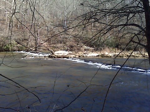
On 03 April 2011, we paddled the 11 mile section from Hugh Stowers Rd to Kelly Bridge Rd. We were impressed that a flatwater creek moved at a nice clip (cfs was ~320).
There were 2 riverwide strainers in that first 2 mile section between Hugh Stowers & Hway 9; the first was less than a half mile from the put in. We removed SOME of it, opening up a decent gap (though still requiring a 'duck under') on river-left immediately along the bank that will be safe ducking under at lower water levels (say, <400). However, at higher water levels that 'duck under' on the left will be dangerous, but the center might become open allowing a scoot-over.
The second strainer is about 1/4 mile before (upstream of) the Highway 9 bridge & ramp. This huge mess is a fresh fall, and in addition to several trees, was also a thick jungle of thorny vines. We managed to clear enough of it on river-right next to the bank to scoot over & through. At low currents (below <400), it should be slow enough to ease through the narrow opening we cut right next to the right bank. (Portaging didn't seem judicious; both banks were high & very steep for a ways downstream, and the thorn vines looked just as bad or worse on top as down on the river.) I'll post photos later.
Rest of the trip from Hway 9 to Kelly Bridge was fantastic (and no riverwide strainers); we averaged 3.5mph with very little paddling. We loved the gorgeous 80ft cascading falls up the Barefoot Creek tributary, about 1.5 - 2 miles before the takeout.
DP
Dallas Pass
Aug 23, 2010
The water Sunday was great on this not so popular for WW. The work Jamie Higgins and his group did to remove some of the recent downed strainers made it very enjoyable and kept the pace going nicely. Water was a lot faster than normal and water level was above normal as well die to the rain we received prior. Had a blast just wished the river stayed this way :D BTW It would be great if as mentioned by the below poster if the Description could be updated to let everyone know there's a new put in at the bridge with parking and bathrooms. They've also provided a swing and picnic tables for observers to watch yakers putting in and witnessing the occasional rookie roll.
JH
Jamie Higgins
Aug 20, 2010
I did a video of folks from the GCA paddling the Etowah River - Dawson Forest Section. FYI. The strainer has since been removed.
http://www.youtube.com/watch?v=h75mNUr\_AWU
JF
Jack Forester
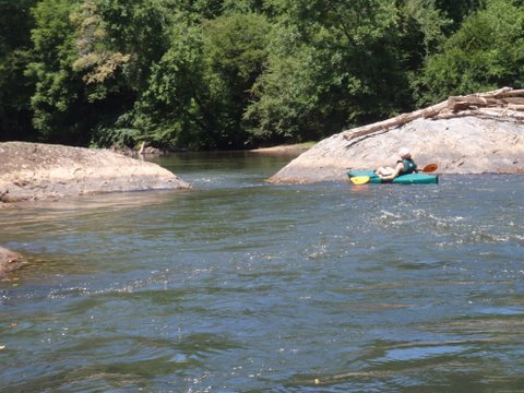
Jul 4, 2009
Chilling out on underwater rock on the right side of the chute at Two Rocks (aka Boulder Squeeze)
JF
Jack Forester
Jul 4, 2009
Encountered cows and deadfall in the river between Hwy 136 and Hwy 9. Still was a fun float (about 3 hrs) at 110 cfs at the Hwy 9 Dawsonville gauge.
JF
Jack Forester
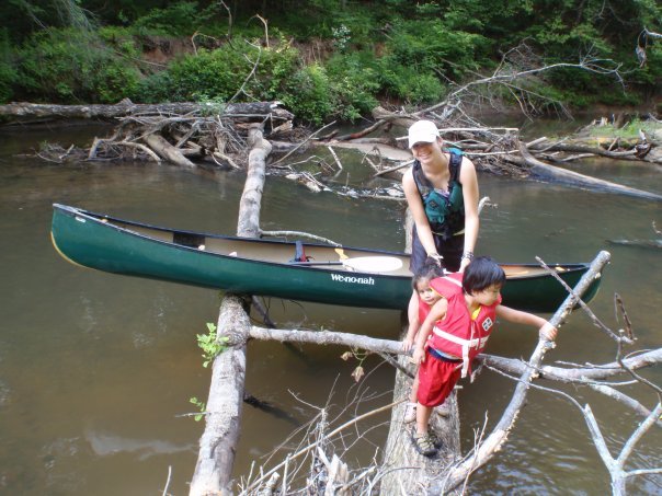
Jul 2, 2009
Ran Hwy 136 to Hwy 9 (River Park) with the kids in my We-no-nah Prospector 15.5'. Water level was around 120 cfs. Took 3 hrs at a leisurely pace. Several downed trees to deal with. One that we pulled the canoe over with the two 3 yr olds still in the boat (probably 8' of log above water). One spot with 2 logs about 3 ft apart 10' above the water that required a boat exit of all members (the kids seemed to like that). Later, we got to see 3 cows in the river with lots more on river right. I reminded the kids why you don't want to drink the water... ;) All in all, a good trip, but would be nice if someone could clear those trees. We saw GK carved into a downed tree that had been cleared (Georgia Kayaker). I remember seeing Richard clearing trees last fall in this section. Time for another clearing trip! ;)
?
Untitled
Mar 17, 2009
Austin Jowers: Are there any primative camping spots along this section of river?