Clear Creek
Rocktown Crossing to Hwy 43 (5.5 miles)
| Difficulty | III-V(V+) |
| Length | 6 mi |
| Avg Gradient | 115 fpm |
| Reach Info Last Updated | December 1, 2015 |
Oklahoma steep creekin'? No we're not kidding! The heart of the lower gorge drops 240 ft in 1 mile with a half mile dropping 150 ft. also Check out nearby Crumb Creek.
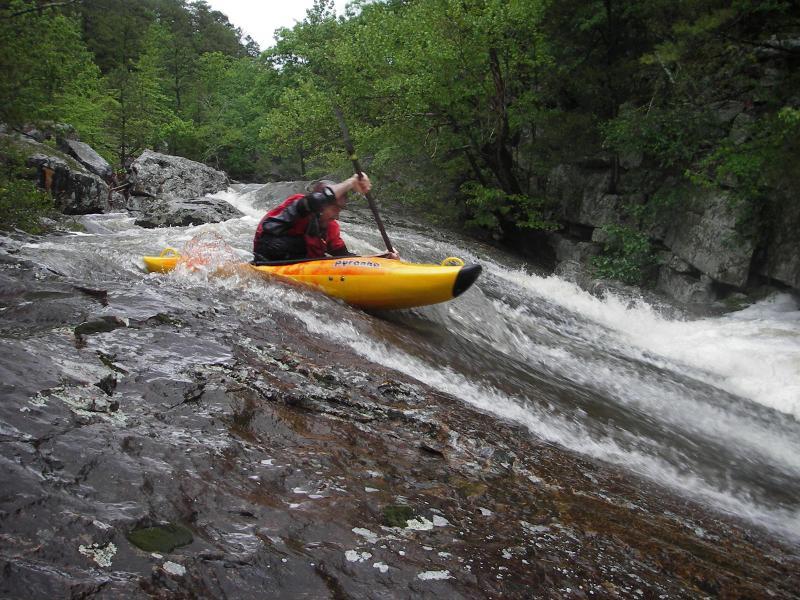
Steep fast boulder drops, slides and slots. Watch for undercuts and wood.
At low to medium water level the creek is mainly III-IV, higher water levels and/or wood will increase the difficulty. O'grilla has a hole feeding a nasty undercut/sieve combo and deserves caution. It appears as the 3rd or 4th main dropin the lower gorge. Be sure to scout.
Shuttle is a whopping 35.8 miles one way (7.4 on dirt road including a deep creek crossing in the headwaters of Pine Creek).
Land in the area, including all of the watershed and access to the put-in is owned by timber companies with some private inholdings. The timber company owners are not receptive to unauthorized visits to their property and has threatened to tow unauthorized vehicles. Closed gates are often encountered on some roads which access the put-in.
Pine Creek should run for a couple days after Clear runs. Camping is available at Clayton Lake State Park.
Apr 29, 2006
First real drop of the creek.
Largest vert on the creek. The hole feeds under the river left rock which is undercut and a sieve.
Backside of the river left undercut and sieve
Similar to Bridal Veil on Tallulah, but the sneak is on the right.
Typical scene for the lower portion of the gorge.
Typical scene on the lower portion of the gorge.
Apr 28, 2006
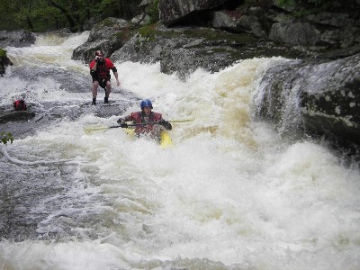
The longest rapid and highlight of the run. Portions of the river left side are undercut.