Pine Creek
Logging road to Hwy 2 (6.5 miles)
| Difficulty | III-IV |
| Length | 7.1 mi |
| Avg Gradient | 40 fpm |
| Reach Info Last Updated | December 18, 2024 |
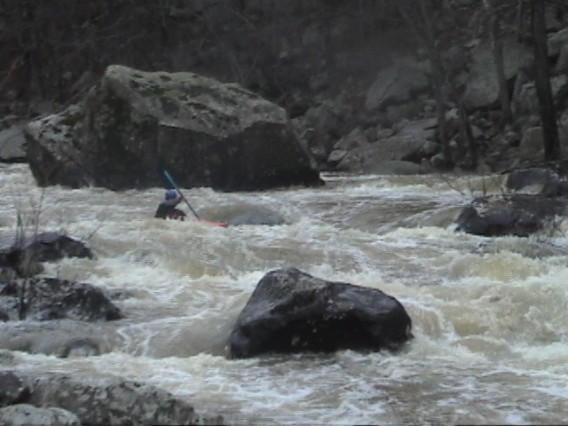
The first mile or so is flat, then the creek offers 3-4 miles of Class III-IV boulder rapids in a scenic gorge, then it flattens out again before reaching Hwy 2.
Land in the area, including all of the watershed and access to the put-in is owned by timber companies with some private inholdings. The timber company owners are not receptive to unauthorized visits to their property and has threatened to tow unauthorized vehicles. Closed gates are often encountered on roads which access the put-in.
Put-in: Low-water bridge 6.5 miles upstream of Hwy 2
Take-out: Hwy 2 bridge
Alternate take-out upstream of the Hwy: To get to this take-out from the Highway 2 bridge: go west 1.4 miles, then turn right onto a dirt road. Go another 1.5 miles on the dirt road, make a sharp left at the creek, then look for the wide pull-out creekside.
Camping available at Clayton Lake State Park.
No trip reports yet.