St. Joe
3. Tumbledown: Gold Creek to Bluff Creek

| Difficulty | III-IV |
| Length | 7.4 mi |
| Avg Gradient | 50 fpm |
| Gauge | St Joe River at Calder, Id |
| Flow Rate as of 34 minutes | 844 cfslow runnable |
| Reach Info Last Updated | March 3, 2023 |
Overview:
Tumbledown starts off easy and gradually picks up in gradient and difficulty. The first three miles is read and run class II and III, building up to Tumbledown Falls (class IV), the standout rapid on the run. Tumbledown starts with a long train of big crashing waves on a sweeping left-hand bend leading into an almost river-wide ledge hole on the right, where the canyon walls up and contricts. The normal line is left of center down the wave train, then hard left to avoid the ledge. Immediately below the ledge is a deep, clear, emerald green pool. Later in the summer this is a great swimming hole. Below Tumbledown you will find one more standout class III/III+ rapid and lots of easy read and run class II and III.
Scout the entire run very carefully before your trip. Highway 50, a paved two-lane road, parallels the entire run although trees obscure the view in places. Logs and sweepers can be common and seem to shift around unpredictably. Also remember that while a road follows the entire length of the run on river right, it is still very remote country. The nearest medical facilities are at least an hour and half away. Air and water temperatures can be very low even late into the season making hypothermia a very high risk. The difficulty of the run varies considerably with flow. At levels above 5,000 CFS it becomes a very solid big water class IV, and at lower flows, below 1,500 CFS, the run becomes very technical and creeky.
Put in:
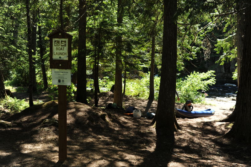
The put for Tumbledown is at the Conrad Crossing Forest Service Campground (Highway 50 mile 75.3). A dedicated boat launch area is at the downstream end of the campground. A number of good put in locations just upstream, including Gold Creek Meadow, make it easy to extend the run. Putting in Below Conrad Crossing is difficult due to lack of parking and the high steep banks.
Take out:
Parking is no longer allowed at Bluff Creek, but there is
...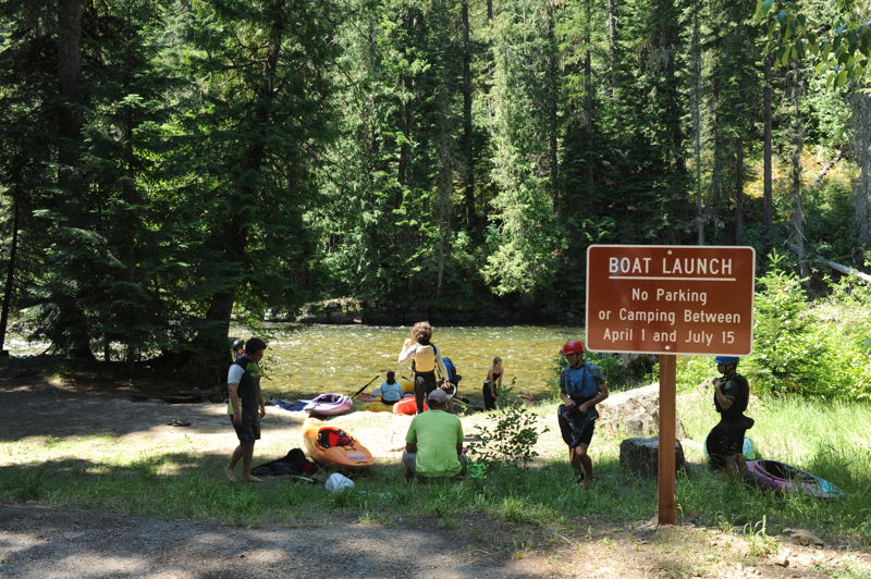
This campground is located at Highway 50 mile 75.3, less than a mile downstream of the Gold Creek conflunce. The campground features 8 camp units (2 on the river and 5 above the highway), potable water (June-October), vault toilets, and a day use area. A formal river access is available at the downstream end of the campround with convenient low bank access.
This rapid can be scouted from the road at the gravel pull out at Highway 50 mile 71.9. The ledge hole extends out from the bank on river left. The drop is recognized by the busy class III lead in and then the river makes a sharp turn to the left around a rock outcrop on river left. The ledge immediatley follows.
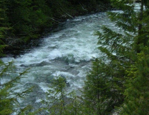
A section of busy class III whitewater can be viewed from the vicinity of Highway 50 mile 71.0.
A formal river access site 1.3 miles downstream of the Bluff Creek Bridge at Highway 50 mile 67.8 provides easy access for rafts or kayaks and parking off the highway.
Jun 30, 2021
We did this run with a group of experienced kids. The lead in to Tumbledown was class III but a couple kids were able to catch the eddy on river right immediately above the ledge. Everyone opted for a river left line. A couple hit the left edge of the hole but made it through fine. This was a great flow for a group of intermediate paddlers.
Jan 1, 1900
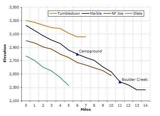
Gradient Comparison - Does not include upper St. Joe (Heller Creek)
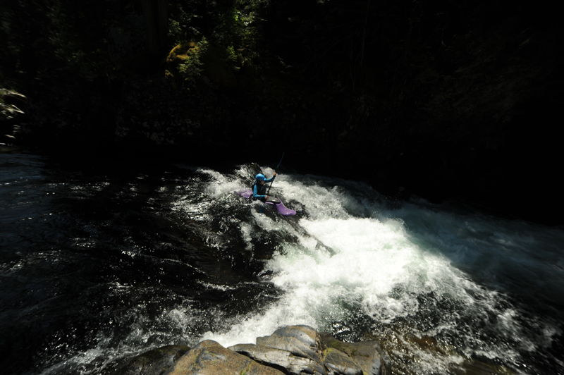
This is the long rapid leading into Tumbledown falls. The falls are around the corner to the left (top right hand corner of pic).
This is the lowe part of the lead in rapid to Tumbledown falls. Tumbledown is just around the corner.
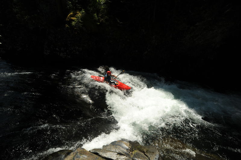
This is the hole in Tumbledown. It's easy to avoid, but you wouldn't want to go in there. At low flows (<1000 cfs) there is a slot move that opens up where the hole normally is.
Here you can just see both the lead rapid and ledge hole at the bottom. The picture makes the hole look much smaller than it really is at this level. The line is to the left of the hole.