| Difficulty | I |
| Length | 140 mi |
| Avg Gradient | 2 fpm |
| Reach Info Last Updated | April 7, 2021 |
Projects
Snake River Restoration (ID, OR, WA)
Encompassing 250,000 square miles, the Pacific Northwest’s Columbia and Snake River system represents a vast network of rivers that have served as the foundation for transportation and commerce in the region for many centuries. Before dams were constructed on these rivers, up to 16 million wild salmon returned to [...]Read More
River Description
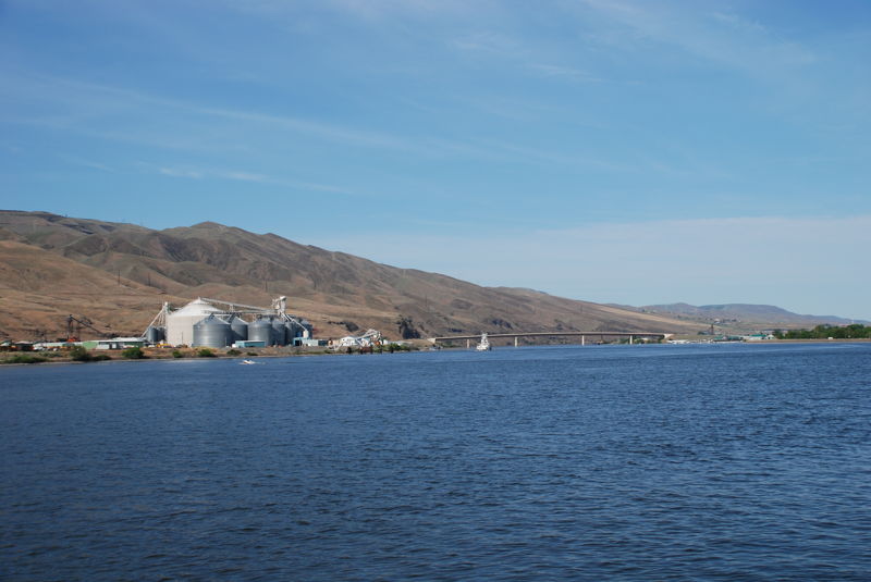
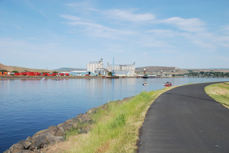
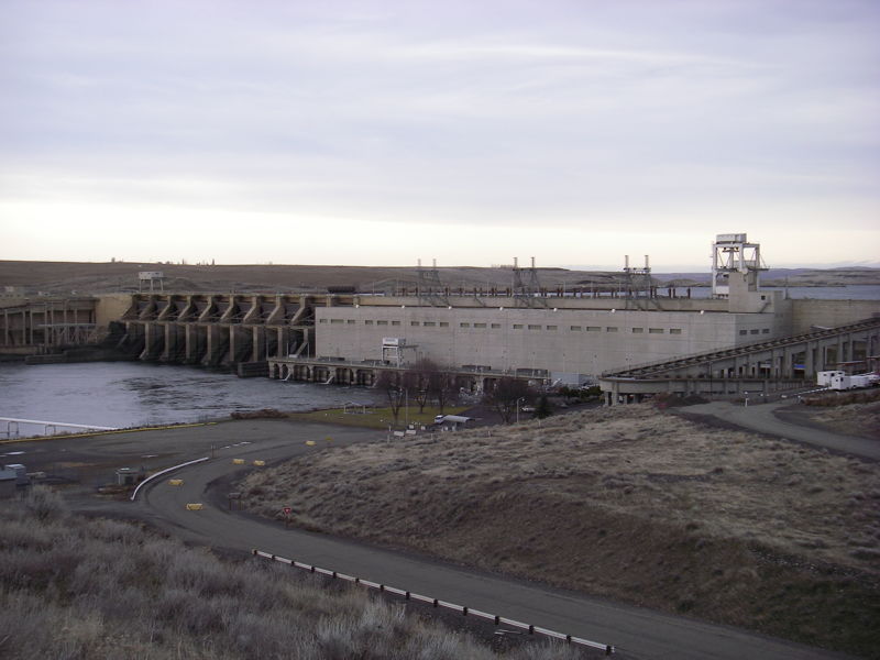
Congress authorized construction of the four dams on the Lower Snake River in 1945 and during the time period 1955 to 1975 the Army Corps of Engineers constructed Ice Harbor, Lower Monumental, Little Goose, and Lower Granite. The Corps documents 63 named rapids that were in existence prior to construction of these dams. Lewis and Clark encountered these rapids on their journey down the river in October 1805. Removing the dams would open up new opportunities for kayaking and rafting along 140 miles of restored river and would attract visitors from across the country.
In February 2002, the US Army Corps of Engineers released the Lower Snake River Juvenile Salmon Migration Feasibility Report/Environmental Impact Statement that includes a review of the economics of dam removal. In a study of potential river users, and not including recreational fishing, results showed that a large percentage of total general recreation visitation to a free flowing lower Snake River would originate from distant areas resulting in an annual contribution of $310.5 million (1998 dollars). The study found that current reservoirs are primarily local-use areas with visitors coming from 100 to 120 miles away. Reservoir users do not travel long distances as there are numerous reservoirs in the local area, including Lake Wallula downstream from Ice Harbor Dam very near the Tri-Cities area, Dworshak reservoir near Lewiston, Idaho, and three large lakes near Spokane, Washington. Those desiring a river-based recreation experience in contrast are willing to travel greater distances to visit free-flowing rivers. Demand for paddlesports would be for over 300,000 user days following dam removal.
The named rapids identified by the Army Corps of Engineers include the following: Upper Grande Ronde Rapids, Lower Grande Ronde Rapids, Upper Lewis Rapids, Lower Lewis Rapids, Upper Billy Creek Rapids, Lower Billy Creek Rapids, Captain John Rapids, Upper Buffalo Rapids, Lower Buffalo Rapids, Couse
...River Features
Snake/Clearwater Confluence - Put-in
Access PointDistance: 0.01 mi
Park and river access at the confluence of the Snake and Clearwater Rivers in Clarkston, WA.
Lower Granite Dam
PortageDistance: 31.57 mi
Little Goose Dam
PortageDistance: 68.57 mi
Lower Monumental Dam
PortageDistance: 97.31 mi
Sacajawea Park - Take-Out
Access PointDistance: 137.64 mi
Park at the confluence of the Snake River with the Columbia River.