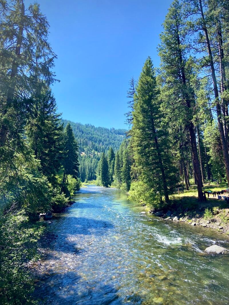
Minam
Reds Wallowa Horse Ranch to Wallowa River

| Difficulty | II+ |
| Length | 23.6 mi |
| Avg Gradient | 50 fpm |
| Permit | Self-issue permit at the trailhead or ranch |
| Gauge | Minam River at Minam, or |
| Flow Rate as of 26 minutes | 153 cfsbelow recommended |
| Reach Info Last Updated | July 26, 2024 |
This Wild and Scenic River flows through the Eagle Cap Wilderness. The put-in is at Reds Wallowa Horse Ranch. The take-out is located where the Minam joins the Wallowa River at Highway 82 mile 33.5 on the downstream river left side of the bridge across the Wallowa River.
There are no roads to the put-in but it can be accessed by hiking, or flying into the airstrip which services the Minam Lodge. To hike in, start at the Moss Springs Trailhead and follow signs to Red Horse Ranch. It is a 7.5 mile hike that descends 2400 feet. A self-issue permit is available at the trailhead.
'The lower section maintains the continuous character of the Upper, but at a class II grade. The first 10 miles are busy, consistent class II that ramps up II+ in a few places with mid-stream boulders necessitating a few maneuvers. I think its worth emphasizing that not all class II is equal. The continuous nature is best suited for developing paddlers with good boat control and self rescue skills. There are lots of midstream eddies and surf waves that make this section quite playful. Wood is still the primary hazard on the Lower, but the wider river bed seems to minimize the number of river-wide strainer that can accumulate (we did just two portages around trees in the summer of 2023). This section seems like a great hike and river combo for competent packrafters to introduce their beginner friends to the sport.' - timkelleyimages.com
May 30, 2026
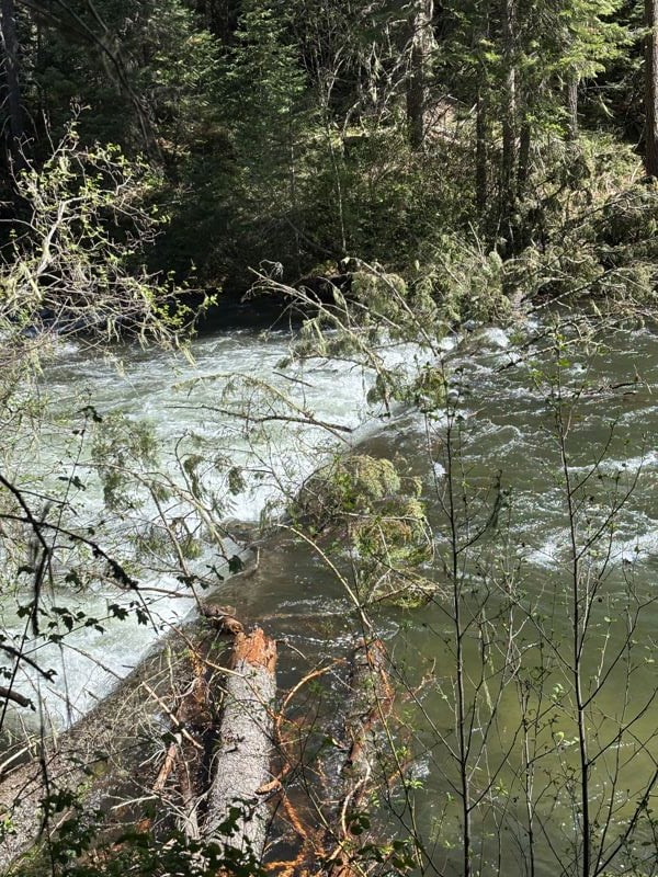
The large strainer mentioned below is at approximately 45.39232, -117.66820, about a half mile before the little Minam confluence. As noted there are limited opportunities to eddy out on either side of the river beforehand. We eddied out 50 yards upstream and lined our boats through a small 6ft wide channel that has been cut out on far river right.
May 11, 2026
Paddled the Lower Minam 5/9/26-5/10/26. Flow was 1350 at put-in at Red's Ranch Bridge, and 1250 at the Minam Rec Area Boat Ramp take out. There is a river wide strainer \~4 miles downriver from the Red's Ranch Bridge put-in. It is in a RIGHT bend in the river, and in the middle of a long rapid. We portaged on the LEFT side. The current was swift with few eddies on river left, but there are a few spots 20-30 yards above the strainer that puts you in thick vegetation and on a steep slope. Right side was inaccessible to portage due to no eddies and downed trees lining the river bank. Other options may appear at lower flows. There is also a fish counter about 1/4 mile above the take out on river left ... non-issue at our flows, but may come into play at lower water.
Jul 7, 2024
Date: 7/7/2024- 7/9/2024
Hike in: 7.5 miles
River Miles: 24
Flow: 400-350 cfs
Portages for wood: 2
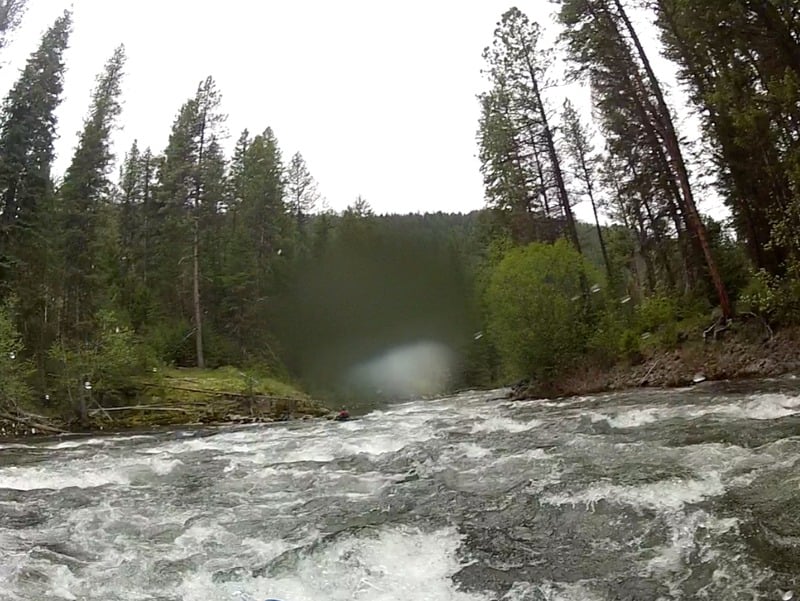
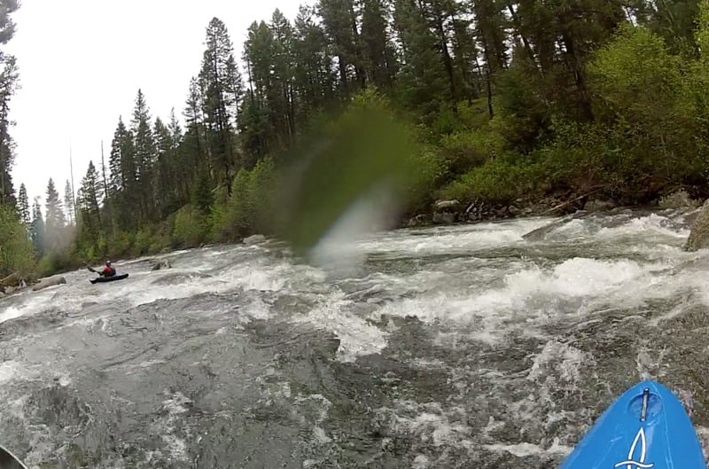
GoPro Video: Packrafting the Lower Minam River
7/7: Kira and I hiked from the Moss Springs Trailhead which descends 2400 feet down to Red Horse Ranch. The trail is a bit chewed up from horse traffic but otherwise in good condition. It was a hot day but the trail is mostly in the forest and exposed sections didn’t last long. There are plenty of side creeks, so we could have carried less water. It follows the Little Minam river valley. We scouted that river for packraft potential, but saw that it was choked with wood. We got to the ranch in about 4 hours. We planned to meet up with a group that had started with the upper Minam (Jim, Yann, Quinn, Jacob, and Priscilla), and found them at a nice large camp across the bridge from the ranch. We were now a group of 7, with a fleet of 2 Alpacka Wolverines, 4 Alpacka Valkyries, and one Tater IK.
7/8: We set off from our camp around 9:45 am, flows were around 400 cfs. We soon encountered wood. The first log was at river level and we were able to boof or sneak around it. Then we encountered a log that had fallen in the river from the right bank. The Valkyries were able to duck under it by edging allll the way over, but me and Kira in Wolverines and Yann in an IK chose to portage. We navigated a lot of Class II boulder gardens. We wanted to camp before crossing out of the wilderness boundary, so in the early afternoon we started keeping an eye out for camps. Lots of promising looking river terraces ended up being really brushy and overgrown. We found a hunting camp on river right a couple miles before the wilderness boundary. We covered 12 miles in about 4 hours.
7/9: Again we set off from camp around 9:30 am, and flows were even lower, around 350 cfs. Fewer boulder gardens on the second day of paddling. We mostly floated with our feet out since it was so shallow. We encountered a log jam where the river splits around an island and portaged around it. We saw more cows along the banks after crossing out of the wilderness boundary. Then we approached what we thought was a bunch of cows in the river, but as we got closer realized it was a massive herd of elk! Females and their calves. We flushed them from the river, it was quite the sight to see. We reached the takeout at 11:30 am, so despite the low flows we covered about 12 miles in 2 hours.
May 28, 2013
Low level
May 28, 2013
Low Level
Sep 14, 2011
The Minam is a great backcountry wilderness run. The whitewater sections above Red's Horse Ranch are worthy - http://teton.outerlocal.com/kayaking/minam-river-db