Flint
Sprewell Bluff State Park to Po Biddy Road
February 3, 2004
| Reporter | Brad Roberts |
Ran the Flint River, GA 36 Bridge to Lazar Creek take-out, twice on
Saturday, 1/31, with Sean McKinnon and Adam Gordon. First run we put on at
about 11:20 AM, second run at about 1:40 PM EST. First run was 8'2' and the
second run was 8'1.5' on the GA Hwy 36 Bridge. The river was dropping.
Impression, we could have used a little more water. There was a little bit
of play out there, but another half a foot more and there would have been
much more play and I am sure our river trips would have taken longer with
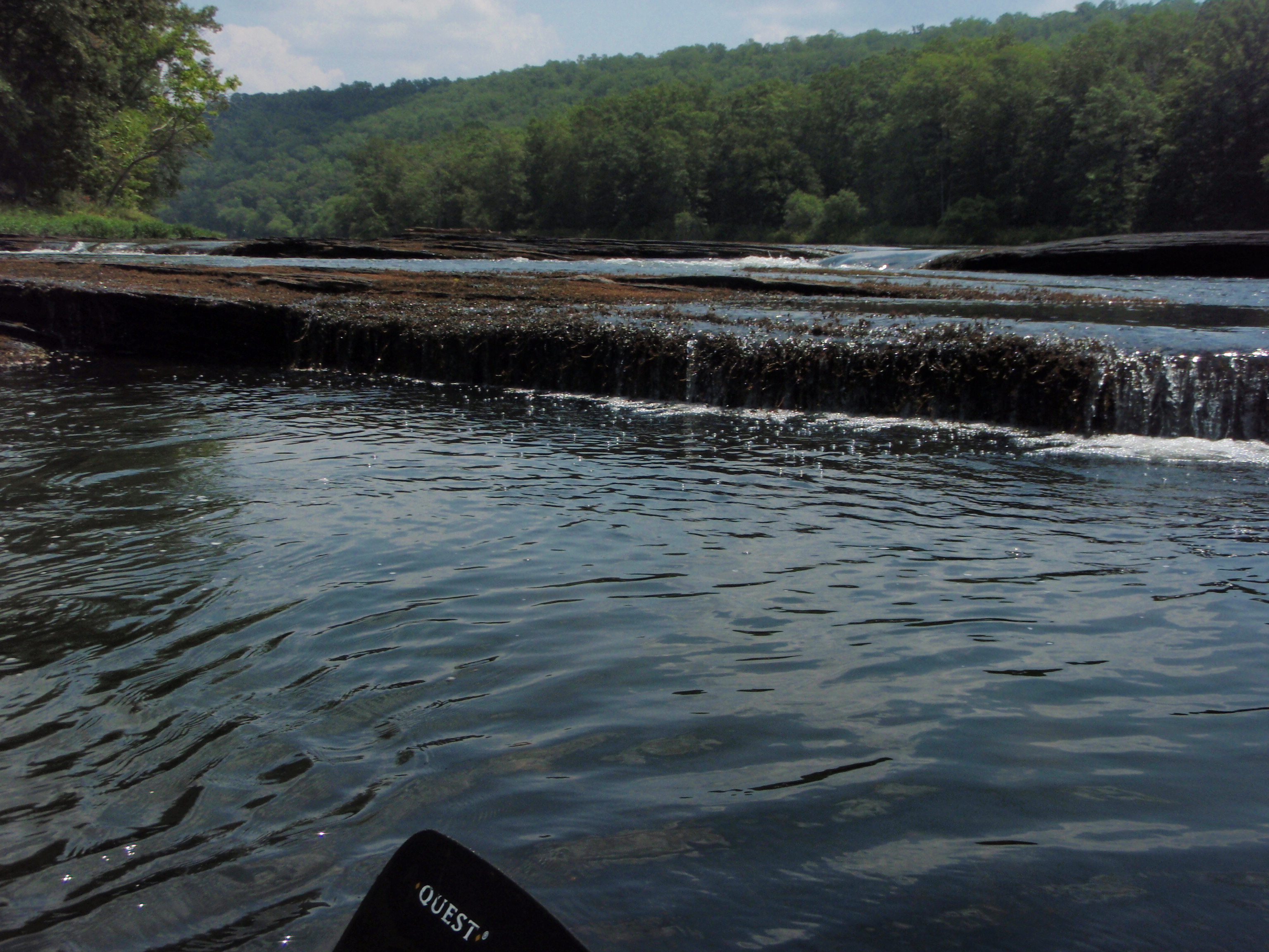
the extra play. All rapids at this level, except Yellow Jacket Shoals, were
class II. Yellow Jacket at this level was class III-. At higher water
levels the Yellow Jacket Shoals section transforms into class IV and even
before flood stage it becomes class V. If my memory serves me right, it is
class IV at 10' on the GA 36 Bridge and class V at 11', but I want to get
more runs to confirm this and get a better idea where the transition points
are. 7.5' at the GA 36 Bridge is getting pretty close to a minimum run, but
all rapids are still passable. This run gets fairly wide in places where
you can not see all the possible routes from upstream without doing some
paddling back and forth across the river.
Depending on road conditions and how much water is in the mud holes when you
get down closer to the Flint River, taking out at the Lazar Creek take-out
may require 4 wheel drive, but it does save 2.5 miles of flatwater paddling
that you get if you take-out at Pobiddy Rd instead. This wildlife
management road comes down along the Flint River south of Lazar Creek on the
river right side. The road was completely washed out and impassable about a
1/4 mile south of Lazar Creek, but this road is following the Flint River
there and you can just make your own take-out along through there with a
little extra effort. Susan Gordon was very gracious to provide shuttle for
us on both runs. Thanks a bunch Susan!
Knowing from Susan Gordon that the level was 8.5'+ on Friday and correlating
to the downstream Flint River gauge at US80/US19 at
http://ga.waterdata.usgs.gov/nwis/uv?site\_no=02347500 , the US80/US19 Bridge
gauge was at 4'2' and 4'1.5' feet when we were putting on at the 8'2' and
8'1.5' GA 36 Bridge levels, and the US80/US19 Bridge gauge was approximately
5' when the GA 36 Bridge gauge was 8.5'+. The US80/US19 Bridge gauge is
about 20 river miles south of the GA 36 Bridge and major tributaries of
Potato, Lazar and Swift Creek along with a number of other smaller
tributaries dump into the Flint river between the GA 36 and US80/US19
bridges that can make a correlation between the GA 36 Bridge gauge and
US80/US19 Bridge gauge to fluctuate.
Enjoyed paddling again as always with you Sean and Adam and thanks again
Susan for the shuttle,
Mark Hicks <><