Flint
Sprewell Bluff State Park to Po Biddy Road
Sep 6, 2020
Ran Flat Shoals road near Concord GA to HWY 74 Woodbury yesterday. Flat Shoals is gorgeous and was the set of the Walking Dead for an episode. Put in on the northeast side of the bridge in Pike County. You will see a sign that says 'no parking'. Put in there and park your car up the east side of the bridge a hundred yards on the right and you will be fine. We were at low water levels (800 cfs or so) and had to drag our boats over a few shoals down past the bridge but it wasn't bad. Stay left as you exit the main shoals area and there are a couple of Class 1+, maybe Class 2 depending on water levels. A lot of fun. I'd say 2/3rds of the run was good moving water with several Class 1s as you move south. Saw lots of wildlife and gorgeous scenery. Incredibly quiet here! Last 2 miles were slow. Caught a shoal bass! At the take out, make sure to go to the ramp. The area can be deceiving and you could be fooled into going up the dirt bank. Continue down about 150 yards past the Hwy 74 bridge and you will see the ramp waiting for you. Beautiful section of the river that many don't see because of the walker at Flat Shoals Road. Warning - there is still a walker at Flat Shoals today! He will harass you from the bridge and will move over to the west side of the river and harass you from the banks. He will claim that he will 'call the game warden on ya' if you step out of your boat to get over a shoal. He drives a white pickup truck, is about 80 with white hair and is harmless. He claims he works for the landowner and that 'when the water is low, his boss owns the river'. Such malarkey! But he will try to make you think twice about coming back. Go back! Perhaps we could get a coalition for a class action on this guy. So ridiculous. The rivers are ours! I plan on going back when the water is up and invite the game warden to go with me!
Jun 14, 2016
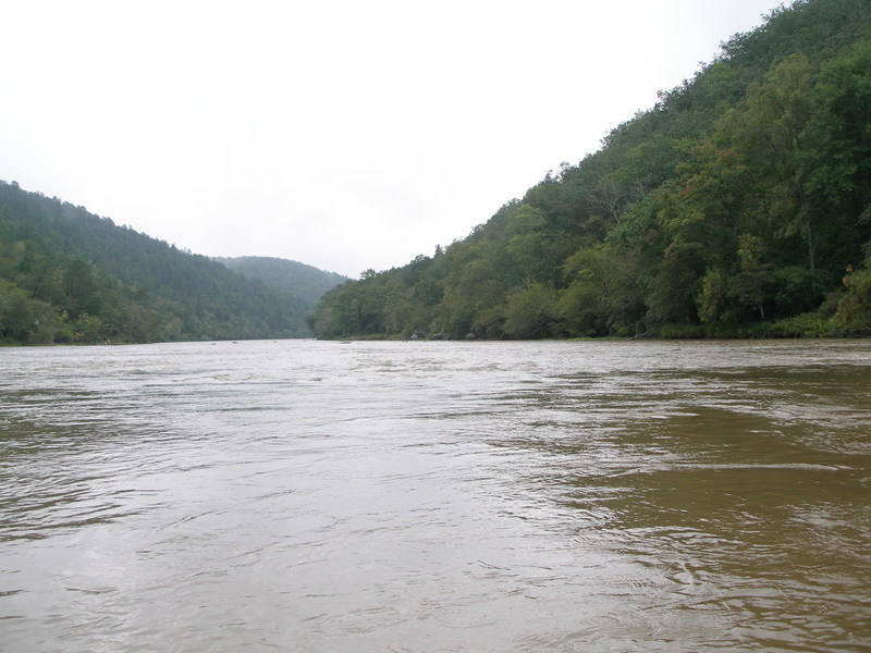
Ran the Sprewell Bluff-Hwy 36 section on 6/11/16. CFS at Carsonville was 622 and the Hwy 36 gauge was at 7 ft.
A little low at these levels. There was quite a bit of flat water, and I had to get out 4 or 5 times to pull my kayak over rocks.
2-3 hours, depending how hard you want to go.
Nice quick trip, but recommend making sure the Hwy 36 level is @ 8 ft. or higher.
May 6, 2013
I don't know how many cfs it was, but circa 1994 , I went solo from the hwy 36 bridge to a take out near big lazar. The gauge on the 36 bridge was covered up and you could barely see up under the 36 bridge. I guess it was 15 foot or more because the gauge was covered up. I was solo in a 15 foot Mad River Explorer. I still have five canoes. I had only a bow and a stern bags installed, on my knees, no saddle. I took in some water as I passed over hightower shoals, pulled up in some willow trees and emptied out. When I looked at the yellow jacket shoals, ( I recognized the shore line ) I choosed straight middle and I passed over THe horseshoe at yellow jacket I could see a faint line of the horseshoe. No rocks were exposed and I consider myself very lucky. I didn't have my camera that day, you could see why.,but I have pictures on my website about the same year(s) of me going through the horshoe at Yellowjacket.go to www.rickywhitley.com. Click the pictures and video and you'll see me with the ABB. band . The picture of the guy with the boonie hat in the middle of the bottom of the horeshoe. The others with blue Kayak is on Hatchett creek Al. And green open canoe dropping powell falls ( classIV) Locust Fk Warrior Al. I went to the Flint today May 5 2013. It was over 11 ft and stained. I had my boat but backed out, alittle cool could't get in the mood. Headed to Hatchett. I don't reccomend going down the Flint at that high level. I've never seen it that high since and probably would't do it again. I've never been stung by the yellow jacket, The one on river right I allways avoid. I've been whitewater canoeing for over 30 years and still feel like a teenager. You can to become one with your canoe, good luck to you. Ricky Whitley www.rickywhitley.com
May 6, 2013
The Flint is a nice river. I spent 4 days and nights on it one time and went all the way from where it looks like a ditch above Halonville near Zebulon. It took a while and there was a lot of dead water in areas where I wished I had a motor. camped out above the sea ( C ) , below David Knott bridge near Gay Ga. , Goat Mt. and above Goat Mt in somebody's waterfront yard. It was dark and a man hailed me , as it was just getting pretty dark. He offerd to let me camp there. He was a nice fellow, I'll never forget it. His name was Mr Fowler, an air traffic controller in Atlanta. Thats about the longest river camping trip on one river I've done. I miss camping on the Flint. It has changed over the years. A lot more Houses have been built. It's still one of my favorite floats in between notes. R. W. www.rickywhitley.com like my fan facebook page please. Thank you paddling friends for sharing stories of floats on the flint.
Feb 5, 2011
Feb. 5 2011
US 19 Downstream Gage- kicking around 10,000cfs or 11.44 feet
36 bridge- just shy of 11 feet
We ran from The Bluff to Podbiddy Bridge, 2 solo canoes. The river was running fast, huge holes in sections, the natural dams were nothing but wash overs, wave trains the role way. Yellow jacket was practically unrunnable, atleast for a solo 14' canoe looking for a clean line(there was no such line). 1 canoe portaged, I was not so lucky. Scouted from island in middle before Yellow Jacket on the left and the 'No Namer' on the right. The no namer looked less forgiving, so I siked myself up, clanked on the on balls of steel, and went for the best line i could find. The river decided it was gonna take me on its own path. It shot me through 2 shoots that are not there at around 800cfs, swamped me but i kept it afloat. Unfortunatelyedly I got turned sideways and pinned on two rocks. Normally this spot is out of the water and covered in river grass. I couldnt manage to unpin it, so i salvaged my drybag and took a swim to the island about 150-200' away. after getting my buddies boat and gear across the river to the island, i set up a Z-drag and added all the muletape(we use it to tie down gear, 1200lb strength) to throwbag, attempted to wade 3x to boat, never successfully made it, and our rope was looking to come up short. I didnt lose much, it was free boat, maybe lost $5 in making my seats. we ended up portaging one more rapid that was river middle on the right side of the island, looked to have a nasty hole and since we were now tandem paddling i decided we should portage. a little under a mile we hit a nasty wave with a deap trough that swamped us and took us for a 100yd swim. we dumped the boat and a way we went. 1 mile of choppy water and to the take out we were. I will attempt to rescue hopefully not a Taco tomorrow. the saying is true 'the river gives the test, and then teaches the lesson'.
Do not run at 10,000cfs unless you have Creek boat or raft!
At the time scouting upstream from the middled i was thinking Yellow Jacket seemed like a Class IV. From seeing the the shoals downstream from island i would say a Class V.
the 'No Name' rapid(falls at current level, small shoot at low level) shall now be known as 'The Michi Rapid'
On a second note, me and my paddling partner have created the 10K Club for the Flint River, more specifically the Bluff to Pobiddy section, If you have ran at or above this level Post Up and Join the Club Paddler Friends.
Jun 7, 2010
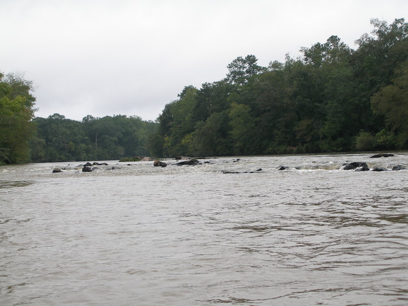
Dad and I paddled from Sprewell Bluff to the outfitter @ GA 36 yesterday - the flow was about 2100 CFS on the online gauge. A lot of flat water, but not bony at all - no dragging. There were 2 decent rapids, a few shoals, and a few waves/holes that were surfable. I would rate this river II- at this level. Also - be wary of the 'map' and 'directions' tabs for this page - they show the put-in at the GA 74 bridge. If you put in there, it is about a 20 mile paddle - about 14.5 miles longer than the paddle down to GA 36 from Sprewell Bluff (which is about 5.5 miles). The outfitter offers shuttle, but we shuttled ourselves. It was still $5 per vehicle, plus $1 per boat to park at the outfitter (take-out), and $5 to park at the put-in at Sprewell Bluff. Be careful out there - my dad got a Staph infection from getting the water in a scrape on his elbow - nasty water.
Sep 20, 2009
1200 cfs. This was right after Goat Mountain. 10 miles from Hwy 18. Hardly any more flat water after this point. River spreads out and is more shallow creating constant small shoals to Sprewell Bluff. Good steady run above 1000 cfs.
Sep 20, 2009
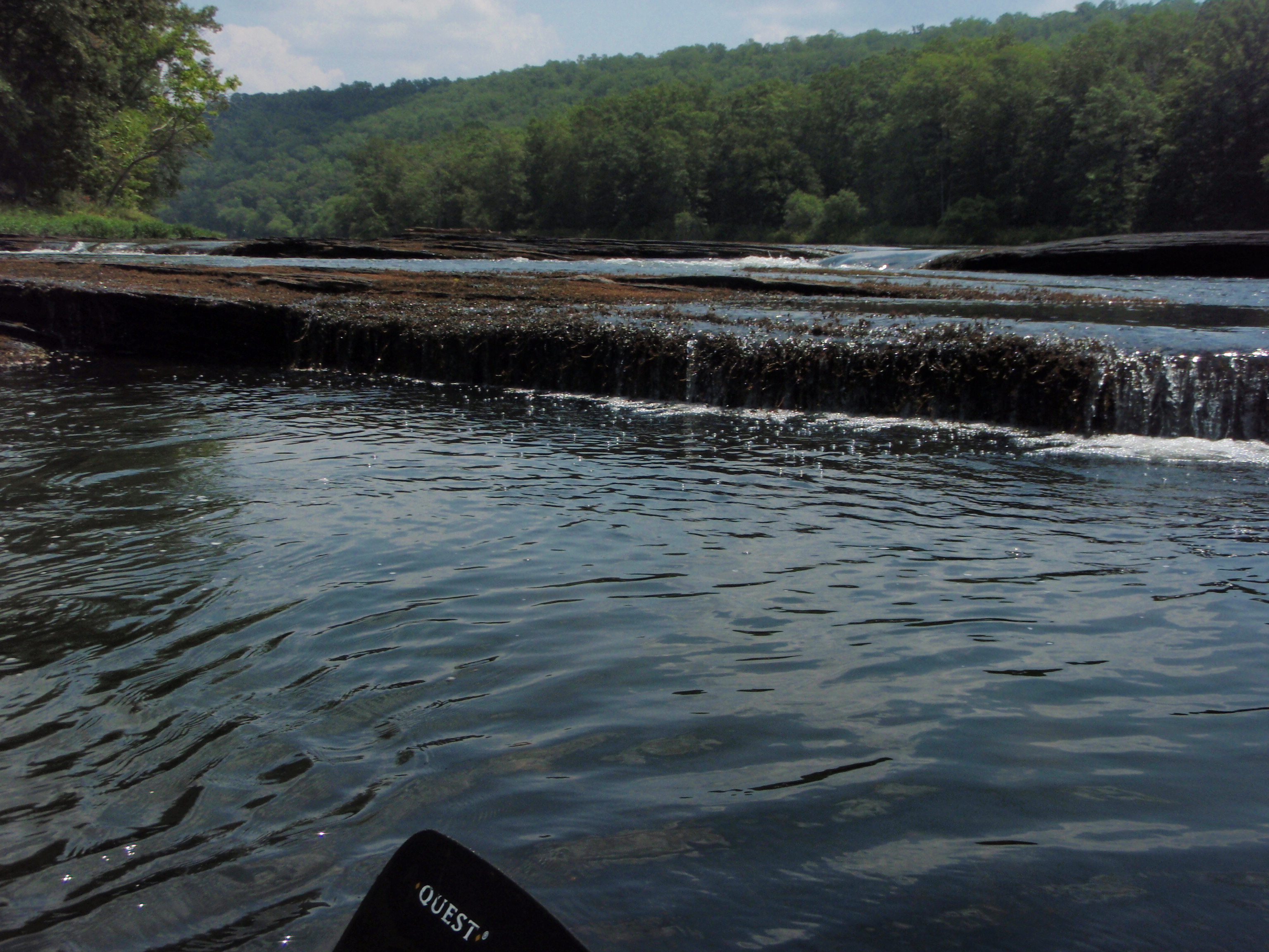
CFS at 1200. Atlanta had just had a pile of rain the day before. Perfect level to get over the shoals including Natural Dam. Some flat water, but made the 20 mile run in 5.5 hours. Would not reccommend this run under 1000 cfs without dragging your kayak some.
Aug 16, 2009
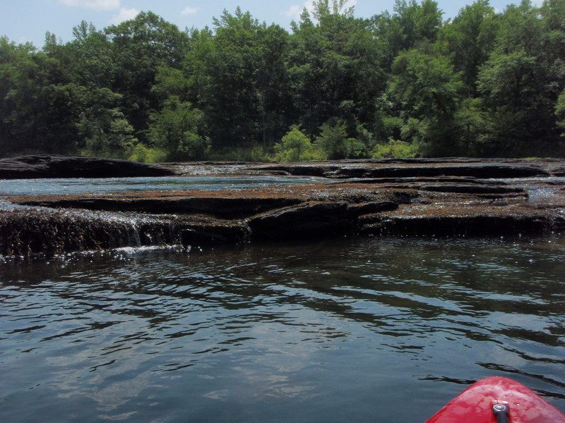
Natural Dam upstream view. was really too low to run without an extremely shallow draft, lots of zig zagging through the shoals.
Mar 27, 2009
Paddled Sprewell Bluff to the outfitter on 3/22, gauge was at about 2100. All this rain certainly helped, not scrapey at all as some folks who'd been there for Paddle Georgia last year reported. Several nice spots to play a little but generally suitable for all levels of paddlers.
Aug 17, 2008
I paddled from Sprewell bluff to Highway 36 yesterday. The height at Carsonville was <1.5 ft. I was in a tandem fiberglass lake canoe...it was more of a fishing trip.
It was painfully low. Basically alternating between flatwater to pulling a canoe over rocks back to flatwater. Maybe two rapids that were runnable in a canoe. 3 or 4 in a whitewater boat. Not worth it as a paddle for fun...great fishing trip though. If you're willing to pull your canoe over some rocks you can definitely pull in quite a few shoal bass. I wouldn't go back unless I was fishing or the water was higher.
Feb 3, 2004
Ran the Flint River, GA 36 Bridge to Lazar Creek take-out, twice on
Saturday, 1/31, with Sean McKinnon and Adam Gordon. First run we put on at
about 11:20 AM, second run at about 1:40 PM EST. First run was 8'2' and the
second run was 8'1.5' on the GA Hwy 36 Bridge. The river was dropping.
Impression, we could have used a little more water. There was a little bit
of play out there, but another half a foot more and there would have been
much more play and I am sure our river trips would have taken longer with
the extra play. All rapids at this level, except Yellow Jacket Shoals, were
class II. Yellow Jacket at this level was class III-. At higher water
levels the Yellow Jacket Shoals section transforms into class IV and even
before flood stage it becomes class V. If my memory serves me right, it is
class IV at 10' on the GA 36 Bridge and class V at 11', but I want to get
more runs to confirm this and get a better idea where the transition points
are. 7.5' at the GA 36 Bridge is getting pretty close to a minimum run, but
all rapids are still passable. This run gets fairly wide in places where
you can not see all the possible routes from upstream without doing some
paddling back and forth across the river.
Depending on road conditions and how much water is in the mud holes when you
get down closer to the Flint River, taking out at the Lazar Creek take-out
may require 4 wheel drive, but it does save 2.5 miles of flatwater paddling
that you get if you take-out at Pobiddy Rd instead. This wildlife
management road comes down along the Flint River south of Lazar Creek on the
river right side. The road was completely washed out and impassable about a
1/4 mile south of Lazar Creek, but this road is following the Flint River
there and you can just make your own take-out along through there with a
little extra effort. Susan Gordon was very gracious to provide shuttle for
us on both runs. Thanks a bunch Susan!
Knowing from Susan Gordon that the level was 8.5'+ on Friday and correlating
to the downstream Flint River gauge at US80/US19 at
http://ga.waterdata.usgs.gov/nwis/uv?site\_no=02347500 , the US80/US19 Bridge
gauge was at 4'2' and 4'1.5' feet when we were putting on at the 8'2' and
8'1.5' GA 36 Bridge levels, and the US80/US19 Bridge gauge was approximately
5' when the GA 36 Bridge gauge was 8.5'+. The US80/US19 Bridge gauge is
about 20 river miles south of the GA 36 Bridge and major tributaries of
Potato, Lazar and Swift Creek along with a number of other smaller
tributaries dump into the Flint river between the GA 36 and US80/US19
bridges that can make a correlation between the GA 36 Bridge gauge and
US80/US19 Bridge gauge to fluctuate.
Enjoyed paddling again as always with you Sean and Adam and thanks again
Susan for the shuttle,
Mark Hicks <><
Nov 18, 2002
from Adam87 on Boatertalk:
Sprewell Bluff State park..in Thomaston...... I just paddled it this weekend. when the Flint gets flooded, it makes some pretty nice waves and holes.The hole i was referring to is at the state park, i just hiked up a path about an eighth of a mile and saw it and put in......it has a nice eddy up above it that you can paddle back up to easily and up further past the hole there is some bigger water features that i didn't attempt. When ever the flint gets up to 10 feet or so it makes a fun ride.
Nov 17, 2002
From Adam87 on Boatertalk:
I live south of atlanta (about 70 miles) and i paddle the flint river often. Whenever it is flooded(like this week it was at 10 1/2 feet) it creates this hole that has about a 3 to 4 foot wave behind it and is about 20 feet wide it was plenty deep enough to throw all the moves( i hit a rock once the whole day). I found this little hole more enjoyable than callahan's ledge on the upper ocoee. also, there is yellow jacket shoals. This is a pretty fun section to paddle that can quickly turn into a class 4 or higher when the water rises(i haven't paddled it yet when it was up that high , but it is supposed to be a pretty technical part).