Lazer Creek
Sunrise/Hendricks Road to Flint
| Difficulty | I-II |
| Length | 9.9 mi |
| Avg Gradient | 7 fpm |
| Gauge | Muckalee Creek Near Americus, Ga |
| Flow Rate as of 1 hour | 38 cfsbelow recommended |
| Reach Info Last Updated | May 5, 2025 |
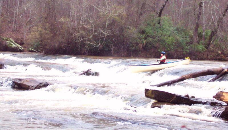
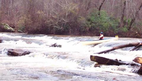
This is one of Georgia's prettiest and most remote Fall Line runs. Typical of Fall Line runs that spill over the edge of the Piedmont onto the Coastal Plain, considerable flatwater separates the rapids, of which there are mostly Is and a couple worthwhile IIs. The riverwide stairstep ledge near Coleoatchee Ck confluence might be a III. It's an impressive II+ at the very least. Swims could be long and lumpy but the routes are straight through and recovery (eventual) not a problem.
The DNR provides two developed take-outs. A fork in the shuttle road (32.8003,-84.3988) has a sign indicating your choice of access points: 'Lazer Ck' and 'Flint River'. The one labeled 'Lazer Ck' is 0.2 miles upstream of the confluence (32.8078,-84.4042). The one labeled 'Flint River' is on the Flint 0.8 miles downstream of the confluence (32.8009,-84.3968). The choice is entirely about whether you want to paddle or drive that last mile.
Consult the WMA map online https://georgiawildlife.com/big-lazer-creek-wma because Google Maps doesn't know its way around the WMA roads:
River left downstream side of the bridge works well. I've used river right side on most occasions but the slick, steep riverbank makes for a difficult launch. The area surrounding the river right side has been decorated with no trespassing signs, which appears to coincide with recent purchases of adjacent property tracts by fishing/hunting businesses. The DNR have been notified that the signs are located in the public right-of-way beside the road.
Big Lazer Creek WMA land begins here and continues on river right for the remainder of the run.
DNR access point at river mile 0.1 just upstream of the Flint confluence
The second of the two developed DNR take-outs, this one is on the Flint 0.8 miles downstream of confluence. It adds one mile of brisk smoothwater paddling beyond Take Out #1 and saves one mile of driving.
This might be an alternative to the Sunrise Rd bridge put-in that becomes useful if landowners between the bridge and the start of WMA land restrict passage.
Located 2.5 miles downstream of Sunrise Rd bridge, at river mile 6.5.
The road might be gated for some or all of the year.
Driving directions
1) Use google to navigate to 32.7799, -84.4358 on Bunkham Road.
2) Turn left there onto St Joe road
3) Drive northeast on St Joe road 0.8 miles
4) Turn left onto a side road at 32.7856, -84.4476
5) Drive westward 0.6 miles to end of the road at 32.7834, -84.4564
6) Park. Follow the trail westward 0.17 miles (300 yards) to the river
Drive here first via Google directions. Then continue on to either of the two take-outs. Google doesn't know the road continues past this point.
Drive here second. Don't ask Google how to get here. As the sign indicates, this fork in the shuttle route goes one way toward take-out #1 near the confluence. The other way goes toward take-out #2 on the Flint River.
It's vital to note that Google Maps does not give proper directions to this point. Google will tell you to park on the wrong side of the Flint and swim here.
Jun 24, 2026
USGS 02351500 Muckalee Ck at Americas' flow has corresponded to Lazer Ck's level on these occasions.
Muckalee Ck --> Lazer Ck observations
450 cfs --> 20–22 inches below the seam in the river right bridge piling; good level
230 cfs --> 36 inches below the seam; lowest level I've enjoyed
285 cfs --> 40 inches below the seam; below my min for enjoyment
240 cfs --> 41 inches below the seam; below my min for enjoyment
100 cfs --> 54 inches below the seam; agonizingly low...drag through shoals
Notice, above, how 230 cfs was good one day while 285 cfs was too low on another day. The correlation between these two streams is imperfect.