Mossy Creek
New Bridge Road to Chattahoochee River
| Difficulty | III-IV |
| Length | 6.6 mi |
| Avg Gradient | 120 fpm |
| Gauge | Chattahoochee River Near Cornelia, Ga |
| Flow Rate as of 15 minutes | 687 cfsbelow recommended |
| Reach Info Last Updated | March 22, 2006 |
Gauge Description:
Look for the ledges on the upstream side of the put-in to be well covered. If its looks like your boat would drag at all on the rocks at the put in, then there is not enough water.
If you see standing waves at the put-in, then Mossy is too high. Mossy is generally run when everything else is at flood. Look for the Chattooga to be 3 feet and rising, or the Upper Hooch to be 5 feet and going up.
RIVER DESCRIPTION
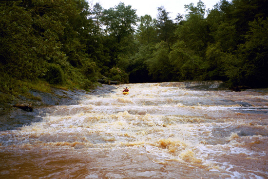
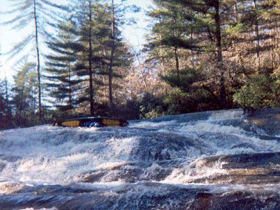
Mossy starts with about a mile of flatwater. The first rapid you come to is a small 4 foot tall riverwide ledge. Shortly after this is a small S-turn rapid with a variety of routes. This is followed by more flatwater. Then you come around a bend and see the mother of all horizon lines. Something not unlike being at the top of Oceana at Tallulah Gorge. This is the start of the slides.
At low flows the first group features about 4 slides. At high flows those first four turn into one real big Class 5 slide/rapid thing. There will be a pretty grist mill off to the right below the first group of slides. At normal flows run the first one on the right. There is a decent sized pool between the first and second slide. The second and third slides are bisected by an island. After the first slide, the cleaner lines are on the left, so, run the next three slides on the left. After that theres a good sized pool beside the old mill.
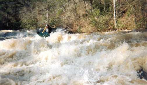
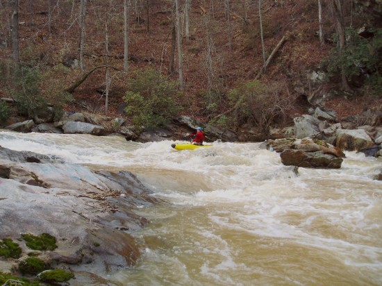
Then there is the ledge slide. This one has about a 9 foot vertical drop into another big slide. This one forms a strong hole on the top right at high flows. After that there are still 4 more big slides before you get to the really big one, 'Over the Bars'. Water levels will dictate the lines on all of these. Scout what you can't see. After the big one, there are two more smaller slides and two class 3/4 boulder drops before you hit the confluence with the Chattahoochee. There are two undercuts on the left in the last series of drops.
From the confluence to the take
...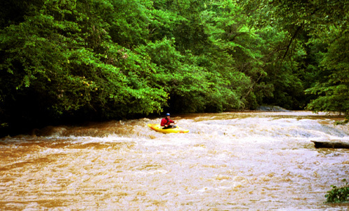
The first slide on mossy. Its about 4 feet tall, and can be run anywhere. Its named after some skeptical comments a famous video boater made before he came around the corner and portaged the big slides.
The river takes a hard left turn and makes a small drop. There are two midstream rocks you can weave around, and do some warm up eddy catching.
A large slide. Most of the water goes down the right side. Usually scouted on the left. Easiest portage is on the right and requires paddling back upstream a bit.
Second Slide. At higher flows the first three slides turn into one very large long slide. At those levels you are likely to run down the right side the whole way.
The third slide is marked my a midstream island. The left side is steeper than the right.
Theres an eddy between the third and fourth slide, but they are pretty much on top of each other. At higher flows this drops makes a huge hole.
At high flows this one is tricky. The hole on the right is really sticky, and below that is another 25 feet of sliding drop. At really high flows this drop can be snuck on the left - but that involves boating more on rock than water, then banging down the rest of the slide in the middle.
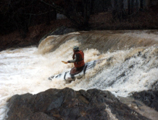
The biggest and steepest individual slide. Be careful at this one, there is a nasty piton rock at the bottom that wants to send short creek boats into the 'over the bars' mode. In other words, you piton, then face plant.
Scout from behind the large boulder, river right. There is a hidden 6 boat eddy behind the rock. You'll know this is the big one when you come around the corner and see tree tops way on past the horizon line. Easiest portage is on the right.
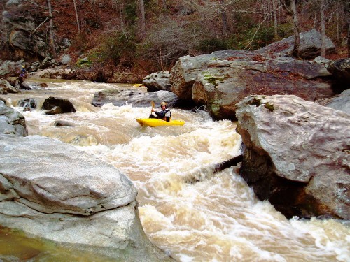
You'll come around a tight bend a see a rapid that is NOT a slide!?!?! This one features some twisting sliding turning routes. Start top right and work the multiple routes to the bottom. Last seen, the bottom right slot had a hidden death strainer that could not be seen from above. It was a log about 9 inchs thick that a boat would fit under, but not with a boater in the boat. Scary. Look before you leap.
Named after the Rebel Flag Painted on the rock on the bottom left. Ride the ramp down to the strong wave/hole the
top left. Either eddy beside it, or make the quick move back to the right.
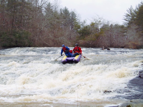
The last rapid before the confluence with the Hooch. A tricky little rapid with some nastily placed rocks, and an undercut on river left. The move is to stay away from and out of the undercut. This one gets easier as the water gets higher.
Jan 4, 2022
Ran mossy yesterday 1/3/22 @6800 cfs and dropping on the hooch gauge. It rained quite a bit the night before. This was our first time out there. I probably wouldn't go out here any lower, but it was still plenty of fun. Water quality is about as bad as short creek AL. FYI large riverwide strainer in the first quarter mile. Not a hazard at this level.
Jan 21, 2012
This article is a home run, pure and silmpe!!!
Oct 2, 2005
UPDATE RE. CONFLUENCE TAKE-OUT
The concrete pillar at the turn onto the dirt road has been updated with a new (and much more readable) name: Homeplace Road. Due to new construction in the area, it looks more than ever like a driveway but goes jsut about exactly one mile to the DNR cul-de-sac/parking area. Good news is that the road has been recently maintained: bad news is that appears to be due to anticipated new construction along the road. No Trespassing signs abound along the road.
From intersection of Skitts Mountail Road and Skitts Mountain Drive (.2 miles south of hall/White County line), Homeplace Road is .6 miles east on Skitts Mountain Drive (past the intersection where Callus Mill Road goes left and Morrison Road goes right).
If you want to walk down to Mossy Creek at the confluence, follow the road/path that is at about 11:00 o'clock when you enter the gravel cul-de-sac/parking area. The path up the hill that passes the DNR sign (which says permits are required)pretty much disappears over the top of the hill, well short of the creek.
May 2, 2003
The biggest slide on Mossy. The top move is nearly vertical with a very shallow landing zone. There is a second tier in the bottom half of the slide.
Jim coming around the corner and about to punch the big hole backed by the undercut. There is a bad strainer in the right side of this rapid.
Coming off the bottom tier of the slide.
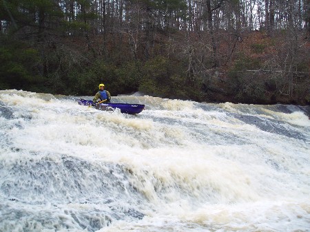
Peeling off into the second slide. At higher flow alternate lines open up.
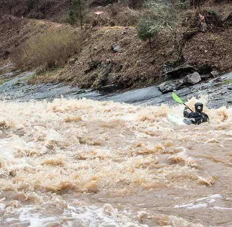
its bigger than it looks.
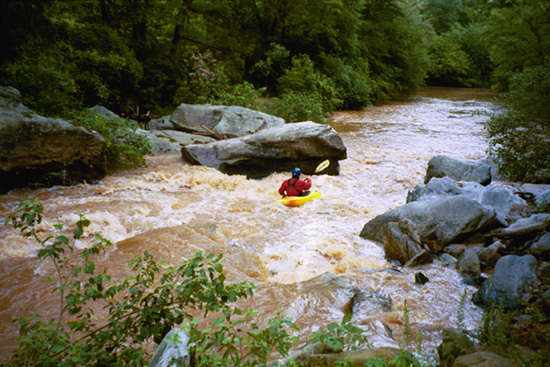
The first little class 2 slide after the flatwater. Next thing around the corner are the big ones.
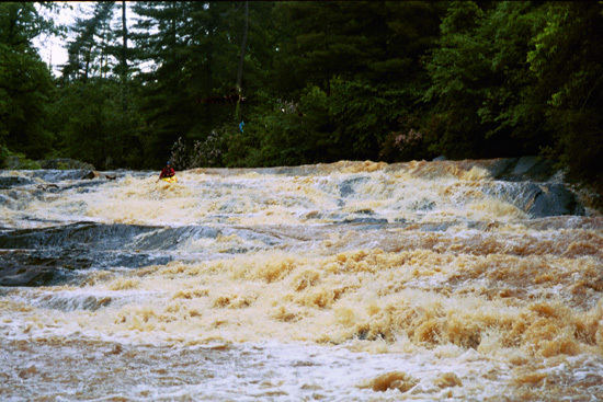
More sliding action on Mossy.