Potato Creek
Hwy 74 to Flint River
| Difficulty | III-IV |
| Length | 12 mi |
| Avg Gradient | n/a |
| Gauge | Potato Creek at County Line Rd, Nr Orchard Hill,ga |
| Flow Rate as of 45 minutes | 2 cfs |
| Reach Info Last Updated | January 12, 2025 |
David Tillman paddling a Gyra-Max on Potato Creek.
Photo courtesy Will Reeves.
Photo circa 1992...we think.
From Mark Hicks, March 2003:
As far as Potato Creek, here is part of a recent e-mail I sent on it recently (It is located west of Thomaston, GA): Friday evening the level was an inch and we played and played right up to dark and took off the river in total darkness. You would have had a ball out there as the air and water temperature is warmer being that far south. We ended up not running the four big drops below GA Hwy 36 because all the light we were getting was mostly from star light. I was not disappointed because the slides start getting a little bony at that level and it meant we did not have to climb back up hill to get back to the bridge afterwards. I was surprised there was still good play-spots between the bridges at what I would consider a lower level run. Zero is what I consider the lowest fun level, but you can still get down at -4' and I have even done a -6' in my Topolino but I would not recommend it. I consider a high water run to be anything above 1' on the gauge.
The Potato Creek gauge is a painted on gauge on a center pillar of the GA Hwy 74 bridge. A water level that is even with the pillar's slab platform is considered zero. I have almost always used this bridge as the put-in. I once put on one bridge upstream at really high water/flood stage on Hannahs Mill Rd. for some class II+ fun with big waves to play, but it would be a very rare occasion that anyone would find those conditions, and most of the time it would be just a boring class II that some people could use as a warm up because the first rapid below the GA Hwy 74 bridge depending on water level is class III-IV (V or higher at high because of a keeper on the left of the island and unbelievable conditions on the right of the island). I have put on as high as US 19, but there is nothing but flat water and strainers between US 19 and Hannahs M
...The rapids that begin shortly below Hwy 74 fall 80' over 0.8 miles (100fpm)
Optional Takeout above some slides but all of the rest of the rapids are upstream between the 74 and 36 bridge. The river to the Flint is mostly flat.
Jul 27, 2009
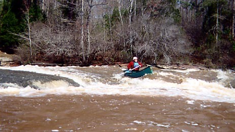
There is an upstream put in that will cost you some flat water but, you will come to a 70\30 split with the 70% going over a fall to the right and the rest down a 100 yard slide that drops into a pool just in time to set up for a 10 ft drop with 15 ft to get back right or else the main flow there pushes into a rock wall. I went by the store right by the bridge and quickly found a local that took 2 guys & 2 canoes to the put in while leaving our truck by the bridge for take out. I think I paid the guy 10 bucks but that was 20 years ago. the time to go is 2 days after a heavy thunderstorm in the area. ther water will be up enough to make it exciting
Jan 1, 1900
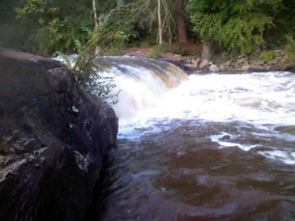
Just downsteam of the Hwy 74 bridge is the first rapid. The more challenging section of the falls can be found on river right. Mark Hicks and Peter Horne take different lines throught the falls. Of course more lines open up with more water.
Just downstream of Hwy 74 on river right is a fun little ledge drop. Its not as challenging as what you'll find on far river right, but its still fun. If you do run the river right falls, paddle back to river left and do the easy hike up to run this drop. Its worth the effort.
Peter Horne runs one of the many slides on Potato Creek.
Peter Horne runs one of the many small slides found on this section.
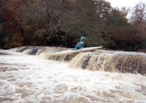
Peter Horne boofing a small ledge.
This is the end of the Slides section of Potato Creek.
Peter Horne side surfing one of the many playspots on Potato Creek.
One of the most powerful rapids on Potato Creek is Dudley's Demise. Its also one of the better play holes at lower levels.
Peter Horne lines up to run the next rapid after Dudley's Demise.
Peter Horne and Tad Day chat, cuz now its the only thing to do til the take-out.
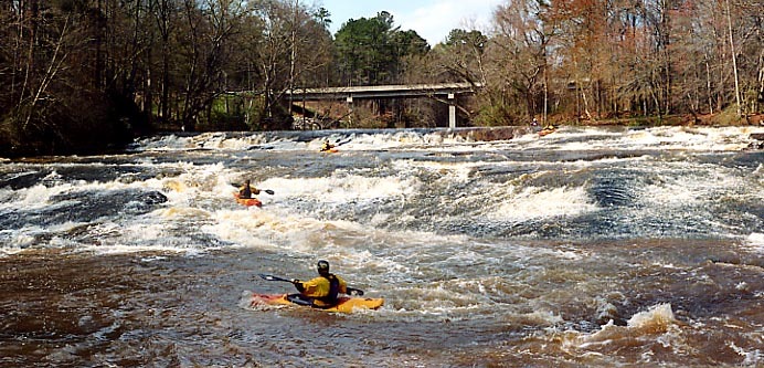
Mark Hicks runs the top part of the GA 36 rapid. You can see the GA 36 bridge in the background. If you are taking out at GA 36 hike back to the bridge on river left as close to the river as possible. It is private property and the land owners have been nice so far.
Peter Horne and Mark Hicks run the middle part of the GA 36 rapid. You can see the GA 36 bridge in the background. If you are taking out at GA 36 hike back to the bridge on river left as close to the river as possible. It is private property and the land owners have been nice so far.
Tad Day runs the last drop in the GA 36 rapid. You can see the GA 36 bridge in the background. If you are taking out at GA 36 hike back to the bridge on river left as close to the river as possible. It is private property and the land owners have been nice so far.