Stekoa Creek
2- Timber Bluff Road off US Route 76 to Chattooga River(Lower Stekoa Creek)
| Difficulty | II-V(V+) |
| Length | 8 mi |
| Avg Gradient | 75 fpm |
| Gauge | Chattooga River Near Clayton, Ga |
| Flow Rate as of 1 hour | 1.54 ftbelow recommended |
| Reach Info Last Updated | December 28, 2008 |
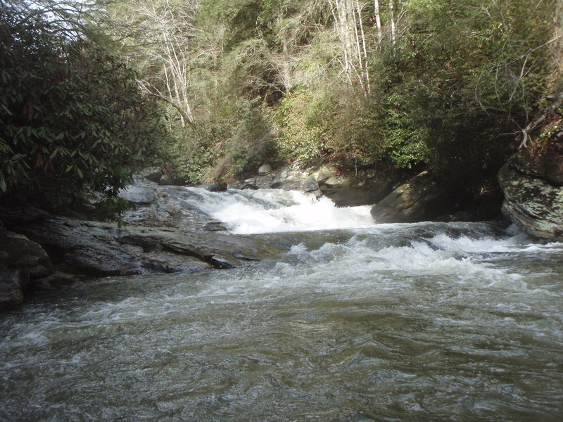
The water quality for Stekoa Creek is very poor. Clayton's sewage system is not very good, and it is on Stekoa Creek as it flows through town. It is also very dirty water from all the road and parking lot run-off from the town of Clayton. I have paddled both the upper and lower sections and the water seems to be a little cleaner in the lower parts but probably because there are a few larger tributaries that help dilute the nasty water that comes from Clayton. This being said this is a beautiful run and it is very sad that such a beautiful creek is being destroyed by the poor sewer system of Clayton. When putting on at Timber Bluff road the creek is pretty flat to start off. There are a few class 1 and 2 shoals along with 2 logs jams that had to be portaged the last time I ran it (Jan. 2, 2008). It then goes through some fields and a pretty large creek comes in on the right while the river has been flat. It is about to pick up after this so be on the lookout. You then go through a little gorge that has like 4 or 5 rapids with three that could give some trouble. The first has a bad undercut on the rive right side where a lot of the water is pushed, right below this is about a 6-8 foot slide that had a log in it. We were able to get around the log but had to stay as far left as possible. The next rapid drops about 8 foot, and can be ran as a double drop down the left center heading left then back to center or possibly boofing on the far right side into small and kind of shallow landing, we ran the left side. The river then mellows to class 2 for a ways and passes under Wolf Creek Road Bridge. It then stays by the road for about half a mile or so before heading around a sharp left bend in the river.
This is the other option to put in at, and is where I have put on mostly because the few rapids that are up stream are not really worth the flat water and log jams, plus there are plenty of bigger rapids down the river. The river takes a sharp be
...
Bridge that crosses creek on Timberbluff Rd. Find a good place to pull off the road completely and be discrete, all private property so be respectful of residents.
This is a put in that cuts out 2 miles of flatwater and only passes up 2 rapids. It is the bend in Wolf Creek Road where the road leaves the creek. There is a gage about a quarter mile upstream on the bridge. 1.0 feet is what I consider a minimum as it will be a little scrappy at that level.
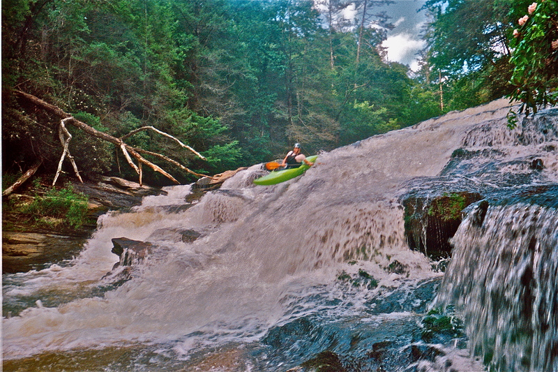
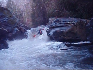
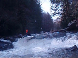
This is the rapid right after the creek leaves wolf creek road. It is right around the corner. At low flows say below 1.6 feet on wolf creek bridge gage run the right side of the island. You can portage and scout on right. At higher flows you can run the more vertical left side. This rapid drops about 15-18 feet total. Class two boogy water afterwards till it gets flat again.
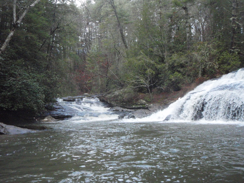
You will paddle by a field on the right side of a short flatwater section and as the river bends to the left you should start thinking about getting out, especially at high water. There are a few small ledges for about 50 yards before the big waterfall of Taylor Shoals. At low water you can run this entrance, but be careful and don't miss eddys. There is an ok portage trail on theleft for the waterfall.
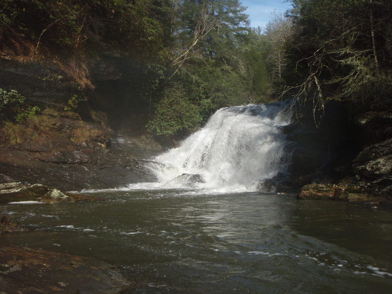
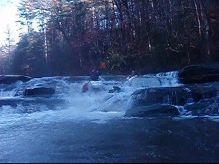
This is a very big waterfall that lands on rocks. Portage on Left. If you run it take pics so you can right the description.
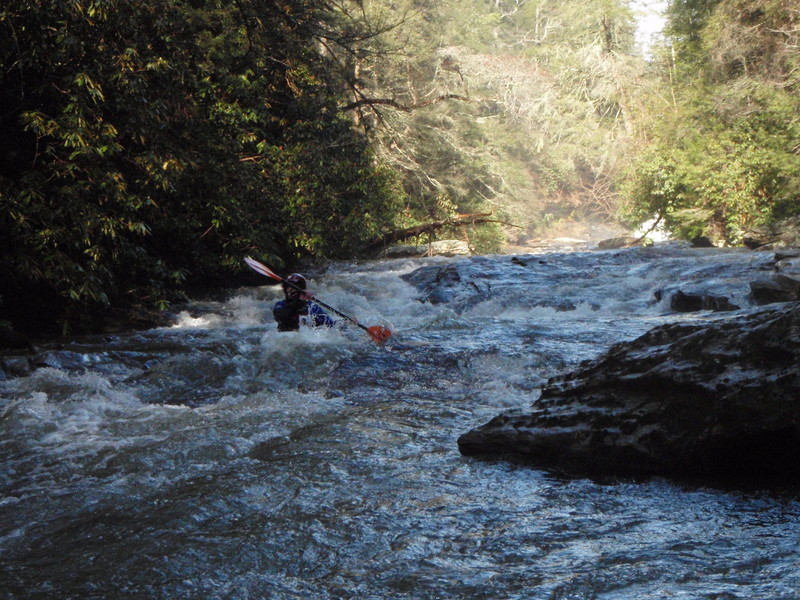
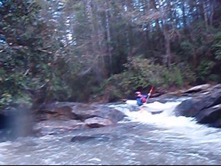
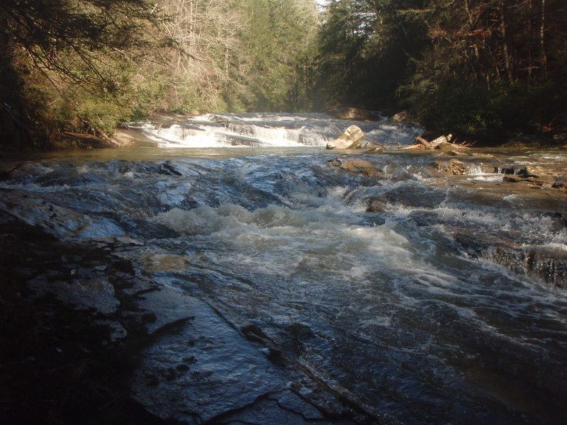
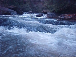
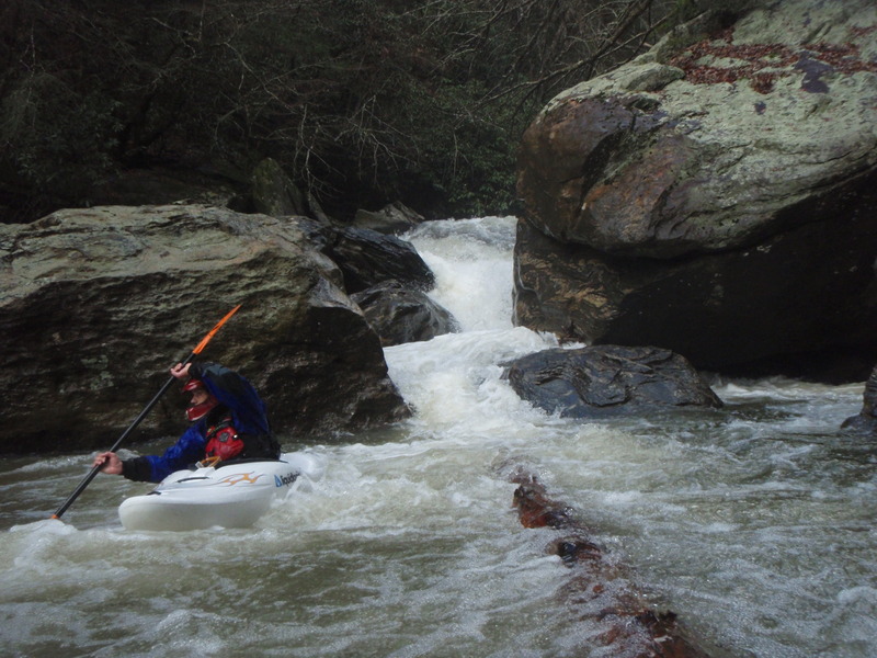
Good fun class 3/4 boogy water after taylor shoals waterfall. This is just read and run, but there are some undercut to stay away from.
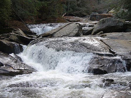
After Taylor Shoals boogy water there is a long stretch of flatwater of maybe a mile or so in length that is broken up by a nice 8-10 foot ledge.
Some Ledges that are the entrance to a very big 40 foot waterfall that all lands on rocks. Be careful after coming out of long flatwater section and know you can make eddys. Portage on the right is not a good trail at all, don't know about left side.
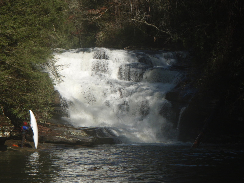
Very big 40 or so foot waterfall that lands on a big rock shelf. Portage on right is hard, but doable. Don't know if left side is a better portage or not. If you run entrance ledges above this one don't miss the eddy.

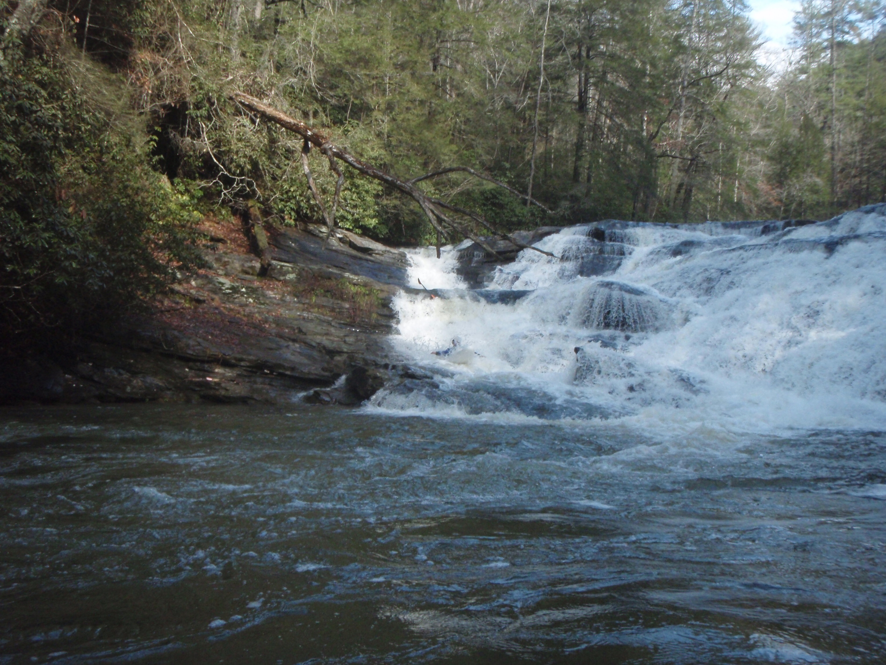
We ran this one down the right side making it like a double drop slide, but maybe a possible line down the center. Pretty scrappy at top at low water. Drops about 30-40 feet total.
This rapid is not too big, but very dangerous. It has bad undercuts on the right side where you enter the rapid and then the current pushes bad to the left side of river to another undercut. There is a rock ledge here that you have to power over at low flows. There is also a bad undercut at the bottom of the rapid. Stay center as much as possible. You can portage on right.
This is another small rapid that is a double boof of about 3 and 4 feet, but it has a very bad undercut sieve on the left side.
This is a pretty nice boof above the cave rapid. The top part of the drop is about 4 feet with current feeding into undercut on right, then some current into a nice boof of about 6-8 feet. It kinda lands on rocks. There are sieves and undercuts everywhere. Eddy out just below cause Cave Rapid is just below.
This is about a 12 foot drop that is very nasty and dangerous. It is all undercut and sieved out. Most of the current goes into a cave with no escape. Fun to Risk factor is very low on this one. We portage and seal lonched off rock on the right, may be able to portage left but not sure.
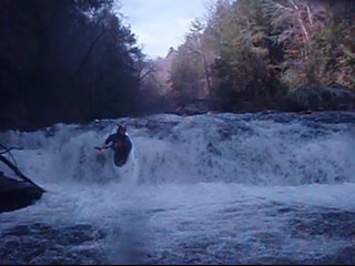
Nice boof rapid of about 6-10 feet total. We ran a little right of center.
The secong nice boof below the cave rapid. Eddy out on the right to scout or portage pothole slide.
This is the slide you can see looking up from the chattooga. it is about 20 feet long slide that has bad undercut on the left. Run far right.
Sep 28, 2010
After many years of putting it off, I finally ran the Lower Stekoa from E. Wolf Creek Rd. into the Chattooga. The 441 gauge was at 0' and the Wolf Creek bridge gauge was at 1.4. This was a low level, but that is ok for an exploratory run. There were seven of us in the group, none of whom had run the entire length. Several had hiked up from the Chattooga previously and run the last several rapids, but none from the top down. It was a good trip, rather uneventful. I was not expecting that there would be so much flatwater. The entire run is probably 60-70% flatwater with some big rapids thrown in. At one point, nearly half way down the creek, one of the guys with us proclaimed, 'wow, I finally got to run a rapid.' The first rapid was fun, right or left of the island. The second rapid was big with a hard hit at the bottom. The third rapid is the money drop. This one rapid, I don't know if it has a name or how many people have run it, but it is the money drop that will lure me back again. It is fairly intimidating looking but smooth as butter. Note to self, don't start celebrating until the rapid is done...I started calling it Gorilla's Mama for lack of knowledge of it's already name. (This name because when you run the right side, it has the same feeling of Gorilla, without the notch, but of the feeling you get of landing off the pad and continuing to drop under the veil)....The last stretch into the Chattooga is tight and technical, but short and leaves you feeling slightly unsatisfied. If it weren't for Gorilla's Mama, I probably wouldn't go back. There is one rapid I would especially like to comment on. The death cave, sieve, whatever its name is rapid. I have heard about this rapid for at least a decade and a half...ever since Chris Harjes and Nathan Hale ran this creek back in '94 or '95. That one rapid...and the poor water quality...let me repeat that...and the poor water quality, have kept me from wanting to experience this creek, at least from being able to find others that would want to go explore it with me. So I am thankful for a group of paddling friends who are willing to try new stuff and break out of the vicious cycle of ALWAYS going to Overflow. Let me state for the record that Toxaway and Overflow were checked first, and since neither were running, Stekoa was our last option short of a long drive to the Smokies. Anyway, the death cave, sieve rapid has a very clear, albeit very narrow line through it that does NOT feed the cave, sieve. Yes it is a mean looking rapid, but a great example of a rapid where you have to drive toward the thing you want to avoid in order to avoid it. What? In order to avoid the cave, on the approach, you have to drive toward the cave, because when you crest the top of the wave that guards the cave, there is a tongue that bypasses the cave. If you try to stay too far right of the cave, there is a ledge with a hole, kicker wave that throws you into the cave. Anyway, the moral is, sometimes you have to go toward that which scares you in order to find the safe way. I could very easily start preaching about giving your life to Christ, but I will save that for River Fellowship (1st Sunday of every month at Woodall Shoals 8 am, 2nd Sunday of every month, Green Narrows take-out 9 am). To sum up, lower Stekoa is fun, big, somewhat stinky, a lot of work if you are not willing to run the big ones, but definitely rewarding. PS paddling Lake Tugaloo with hand paddles is less than enjoyable. Happy boating and may you find the joy of knowing Christ as you enjoy His handiwork.
Dec 18, 2008
This is one of the entrance ledges to Taylor Shoals a nasty 35 foot waterfall just downstream. Be careful and don't miss the last chance eddy.
Just some class 3 boogy water below Taylor Shoals
This is the Entrance ledges to You Run It First which is a very big 35 foot waterfall that does not have a good line cause it all lands on a big rock shelf. Don't miss any eddy's here.
This is a big waterfall that lands on a Rock Shelf. Not much a portage trail on right, don't know about left.
This is about a 30-40 foot slide that we ran down the right side.
This is about an 8 foot ledge that breaks up a long streatch of flatwater in Between the two huge waterfalls that have to be portaged.
This rapid is not to big, but very dangerous. It has bad undercut on the right side where you enter the rapid and then current pushes bad to the left side of river to another undercut. There is a rock ledge here that you have to power over at low flows. There is also a bad undercut at the bottom of the rapid. Stay center as much as possible.
This is a pretty nice boof above the cave rapid. The top part of the drop is about 4 feet with current feeding into undercut on right, then some current into a nice boof of about 6-8 feet. It kinda lands on rocks.
This is about a 12 foot drop that is very nasty and dangerous. It is all undercut and sieved out. Most of the current goes into a cave with no escape. Fun to Risk factor is very low on this one.
Nice boof rapid of about 8-10 feet total.
The secong nice boof below the cave rapid.
This is the slide you can see looking up from the chattooga. it is about 20 feet long slide that has bad undercut on the left. Run far right.
This is another small rapid that is a double boof of about 3 and 4 feet, but it has a very bad undercut sieve on the left side.
Jul 16, 2007
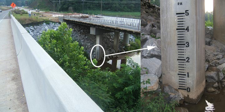
I painted a paddler's gage on the new Hwy 441 south bound bridge over Stekoa on 7/14/07. To see it, you'll need to park on Rickman Airfield Road, carefully cross 441 to the median between the north and south bound bridges. The gage is on the South bound bridge river right, downstream pilon. Please report your levels and low, medium and high info so we can dial this gage in and develop a correlation. E-mail info to me at h2olevelcheck@hotmail.com. -- Thanx -- Rob Maxwell
May 3, 2004
We hiked up this from the chattooga on Sunday May 2, 2004. It was a pretty good medium level. The chattooga was only about 1.7 (it had just rained the night before). But the last mile or so into the chattooga is non-stop class 5. The entire section we looked at had undercuts, sieves, caves and potholes everywhere and there were very small pools in between the drops. You can hike/wade/climb up the creek on the river right side but it isn
Jun 20, 2003
I have run this whenthe Chattooga was 2 feet and would warn against rushing to jump on the creek at extreamly high water. Several Southeastern Guides said 1.9 on the Chattooga was a good minimum. At levels near 3 feet or higher you could easily not be able to stop at the big rapids and find yourself as a greasy spot on some rocks at the bottom of the big waterfall.
Jan 1, 1900
This is the 2nd waterfall on lower stekoa over 30+ feet.
3rd Huge waterfall over 30+ feet on Lower Stekoa, bout a mile above where it empties in the Chattooga.
First large rapid in the gorge of last 3/4 mile as you enter the Chattooga.
This is second rapid as you enter the lower gorge before empting into the Chattooga.
THis is the 3rd big rapid in lower gorge before emptying into Chattooga, I think it is a portage for most boater, but know it was run on the PaddleSnake video. Landing is small and there are rocks on the right and cave on left where most of the water goes.
This is the 4th rapid on lower gorge before empting into Chattooga. It is pretty clean and straight forward.
This is the 5th rapid in lower gorge as it empties into Chattooga, you can see the 4th in the background. Pretty clean rapid with more water, but tall slide is just below.
This is the last slide of lower gorge that can be seen from the Chattooga. There is a bad sieve on the left. When we ran it at 2.1 we ran far right. It was rocky, but pretty safe.
This is the 3 huge waterfall on lower stekoa.
This is the 3 huge waterfall on lower stekoa.
This is the 3 huge waterfall on lower stekoa.
This is the 3 huge waterfall on lower stekoa.
This is the 2nd huge waterfall over 30+ feet on lower stekoa.
This is the rapid right after the bend in the creek after it leaves road on Wolf Creek road off of 76 east.
This is a big waterfall or about 35 feet total. There may be a line down the far left side but the landing is defently on rocks. Good portage on left side.