Helms Creek
Courtright reservoir to the NF Kings river

| Difficulty | V |
| Length | 3.3 mi |
| Avg Gradient | 400 fpm |
| Gauge | Helms Ck Blw Courtright |
| Flow Rate as of 21 days | 4.12 ftstale data |
| Reach Info Last Updated | May 21, 2021 |
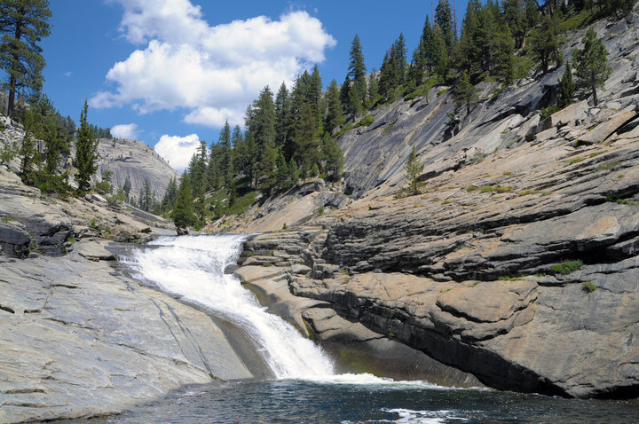
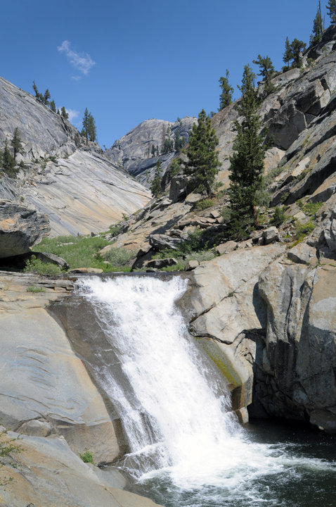
Helms Creek drops through a fantastic glacier carved canyon below Courtright reservoir. Hiking through the canyon is fun and fairly easy. There are numerous long and steep slides in the canyon. A few are clearly not safely boatable/slidable. A number of slides look appealing. A lot of the slides are pretty steep. A few have bad landings or rocks in bad places. The two biggest waterfalls land on rocks, but all the portages are easy and mostly on smooth bedrock slabs
This auther has only heard of one kayak descent of this creek and that was in 2010. Others have agreed that it looks intriguing.
Forty cfs is about the most release this creek ever sees since the construction of the Helms Project. But since much of this creek is bedrock slides and falls, 40 cfs seems like it might be ok if you don't mind leaving some plastic behind. During the spring, a side creek may add enough to improve the boating potential.
Getting there: From Fresno take freeway 168 to Shaver Lake. Just before the main town of Shaver Lake, turn right onto Dinkey Creek Rd. At Dinkey Creek the road becomes the McKinley Grove Rd. A few miles before Wishon Reservoir, turn left onto the Courtright road. At Courtright, bear right across the dam and park near the trailhead. google map.
Put-in: There is a trail and stairway near the dam that provides access to the gauging station. However the creek is very congested and tight at first. Depending on your taste, you may or may not find it enjoyable. If you hike around behind the large dome on east side, then follow a small creek down to the main creek you will bypass 7/10ths of a mile of congestion. The first big slides start 1.2 miles below the dam.
...
Hiking down this side creek avoids the junky section below the dam. In the spring this creek may supply enough water to improve the boating below, but it will not show up on the gauge.
Aug 1, 2011
Did a descent of Helms Creek in the summer of 2010. It has some really nice large slides and falls for about a half mile stretch. These start at the confluence of a small side trib (river left) just below the large dome. This side trib is a nice put in....and a short walk from the climber's parking lot. After the few nice drops, Helms then careens off it's final cascades down into the NF Kings. I found it easiest to just hike back out the way in. Very beautiful, open and novelty. The flows of 4.4 feet on the gage was too low. It's too bad that there isn't a little bit more (~like 100 cfs) being released from Courtright Res, because all it needs is a few cfs to go.
Aug 1, 2011
The last slide before the confluence cascades down to the NF Kings. '10 descent - 4.4' on the gage.
Aug 1, 2011
The 20'er below the top two large slides. '10 descent - 4.4' on the gage.