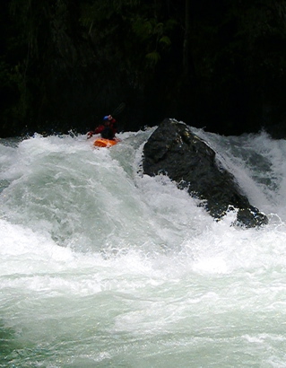
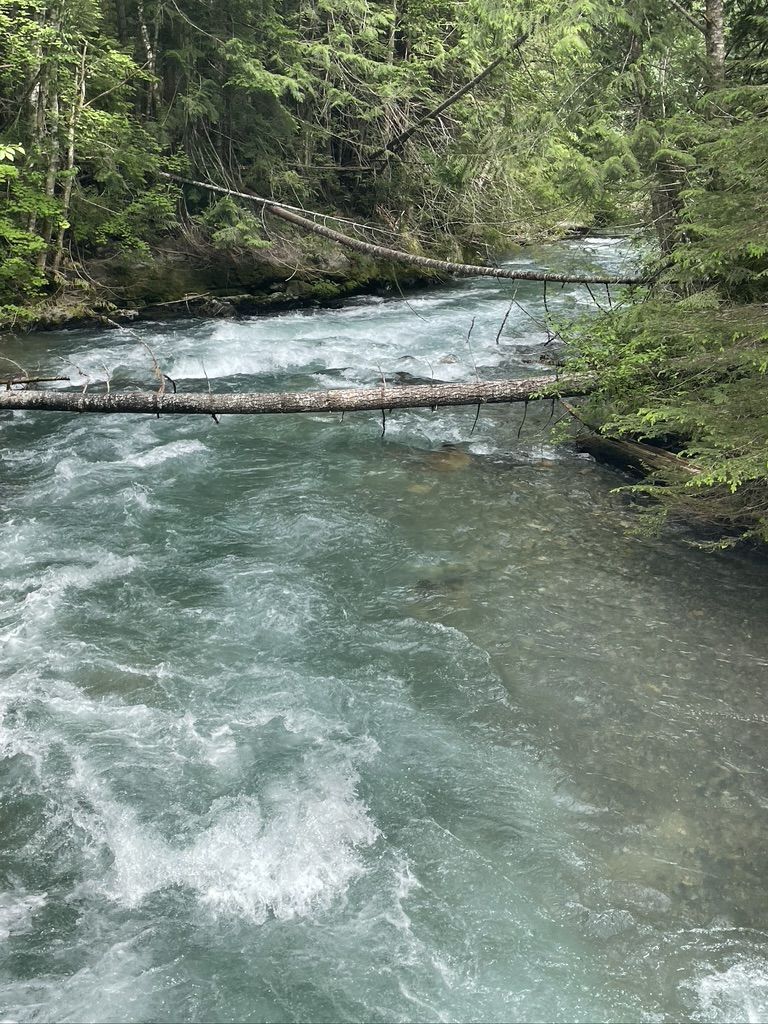
Becky Shepard, Mikenzie Matteson, and I set out to explore Lightning Creek Juuly 9,2022. There was very little information available for the run, and apparently those reports were at low flow. The Methow gauge was 3850, Thunder Creek gauge at 1900, which appeared medium-flow --this REALLY impacts the ability to easily scout/portage everything on the run (unlike what the original AW report indicates and the one other report we could find, at low flow). First, the Ross Lake resort no longer provides water taxi service for your whitewater kayaks, so you have to paddle approx 11mi across Ross lake. That's after you hike your boat and gear a mile down from the parking lot to the water. Took us 3.5hrs on the way out across the lake, 5.5hrs on the way back (always a headwind heading back). We camped the first night on Ross Lake. The next morning we set out to hike-a-boat up the approx 4mi well-maintained trail to the put-in. FYI it's about 1000ft elevation gain, and it's quite high above the river - you can't scout from it. From the put-in, we could already see mutiple logs across the river. That pattern persisted with us scouting/portaging every appprox 50 yards through the first 1/3 of the run but did improve after the confluence with 3 Fools Creek. Semi-truck sized log jams were present, but at least the portages are through dense underbrush and slide alder to sweeten the sufferfest. Between scouting and portaging, I was out of my boat at least 15times in this 4mi run. The wood situation continued through the whole run, often in crux moves, but was scoutable with effort. One of the Class V drops about 1/2mi from the end of the creek put the nails in the coffin of fun, with wood in the crux in the left line, and a grueling portage river left beginning at a log jam before continuing over a cliff. I'd estimate that took about 6hrs, resulting in us having a bivvy on said cliff overnight. It involved approx 5 rope-a-boat belay stations and ended in a free-hanging rappell to get back down. Unfortunately, due to river level, the right side of the river did not have accessible eddies for us to portage that side (which also had cliffs but may have been better). The rest of the run involved another easy portage around a class V/VI on the right and 2-ish lovely class IV rapids.
At moderate flows, this run is not trivial. SUFFERFEST through and through. You should have a class IV+ skillset at least and someone with climbing skills. A hike out would be very very tough, and most of the run is bordered with cliffs. Download a map on Gaia/navigation program of choice. Get an early start (we started our hike at 11am after padddling from camp and scouting the mouth of the creek - WAY too late). We made harnesses out of webbing but a belay device would have been very welcomed. Our boat scouting was from often moving 1 or 2-boat eddies. There's a lot of wood everywhere this year, and this creek was no exception. If you think you want to do this run, maybe just divert to Ruby/Granite and actually enjoy yourself.