Talking Rock Creek
GA Highway 136 to Carters Lake Reservoir
| Difficulty | I-III |
| Length | 15.5 mi |
| Avg Gradient | n/a |
| Gauge | Talking Rock Creek Near Hinton, Ga |
| Flow Rate as of 51 minutes | 0.91 ftbelow recommended |
| Reach Info Last Updated | September 8, 2015 |
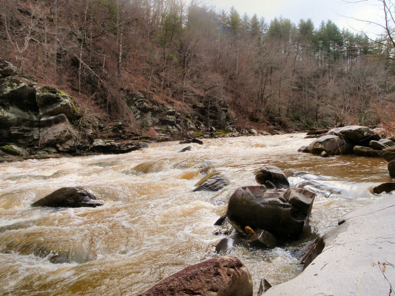
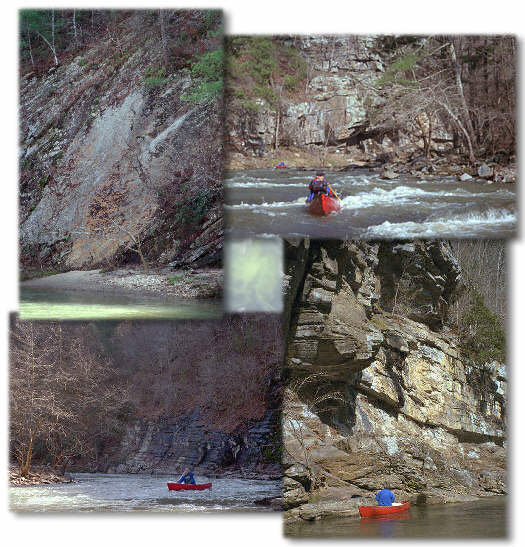
This was our first time on this river and probably the most remote we've been in GA. Yep them Georgia mountains shore are beauteeful and this particular stream is an extra kewl treat. It was a delightful adventure as we had never scouted it before and put in with boats loaded with camping gear for the first time. All we knew was that it was purdy, fairly remote and that it was a class I/III creek. At 2.3ft there were only 2 or 3 rapids of any consequence and a coupla fun wave trains.
Did an overnighter on 3/18/01 and had and absolutly great time, cept for the flats at the end ... We had head winds all the way thru them. I would not have minded the flats much but the wind really made it a trudge. I can see where doing it as a day trip and ending up with headwinds after a 14-15 mile paddle would be a test of endurance.
We checked the gauge
( USACOE) on the net Sat (3/18) and it was at 2.3. Sunday evening when we came back the gauge was at 1.9. Based on those readings and our experience with loaded down boats I would say that that those levels are just about the cutoff point the do T.Rock on OC1s loaded with camping gear. At the level we did it at many of the shallower areas were quite marginal and technical. You really really had to pick your lines well. All in all a beautiful and fun river especially after Talking Rock/Rapids (34.55919N/-84.63063W) where the rapids are fairly close throughout the run cept for the 3 mile flats at the end.
I have put up a website with pixs from this trip at:
http://www.mindspring.com/~pepe3/talkingrock
At the bottom of the page the page containing the thumbnail images I have a
link to another page I created containing an overall and a detailed road map showing the put-ins and take-outs.
Someone had ment
...Jan 29, 2012
Level was about 2.19 feet
Nov 12, 2003
Hey all I made the run this last weekend(11/08/03-11/09/03)and had a rude awakening . All the sandbars that are decent for camping are gone due to a recent flash-flood. This also dumped tons of debris in the creek (i.e. trailers, sheet metal, small houses, and even cars) nothing major though. Also a lot of the land has been posted now due to some problems with poachers over the last winter. A lot of the people are VERY protective of their land so when camping tread lightly. We managed to find one small sandbar halfway down the run but at normal levels it will be underwater.
Jan 25, 2002
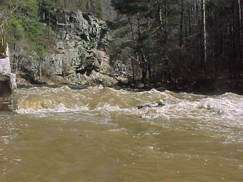
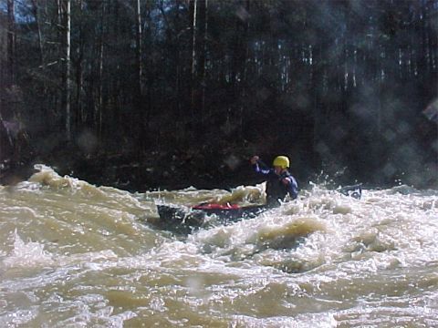
Great high water wave/hole at the base of the cliffs