Trout Creek
Gorge
| Difficulty | IV-V |
| Length | 2.4 mi |
| Avg Gradient | 400 fpm |
| Reach Info Last Updated | December 5, 2025 |
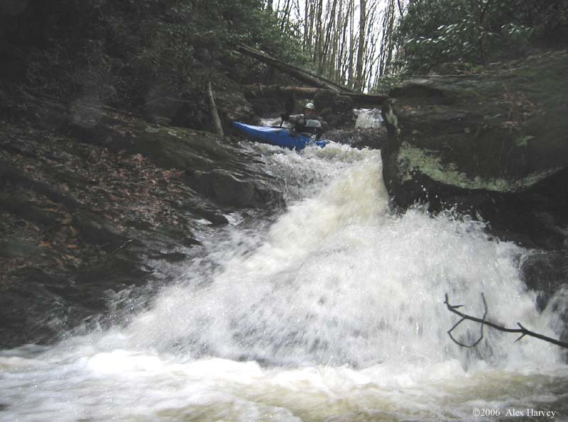
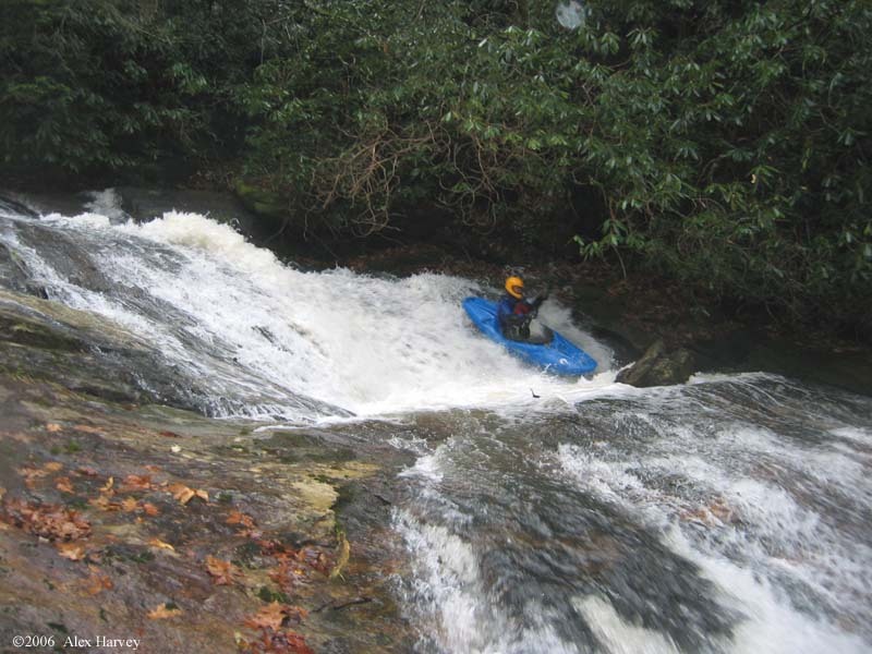
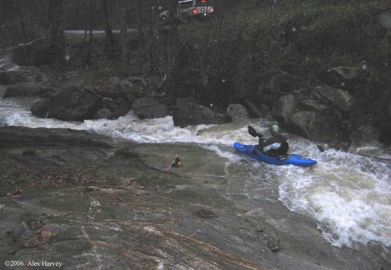
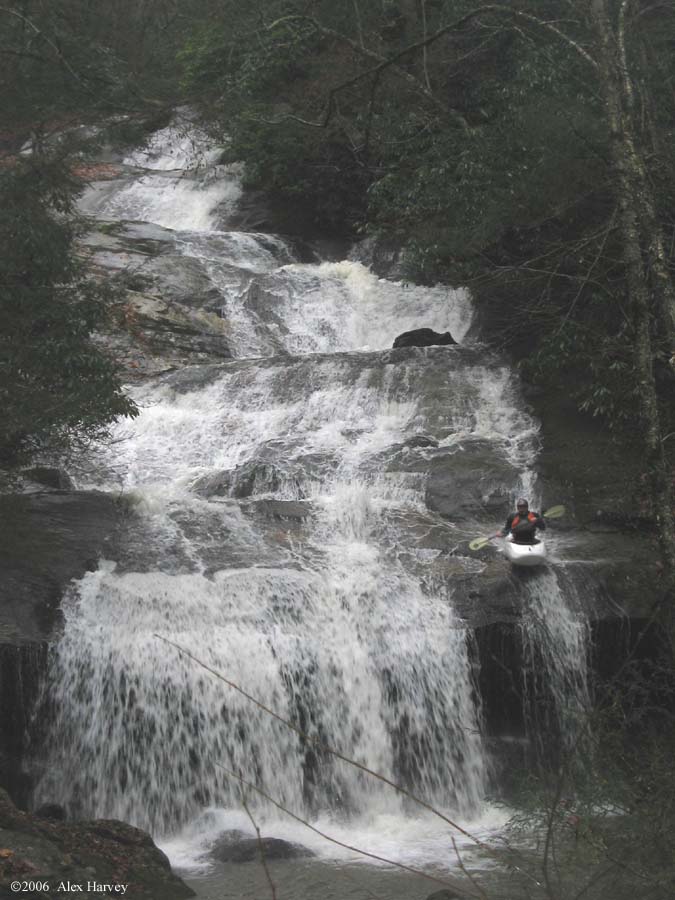
Trout Creek is a tiny creek that does not run often. But when it does it is worth the effort. Here is some beta: Drops ~980 feet in 2.5 miles alongside Trout Creek Road. See the map in the photos/videos section below for directions. There are numerous homes along the creek, some residential, some vacation so exercise good judgment and be friendly. Beginning section is the steepest at an estimated 660 feet per mile for 0.6 miles, ending with the tentatively named Anoxia Falls. Anoxia Falls is a monster drop of five cascades dropping an estimated 80 feet. It is very runnable. Onion Cliff Falls is downstream which should be looked at on the way up for prior exit points. The gorge ends with a steep, technical section not dissimilar to the Lower Rocky Broad, but steeper and tighter. From the run in the photos on this page, it had rained 2.0 to 2.7 inches at the AWFS Jackson County rain gauges 1866, 1880 and 1880 in the previous 12 hours. It was very bony in spots but still good. If anyone has any information on previous runs, names of rapids, etc please contact the streamkeeper.
No trip reports yet.