Lawrence Brook
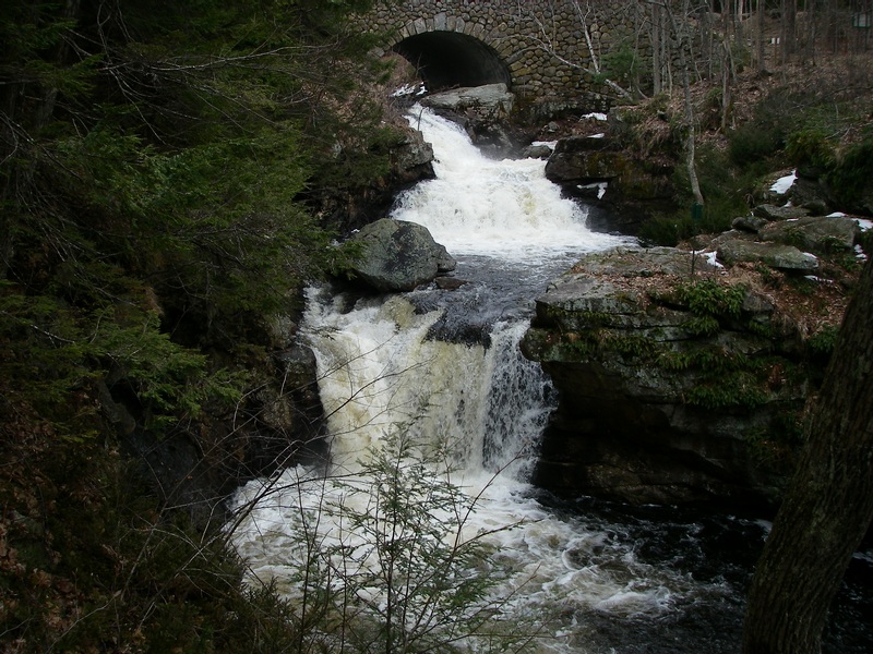
Doane Falls
| Difficulty | V+ |
| Length | 0.3 mi |
| Avg Gradient | 600 fpm |
| Reach Info Last Updated | June 12, 2018 |
The access points are owned by The Trustees of Reservations, and they've posted the land due to a number of fatalities among swimmers. The sign by the entrance prohibits many activities, but does not specifically mention boating; this is probably an oversight.
Access to the river is fenced off; they don't want anyone getting close enough to scout it. If they had any idea the creek was navigable they certainly wouldn't want you running it either.
Please respect their wishes. Nobody wants to create ill will over one park-n-huck.
Although there is no correlation currently, there is a guage nearby. If you catch this section please leave a comment with the gauge reading.
Dec 4, 2006
Last time I ran, err, checked on these four sweet runnable drops, the signs said 'No Swimming...'
Jan 1, 1900
Last legal run (to my knowledge) on Lawrence Brook near Athol, MA. Due to numerous drownings (all due to swimming and alcohol to my knowledge, none from kayaking), the owner have closed off access.