Rogue

3. Gold Hill Boat Ramp to Grants Pass (up to 18.3 miles)

Reach banner
DifficultyII
Length18.4 mi
Avg Gradient8 fpm
GaugeRogue River at Grants Pass, or
Flow Rate as of 47 minutes
2220 cfsrunnable
Reach Info Last UpdatedApril 1, 2024

Projects

Protecting and Restoring the Rogue (OR)

The Rogue River was among the nation’s original Wild and Scenic Rivers designated in 1968. Recreational opportunities abound from the Lost Creek Reservoir to the Pacific Ocean. Several fun day trips are available downstream of Lost Creek Reservoir which now flows freely with the removal of 3 dams: Gold [...]Read More


River Description

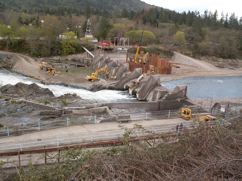
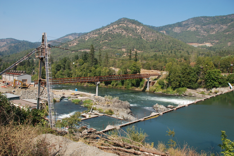
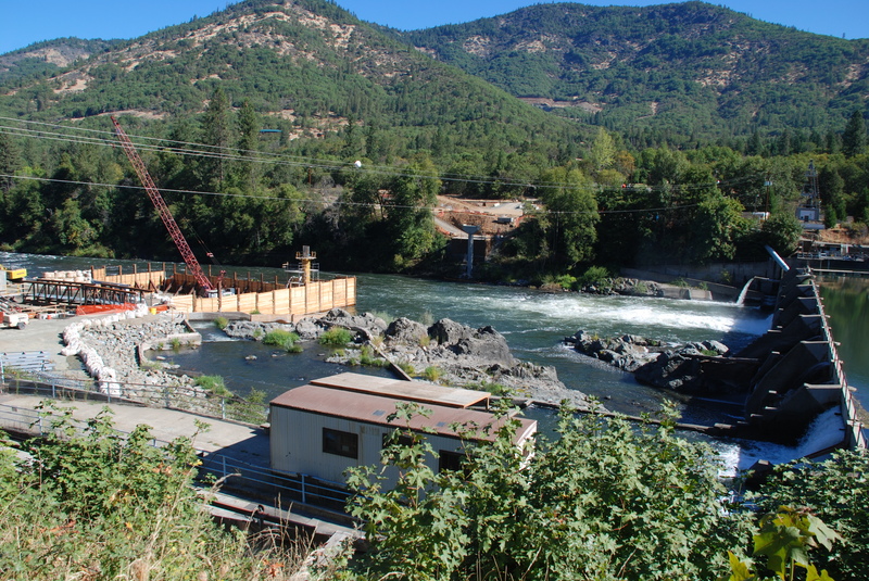
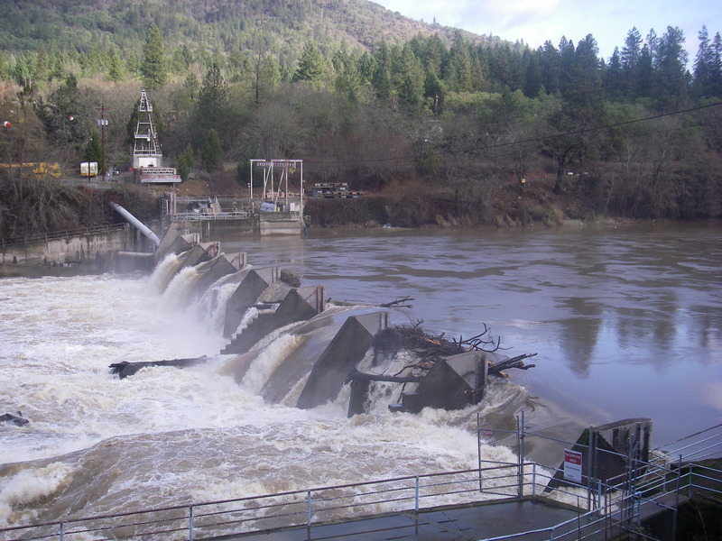
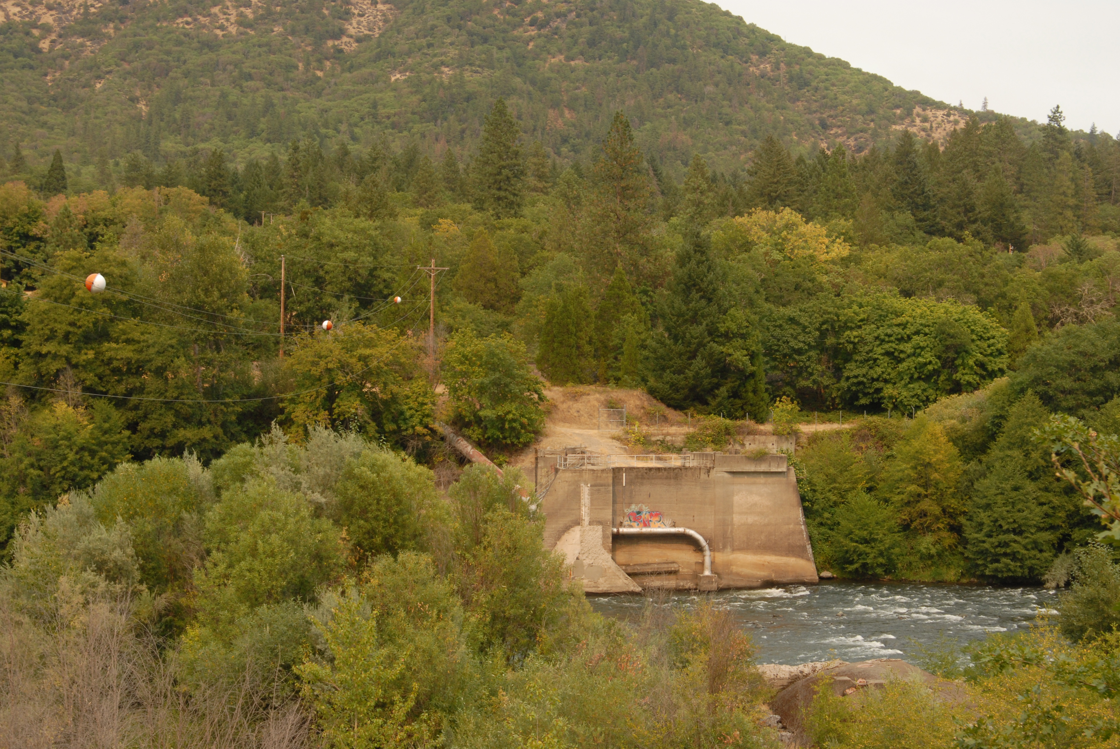
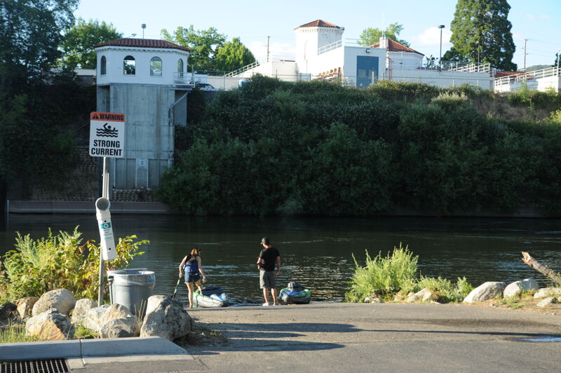
This reach runs from the town of Gold Hill to Grants Pass with I-5 paralleling the river on the north side and Hwy. 99 paralleling the river on the south side. One barrier to navigation is Savage Rapids dam set to be removed to improve fish passage (this dam is visible from river left at Hwy. 99 mile 5.5 east of Grants Pass).

Logistics:

Put-in at Gold Hill Boat Ramp is accessible from I-5 exit 40. Cross the Rogue River and enter the town of Gold Hill. Take Highway 234 north out of town. The boat ramp is located less than a mile out of town on river right at Gold Rogue Sports Park at Highway 234 mile 3.0.

River mile 120.2, elevation 1056'.

Take-out at Baker Park Boat Ramp in Grants Pass on river left downstream of the Highway 199 Bridge is accessible from I-5 exit 55. Follow Highway 199 from I-5 down to the river.

River mile 101.9, elevation 896'.

Alternate access points are available to make runs of various shorter length (or combine with upstream runs for greater length).


River Features

Rogue Gold Sports Park Put-In

Distance: 0.01 mi
Rogue Gold Sports Park Put-In

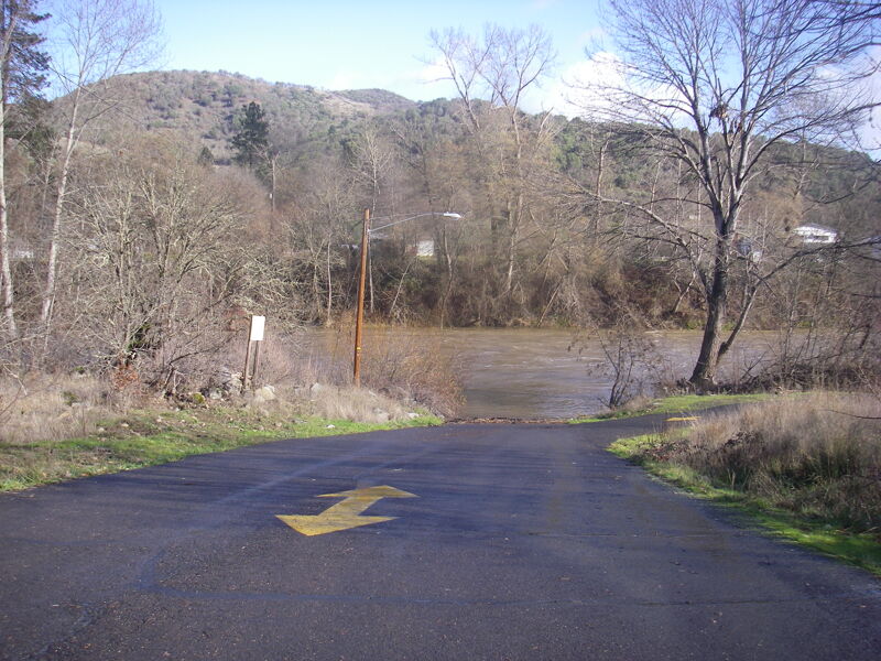
Put in at the park on river right.

apparent rapids #1

Distance: 0.27 mi
Rapid
apparent rapids #1

USGS river mile 120.0.

apparent rapids #2

Distance: 0.66 mi
Rapid
apparent rapids #2

USGS river mile 119.7

apparent rapids #3

Distance: 1.76 mi
Rapid
apparent rapids #3

USGS river mile 118.6.

possible rapids

Distance: 3.33 mi
Rapid
possible rapids

USGS river mile 116.8

possible minor rapids #1

Distance: 4.19 mi
Rapid
possible minor rapids #1

USGS river mile 115.7

apparent rapids #4

Distance: 5.6 mi
Rapid
apparent rapids #4

USGS river mile 114.4.

possible minor rapids #2

Distance: 6.79 mi
Rapid
possible minor rapids #2

River mile 113.2.

John Fleming Rest Area Access

Distance: 9.27 mi
Access Point
John Fleming Rest Area Access

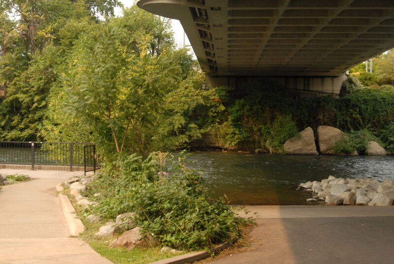
Access on river left under the bridge.

Savage Rapids - Former Dam Site

Distance: 12.83 mi
Rapid
Savage Rapids - Former Dam Site

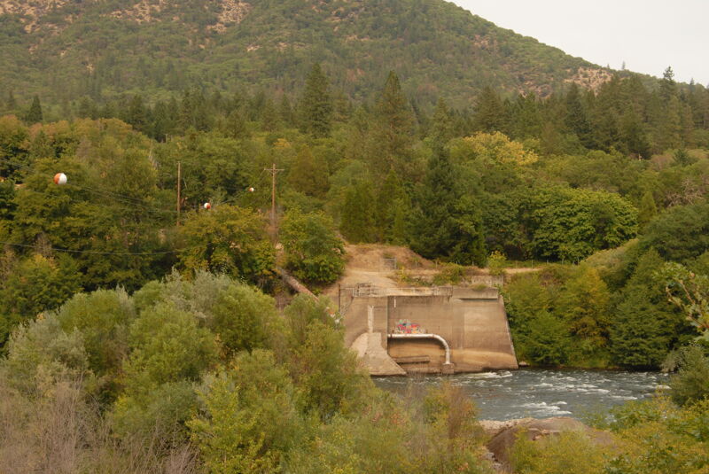
The dam was removed in 2009 revealing some additional riffles, rips, and rapids in the (nearly six mile) stretch of no 'marked' rapids on the topo maps. USGS river mile 107.3.

Pierce Riffle

Distance: 13.46 mi
Rapid
Pierce Riffle

USGS river mile 106.6

apparent rapids #5

Distance: 14.52 mi
Rapid
apparent rapids #5

USGS river mile 105.6.

apparent rapids #6

Distance: 14.89 mi
Rapid
apparent rapids #6

USGS river mile 105.2.

possible minor rapids #4

Distance: 15.03 mi
Rapid
possible minor rapids #4

USGS river mile 105.0.

apparent rapids #7

Distance: 15.96 mi
Rapid
apparent rapids #7

USGS river mile 104.2

possible minor rapids #5

Distance: 16.61 mi
Rapid
possible minor rapids #5

USGS river mile 103.5.

Baker Park Take-Out

Distance: 18.31 mi
Take Out
Baker Park Take-Out

This access is on river left downstream of the Highway 199 Bridge in Grants Pass. Located at USGS River Mile 101.9. Parking (including dedicated trailer parking) and toilet facilities are available in Baker Park.


Thomas O'Keefe
Thomas O'Keefe

Apr 1, 2024


Carla Miner
Carla Miner

Dec 14, 2010


Savage Rapids Dam. Photo by Roger Funk 5/1/10

Carla Miner
Carla Miner

Dec 14, 2010


Savage Rapids Dam. Photo by Roger Funk 5/1/10

Carla Miner
Carla Miner

Apr 12, 2009


Spring 2009 photos of the Rogue River at the Savage Rapids dam site.

Thomas O'Keefe
Thomas O'Keefe

Sep 11, 2008


Pump installation nearing completion in anticipation of Savage Rapids Dam removal.

Thomas O'Keefe
Thomas O'Keefe

Sep 2, 2007


Construction of new water intake underway (to the left) in preparation for removal of Savage Rapids Dam (to the right).
Savage Rapids Dam getting ready for removal.

Thomas O'Keefe
Thomas O'Keefe

Dec 7, 2006


Savage Rapids Dam, a barrier to navigation on
this stretch, is an irrigation dam on the Rogue
River scheduled for removal. It is located at river
mile 107, approximately 5 miles upstream of
Grants Pass. The fish screens and ladder do not
meet current criteria for fish passage and the
Bureau of Reclalmation determined that it would
be cheaper to remove the dam and replace it with
pumps.