Toccoa
Deep Hole Recreation Area to Sandy Bottoms
A very large tree is blocking the usual route (river right) down Margret Drifts. Tree was washed down river and is lodged parallel to shore.
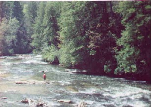
Ran from Deep Hole to VanZant/Daniel Bridge (Newport Rd) at 300cfs with two recreational kayaks and one tandem canoe. On the water about 7hours with a long lunch at and two portages and several disaster recoveries. Previously my wife and I paddled Etowah through WMA with four college age girls and they were all asking for something a little bit more challenging. This looked manageable for a couple of newbies.....Be careful what you ask for.
Great river, nice variety of what should be challenging or entertaining shoals/sections, but maybe is NOT suitable for inexperienced or ill equipped kayakers at this 300cfs water level. Something of an admission of guilt despite my years of lake canoeing and three other kayak trips with my wife just this year. Oversimplified, many of the ledges are difficult to spot and are quite shallow. It is easy to get hung up and turned sideways.
Note, our friends in a tandem canoe made it through without incident...couple close calls which are expected.
Regarding general hazards.......
Similar to July post ......Two deadfalls early on, first within 30minutes is passable on far left. At higher flows, have to believe it is full blocked....second is within another 30minutes and it is a floater? which we had to portage over.
For those unwilling to ran the rapid on river right at Margret Drifts after swinging bridge, there is an easier passage far left which takes you to a lower pool which you can then exit and portage a kayak on shore around the final severe ledge/chute. Not sure if a canoe would make it through the underbrush ....My mistake was bringing my wife's kayak down river left, portaging, and after going back up for my kayak, watching my canoe friends go right with success, I then followed, and swamped at the bottom...almost made it.
I should have recognized the risk of swamping at the bottom wave section avoided. I should have just started and stayed left as I did for my wife..
Contrary to the River Description / Rapids advice for Margret Drifts, at 300cfs, once you start right, there is no path to the middle that either of us could see while scouting from bridge and from shore.....once at bottom, left is available, but there is no obvious path left once you start down that right chute.
I regret not having a skirt for the sit in kayaks. My wife swamped at least six times, and twice very nearly injured herself severely on what should have been modest or easy sections. Rookie mistakes getting hung up and a little sideways. I swamped twice.
As a side note, a group of three was putting in behind us and the outfitter who provided for them sent spotters out looking at end of the day and we had not . Despite at least two hours of lunch/portage/disaster recovery time, we never saw them. An hour or so later we saw one of the three hanging on to the back of the four wheeler headed to take out location.
A short distance from the put-in at Deep Hole, a large tree is blocking about 95%of the river. Passage is possible on the far left, but it's a tight squeeze. Othewise, it was a great trip this time, with water levels around 415cfs (just don't ask about how we swamped the canoe just past the Swinging Bridge!).
A friend and I had a great overnighter on the Toccoa this past Friday/Saturday. Water was running a little over 500 cfs which was great. There was a solid push all the way with very few 'dead zones'. I can imagine that even at the recommended minimum 350 cfs, you would have to watch your lines to avoid scrapes. Two deadfalls are present above Margret's Drifts. I'm not sure how far upstream but they were easy to spot. I don't know if they constitute a warning flag either, but we did watch three guys in a canoe flip trying to go around the first. I've flagged it just to be sure. The first tree has a passable gap on river left. The second tree stretches the full river width and we had to portage around it. Not easy, but doable. Both trees are a foot or more thick and will probably be there for quite some time. Forrest Service has posted a 'No Camping' sign on river left at the Swinging Bridge just above M.D. I don't know how new the sign is, but we spoke with a fellow camper who said it was posted because of excessive littering. No sign on river right, but the ban may still cover this area too. Camp here at your own judgment. Several primative camp sites are open and available just before and just after the Drifts, though. Good trout fishing. 500 cfs made the Drifts look a little indimidating with our boats loaded with gear. No problems running them in the morning, though. We actually had an interesting encounter with a family in four canoes that split their party up because some of the younger ones didn't want to run the Drifts. There really is no hiking around these rapids. The family finally connected up after more than an hour . . . back at the bridge with all four boats more than a mile downstream. It was a reminder to me that scouting and proper planning are essential even on a relatively flat river like this one. If you MUST walk around the Drifts, try the right river bank. Forget portaging all the way, but an intimidated passenger might be able to walk around this way. The rest of the trip was great. A little cold for the morning run, but very nice. At the present water level, we estimated that the trip could be done in 6 hours if you stopped for lunch. I took a good many photos. I'll try and post some later. - Austin
No articles