Cumberland, Martins Fork
Cumberland Gap National Historical Park to route 987 (1.6 miles)
| Difficulty | V |
| Length | 1.7 mi |
| Avg Gradient | 290 fpm |
| Gauge | Cumberland River Near Harlan, Ky |
| Flow Rate as of 1 hour | 145 cfsbelow recommended |
| Reach Info Last Updated | January 25, 2011 |
Original Trip Report from Boatertalk, (edited):
Toby mentioned to me about 7 years ago, this creek up in KY that hadn't been run. Martins Fork. He said he had hiked it and it looked good. I scoped it on the map, but forgot about it for a while and then Karl Whipp mentioned it to me again. A month later, Keith, Tony and I scouted it, and reallized it was pretty good, with great water quality, good views, and a short stretch of serious and quality class 5 before 'flattening out' to class 3-4. That was a little over a year ago, and just this December, 2008, I finally found sufficient flows to go out on a hunch.
A normal plateau run affected by pine plantations and mining wouldn't hold water, but this run is different. It is on the edge of the cumberlands overlooking the valley ridge and gets alot of rain. It is high elevation for the plateau, and the watershed, which is around 8 square miles, hasn't been massively logged, if at all, and has remained relatively untouched for most of human history. It is also protected by Cumberland Gap National Historical Park. So all that rain gathers in the bowl, and runs flat for around 8 miles before dropping to the valley below. The most abrupt drop occurs in a mile or so. The run drops slower than comparable ones on Walden Ridge, and holds better, runs more. So I caught it today at a good low level. Perfect first time level. I hiked 2.2 miles up an old jeep track to the put in above the gradient. I paddled 1.6 miles that dropped 450 feet, with the steepest mile being 320 feet, and the stacked 4/10 of a mile at the top averaging 540 feet per mile.
First, to the aesthetics. The water quality is better than some smokies runs. It was SO clear. The forest and canyon in general were very unspoiled. Overall, it meets and possibly exceeds the pristine qualities of really clean plateau runs like North Chick and Island Creek. The rock is horizontally bedded sandstone, just like further south. The entirety of th
...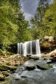
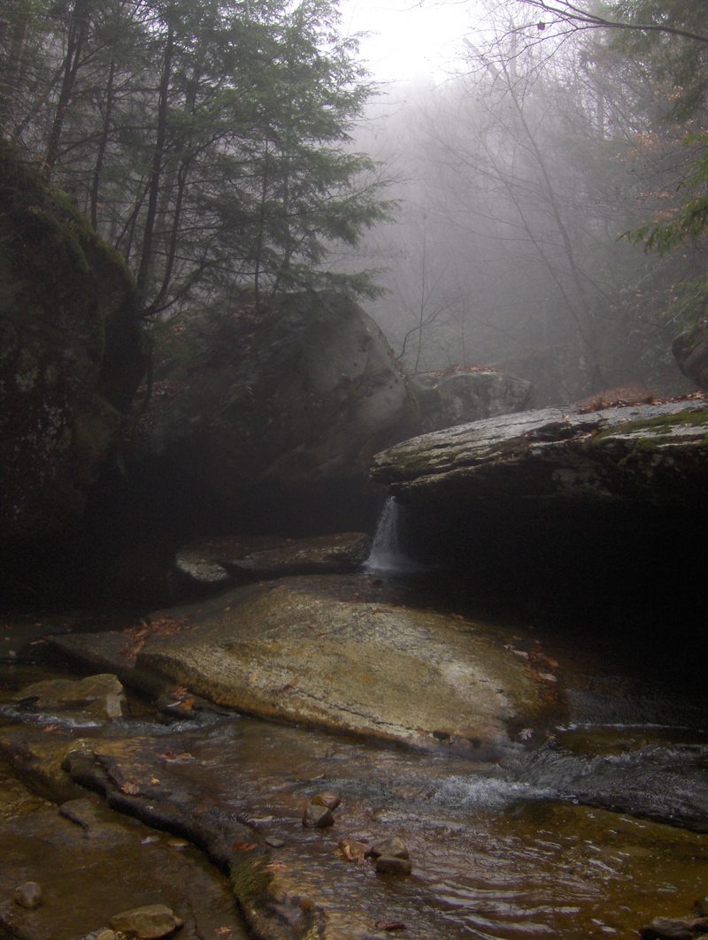
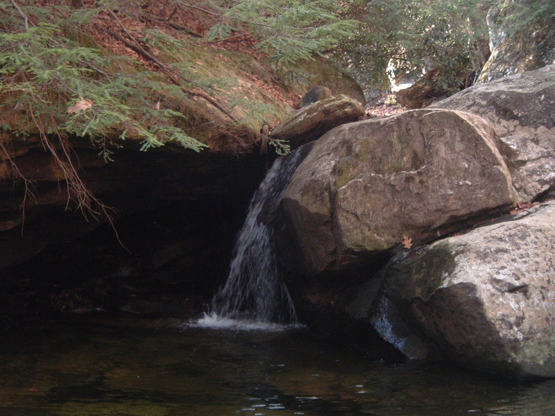
A 15 ft falls runnable straight down the middle.
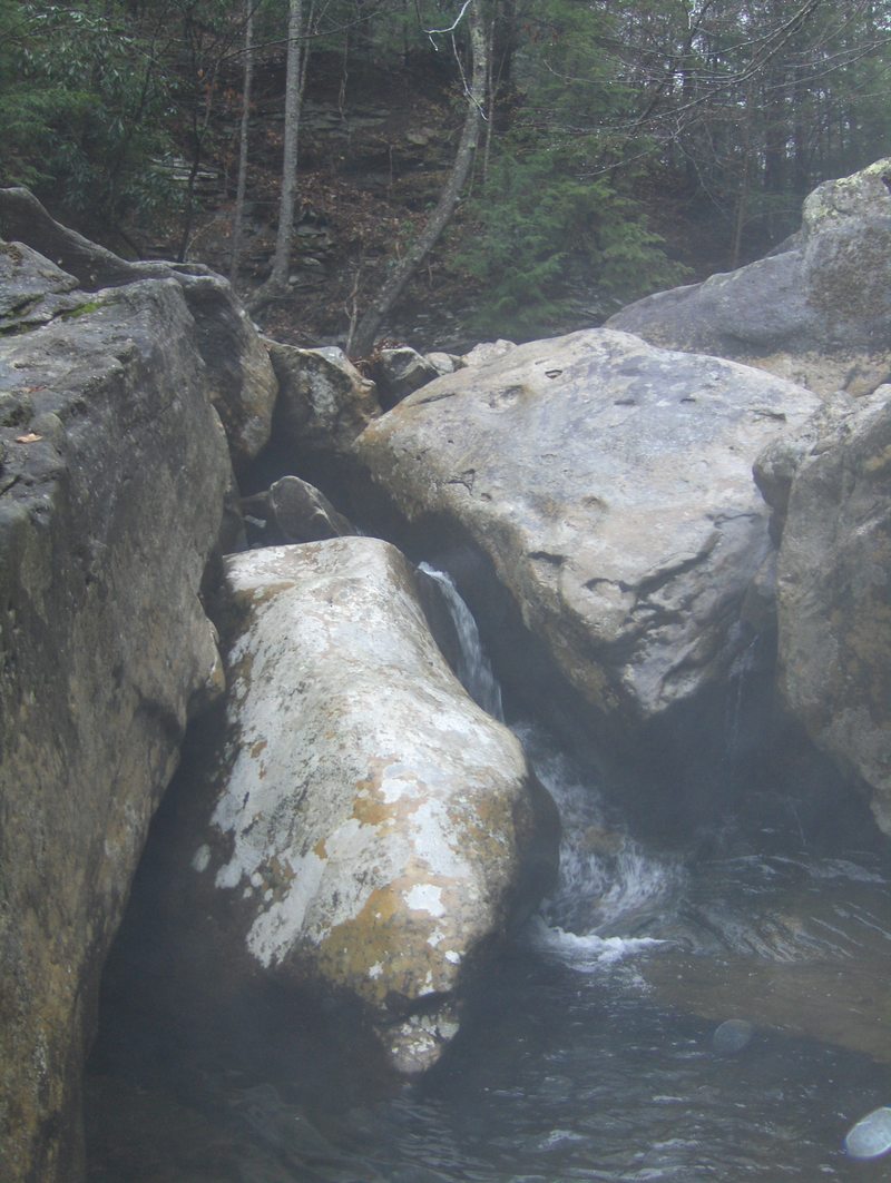
Clean twelve foot low angle slide. Get out right below to scout the hardest and most consequential rapid on the run.
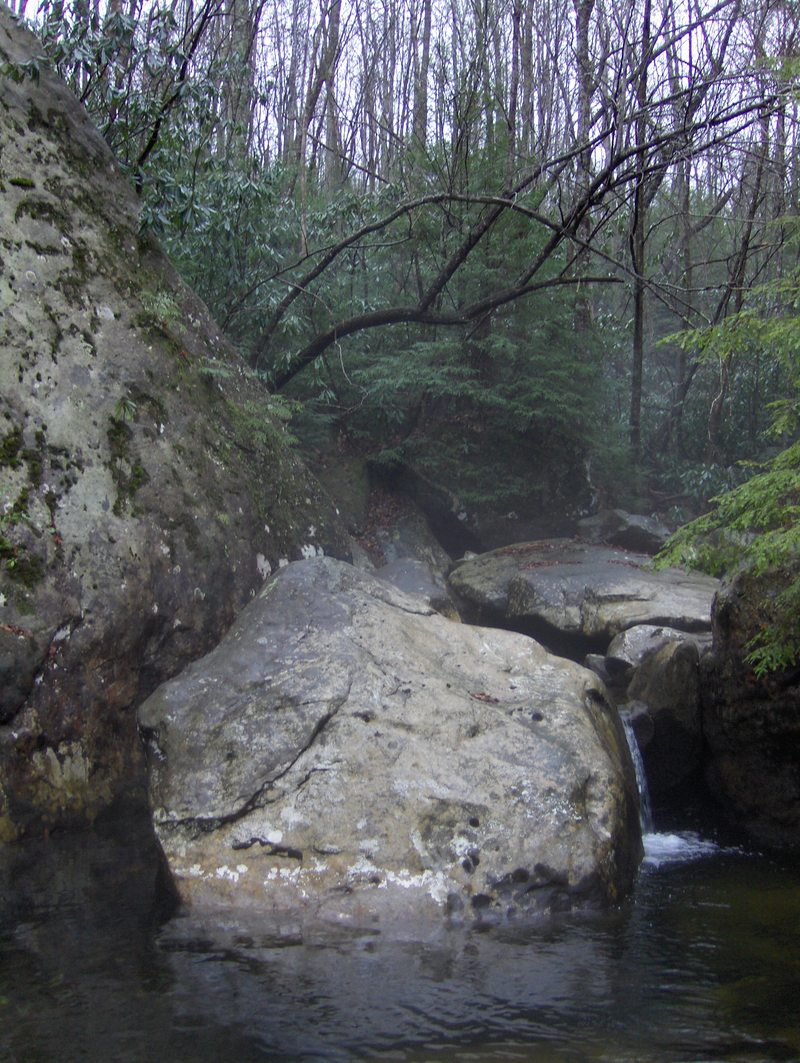
Right below the put in slide, the creek drops down this complex and serious drop. The entrance consists of fighting to get left up onto a shoulder where one boofs 8-10 feet back into the center into a big cauldron with an overhung hydraulic and boily room. Keep driving downstream and out over a drop that kicks off a rock and lands in the pool below. There is a gap between the drop and the rock, so safety and a convicted boof with speed are necessary. Make this crux move left of center away from the sieve on the right.
After a brief stretch of class 4 boogie below the holding cell, The creek drops into a tight bedrock section of three serious and quality drops. The first is a tight jumble that focuses the paddler against a narrow 4 foot slot agains the right bedrock wall, avoiding the channels to the left that are full of wood. Then the creek rounds a bend and drops through a bedrock corridor and slides off to the right over a 6 foot clapping drop and right into some bad undercuts. Drive straight through heading left and avoid the mess to your right. Then line up for the third walled in drop off a 5 foot ledge left of center against a wall through a hole and down a flume into the pool below.
Here the creek bombs down several s-turning slot drops, culminating in a 6 foot boof down a center channel. Quickly eddy right and begin scouting the big daddy of the run.
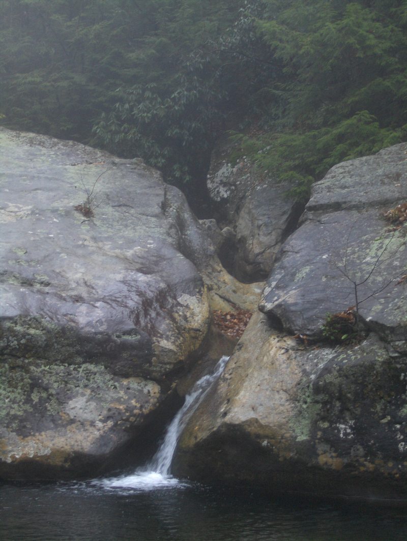
This is the biggest and best rapid on the whole creek, and has classic written all over it. The creek bundles up energy on a left to right line, berthing a few 3 foot drops before bottling up and driving off a 7 foot boof through a narrow slot into a boiling room where half the water breaks left into a crazy eddy, and the other half breaks right into a narrow slot that raises up and then drops over a 15 foot vertical slot falls that lands in a big pool. You could catch the eddy, but I would think the less time in that boily place the better. Be prepared for little boof opportunity on the big final plunge, and expect some downtime and or hole surfing. It is plenty deep though, and I think the key to the rapid is a solid entrance boof, followed by a stable and momentum conserving landing. In the pool below, the side trib you crossed on the hike in joins the river, and the creek gains volume.
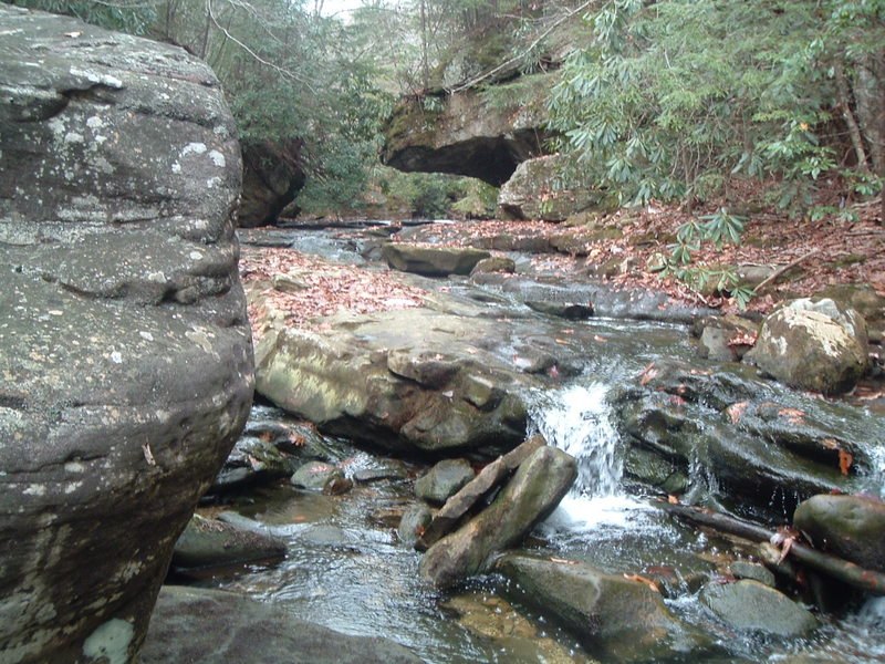
Below the big pool, the stream runs through a little bit of class 3-4 boogie before overhanging walls close in and the bedrock reappears. Get out and scout this one for wood and your line. The creek begins to run down low angle bedrock at high speed through some overhangs. Then a downstream right to left ledge/curl throws right into a bad undercut on the left. Come in late on the left driving right and thread between this and the undercut on the right, then once through, driving left again away from another badly undercut boulder on the right. Then the creek splits, go with the flow on the right down some more fun bedrock. This is a fun but serious section.
Shortly after Unforgiven, and on a right bend, take the inside right line and drive off a beautiful 8-10 foot boof into a soft landing. This is the best boof on the run.

Below Big Boof the creek runs through quality class 3-4 with a handfull of good slots and ledges, and things start to wind down. Just when you think it is over the creek rounds a bend and speeds down a low angle slide that goes around maybe 4 bends and is up to 100 yards long. This is a blast, and then the takeout is 300 yards below this last hurrah.
Jan 23, 2011
Bear Hazard. I ran this on 01-02-11 and found a bear den on river left while scouting the Catacombs. Also, there were several strainers. Heads up out there.
Oct 11, 2010
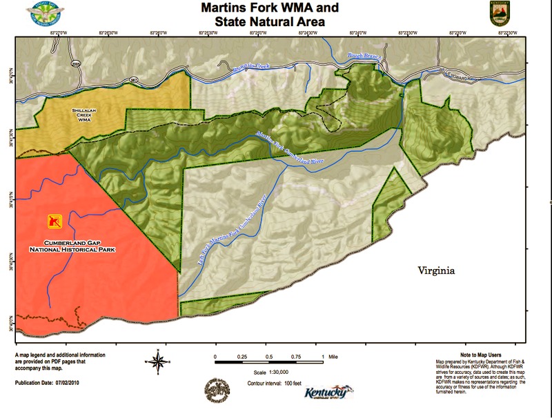
This is a map of the Martins Fork area. The WMA in green, private property in grey. You can see the trail as a dotted line on the north of the mountain leading up to the ridge. The turn off the ridge down to the river is along the 83. 25'30'W lateral mark. Hope this helps.
Oct 11, 2010
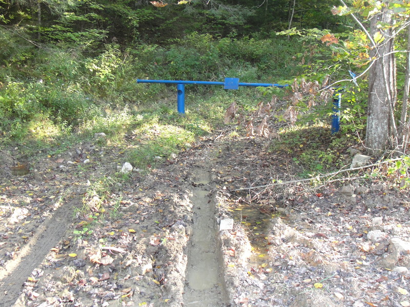
This is the trail head and parking for the river left put-in option.
Jul 28, 2009
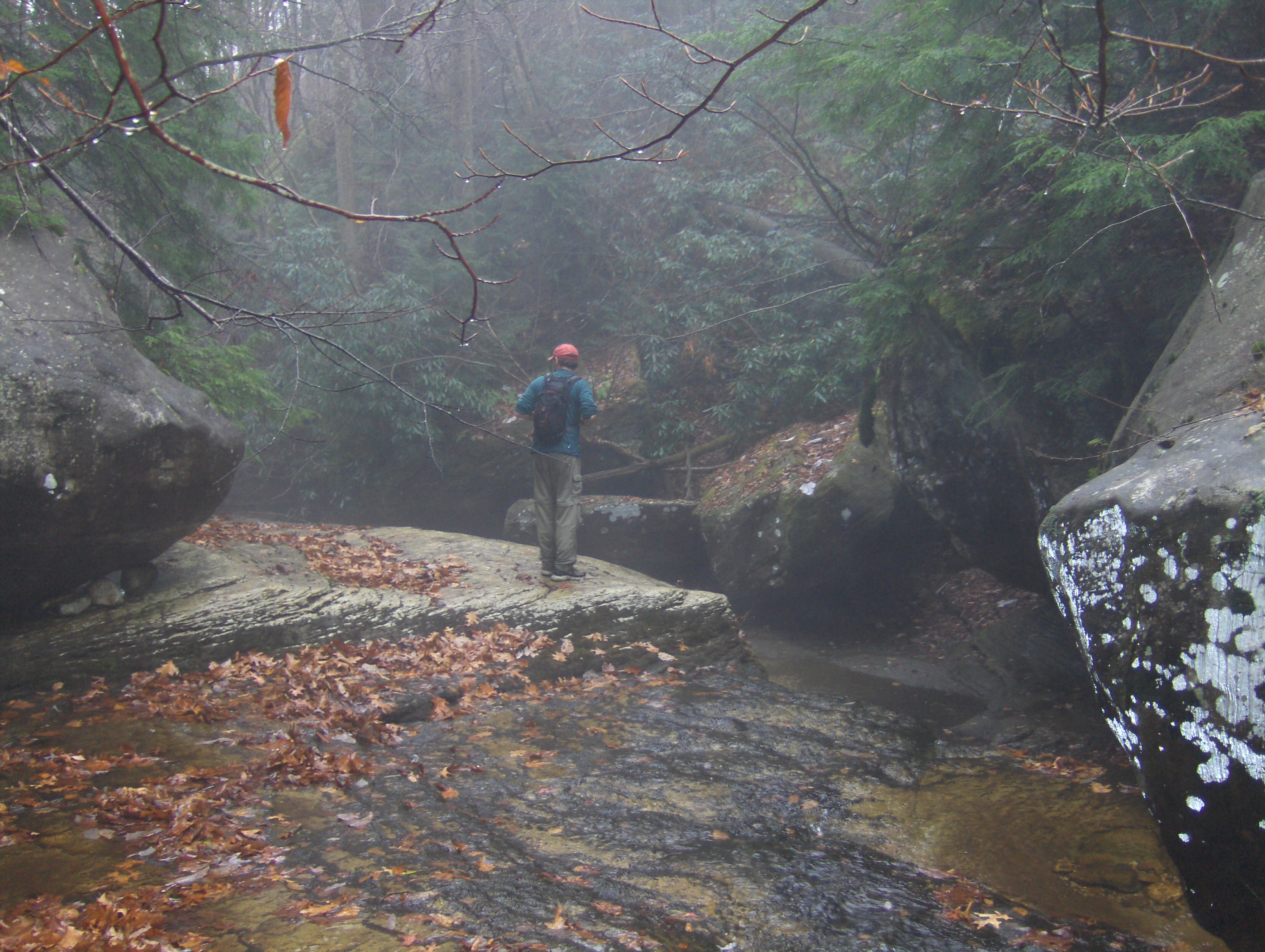
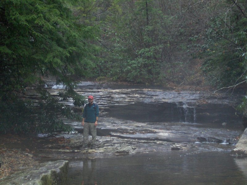
A friend and I hiked around the martins fork today. The gauge read 1030cfs, and it looked like you could run down it without to much scraping. We couldn't make it to Quadrule Falls, before sunset, but bush-whacking through the rhododendron groves, massive rock outcroppings and ancient hemlocks was well worth the trip. This river is so pristine, like walking back in time, and has nice rapids to boot. Here is a google maps link of the trail and shuttle. http://maps.google.com/maps/ms?ie=UTF8&hl=en&msa=0&msid=116794144407359062085.00049208978b5039873d6&t=h&z=14
Link to Video: http://vimeo.com/9058626