Center Brook
Pisgah Mtn. Rd. to Sandy Brook
| Difficulty | V |
| Length | 0.9 mi |
| Avg Gradient | 200 fpm |
| Gauge | West Branch Farmington River Near New Boston, Ma |
| Flow Rate as of 46 minutes | 2.28 ftbelow recommended |
| Reach Info Last Updated | November 15, 2010 |
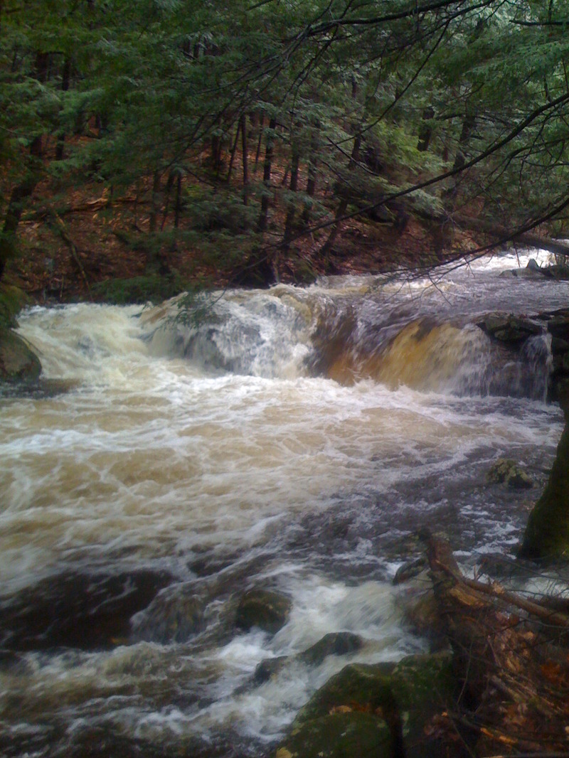
Only one known descent (as of 3/28/07; there have been more since). Length and gradient are estimations. Access at the put in is tenuous. Reportedly, this is a steep, narrow wood-filled rollercoaster ride that empties into the Sandy. The two guys who ran it are good friends of mine. One described the event as terrifying. The other, who happens to be a sponsored paddler and is regularly regarded as one of the best in the Northeast, called it a classic. If you're interested in finding out where you stack up, do your homework, find an appropriate put in, and post a comment here for all to see.
Nicholas Gottlieb shared:
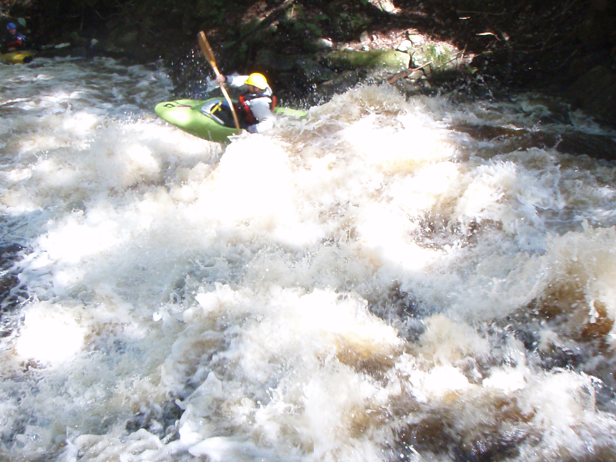
Sometime between two and three years ago, I think, Chris Brost and I ran the bottom five or six drops of this run. We were running the Sandy at a low level -- really low -- and we got to this creek and it was cranking, comparatively, so we started hiking up and ran a few drops. The first was a funky, narrow winding 8 or so foot drop that fell off a 2-4 foot ledge at the bottom right towards a rock sticking out (that is tough to dodge). The biggest drop we ran was a 10+ foot slide into a pillowed rock above a narrow hole at the bottom. The runout into the Sandy was a little funky -- channelized, a little bony, and had some wood in it. Looks like a great run, although I haven't seen anymore than what I saw when I hiked up those drops. Can't wait to try it from the top.
Another thing -- it might run more often than you would expect. At the very least, it's probably pond/swamp fed...When I ran part of it, Sandy was absurdly low and this thing was running at a fine level.
Another paddler testified:
Looked at this today.....traveling from WY to my home state. Access seems pretty simple off of Pisgah Mtn. Rd. (no 'no trespassing' signs at least)...certainly could be a great run with a bunch of water and a little tree maintenance. Length and grad
...Apr 6, 2017
EJ McCarthy & I ran this circa 1990. EJ was in a Prijon plastic K1 & I was paddling a 4 meter composite Fanatic Slalom C1. We didn't run the manky rock pile at the confluence to the Sandy but ran everything else.
Dec 3, 2010
I've paddled around on the top drop only, but have scouted the whole run in 2009. Access at the top is easy off the dirt road, but then the brook leaves the road into the woods. If you want to walk the run to check it out, it requires some bushwacking and hiking on some fairly steep banks. The hardest part of the run is definately in the middle which you can't see from the road. There is a tight slot and a large drop which aims you at a rock at the bottom. Center Brook meets Sandy just after the 90 degree corner/hole on the Sandy. There is an exciting looking slide shortly before the end of the run.
Center Brook is definately a class V microcreek with the middle part probably rated at a class V+. When I walked it last year, there was quite a bit of wood, especially after the hard drops in the middle. If this run were cleaned up, it would make a great adventure for some expert creekboaters!
-Stephan B.
Dec 3, 2010
First real drop on the run.