Cuyahoga
C. Front St. to Abandoned Ohio Edison Dam(Middle/Virtual Gorge)
| Difficulty | I-II(IV) |
| Length | 0.4 mi |
| Avg Gradient | 50 fpm |
| Gauge | Cuyahoga River at Old Portage Oh |
| Flow Rate as of 38 minutes | 375 cfs |
| Reach Info Last Updated | May 23, 2008 |
UNDER CONSTRUCTION
Introduction:
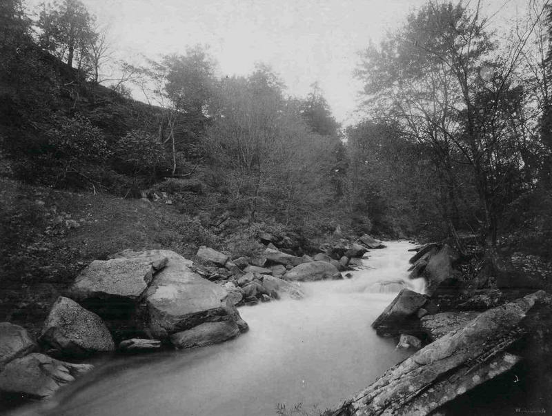
This page calls attention to the recreational aspect that once existed on this section the river prior to its drowning by the abandoned Ohio Edison dam (built in 1912). Some photos displayed here prior to that time are believed to be portions of the river as it once existed before its damming. The white water features drowned out by the dam pool were determined through the process of elimination by comparing to rapids currently existing on the river ( Upper/ Lower gorge).
The middle gorge, AKA virtual gorge since it is gorged with water by the abandoned Ohio Edison dam, is defined here by the end of the Upper Gorge at the upstream end of the dam pool created by the abandoned Ohio Edison dam. Conveniently, Anchor rock rests essentially at this position. The section ends and transitions to the Lower Gorge at the last drop of the Big Falls of the Cuyahoga. The abandoned Ohio Edison dam was built on the upper portion of the Big Falls. Estimates for section length and gradient were determined by a combination of actual measurements with a barometric altimeter equipped GPS, and review of topographical map software (Delorme TopoUSA, v. 6.0, Magellan MapSend Topo 3D USA, v. 1.00).
Access:
A virtual whitewater trip down the middle gorge can currently be experienced as a real flat-water paddle. Metro Parks of Summit Country requires a permit see kayaking permit link for access to the river (canoeing can also be written in).
Put-in / Take-out:
Front street bri
...May 9, 2005
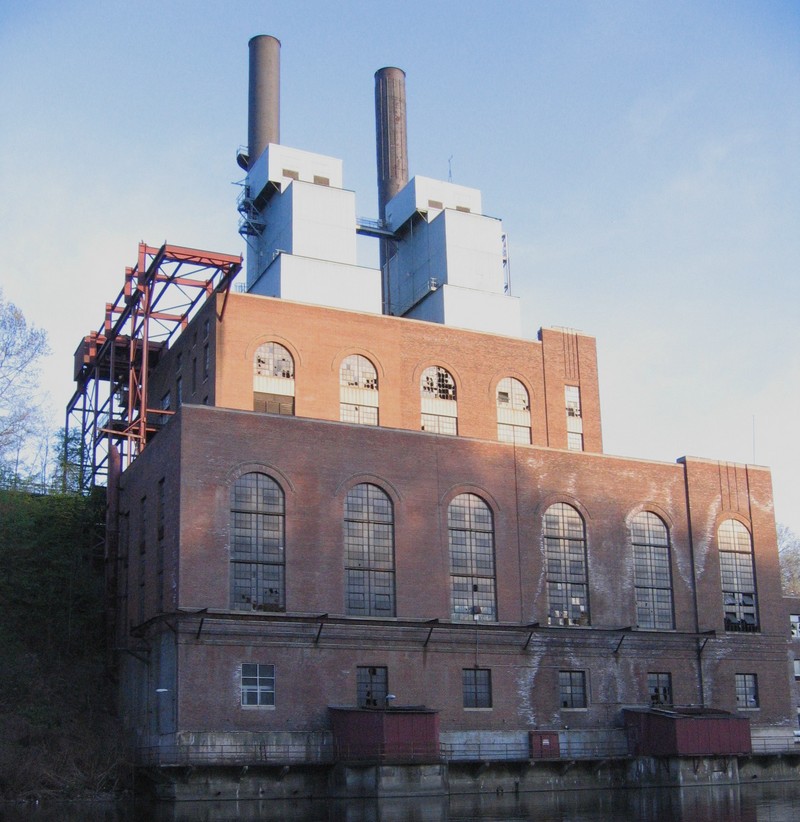
This is the abandoned First Energy (a.k.a. Ohio Edison, previously Northern Ohio Traction & Light) gorge powerhouse. The current powerhouse (built in 1945) is located on the river left about 0.8 mile downstream from Anchor Rock, and visible from the Front Street Bridge. It was a larger annex to the original powerhouse built in 1912. The original power house was demolished in 1965. It is not known if demolition debris was removed or dumped in the river. The dam pool provided a water supply for the coal fired powerhouse, and a hydroelectric plant downstream from the dam. (Blower, J.M., Korach, R.S. The NOT&L Story, p. 114. Fox Valley Printing Co., S. Elgin, IL, 1966)
Jan 1, 1900
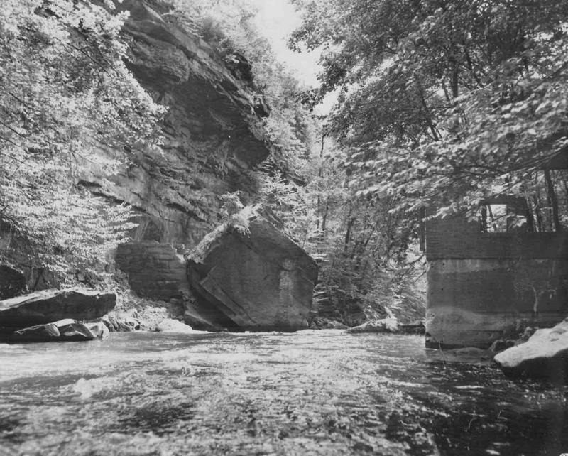
Anchor Rock was first incorporated into the Chuckery Dam of the Portage Canal Mfg. Co., then into the Marathon Rubber. Co. dam. Stone wall at left is not part of the dam. It is the bulkhead built by the Marathon Rubber Co. to prevent water from escaping down the old Chuckery Darn. Marathon took power from the west end of the dam.
This photo is looking south at the location of the Chuckery Dam (Portage Canal & Mfg. Co. at Cascade, Ohio) and, later, the Marathon Rubber darn which was built much in the same manner as the Chuckery dam which preceded it. The so-called Anchor Rock was used by both dam builders as the east abutment. Evidence of the masonry tie-in is clearly visible on the rock. Both dams were of wood cribbing filled with stones (upper face was smoothly and tightly planked) with masonry abutments.
The 'part of the dam' seen at left is the wall erected by Marathon to pre- vent water from escaping down the old Chuckery Race. The race (hydraulic) and turbine for Marathon were on the west end of the dam and side of gorge.
As I understand it Marathon's turbine shaft was enclosed in a vertical, tubular, steel housing to the top of the gorge. A steel, spiral stairway was attached to the shaft housing to allow quick access to the turbine at the bottom. - Carl Ehmann June 8, 1998 Canal Historian
Cuyahoga River. Photographs. 1800's. Cuyahoga Falls Library Archives, Cuyahoga Falls, Ohio.