| Difficulty | I-II |
| Length | 5.4 mi |
| Avg Gradient | 7 fpm |
| Gauge | San Marcos Rv at San Marcos, Tx |
| Flow Rate as of 41 minutes | 114 cfsbelow recommended |
| Reach Info Last Updated | July 10, 2015 |
River Description
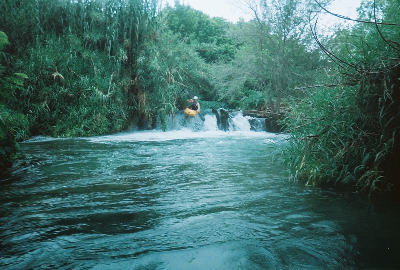
Although Rio Vista Whitewater Park is the primary attraction for whitewater paddlers on the Upper San Marcos, the rest of the run makes for a very scenic float trip, as the crystal-clear 72-degree spring water meanders through cypress trees and past farms. Above the confluence with the Blanco, the San Marcos is entirely spring-fed (except during runoff events) and maintains its temperature year-round, which makes it a good paddling destination during the winter. The lush area between Rio Vista Whitewater Park and Thompson's Island is home to some endangered species.
There is a lot of flat water on this run, courtesy of the twelve-foot-tall Cummings Dam (below the confluence with the Blanco.) Apart from Rio Vista Whitewater Park, the rest of the rapids on the run are small and unconsequential, but because the river is mostly spring-fed, it tends to be one of the few rivers that is runnable during periods of drought. The river is generally runnable down to 100-120 cfs, but some rapids will get scrapey below 200 cfs.
Distances and gradient measured using GIS tools in 2015.
A note about Spring Lake Dam:
Just upstream of the City Park put-in is an artificial waterfall next to the Saltgrass Steakhouse (formerly Joe's Crab Shack.) This feature is created by a dam that raises the level of the lake around San Marcos Springs (Spring Lake.) This lake was formerly the site of Aquarena Springs, an amusement park, and now serves as an environmental research center for Texas State University. Running Spring Lake Dam is illegal.
River Features
San Marcos City Park
Access PointDistance: 0 mi

The normal put-in is at the Lion's Club tube rental place (off of City Park St.) Bathrooms/changing rooms are available. This is the closest parking lot to the water, but if that lot is full, there is additional public parking in the adjacent Sewell Park.
Rio Vista Whitewater Park
Access PointPlayspotClass: IIDistance: 0.61 mi
A series of three artificial drops. The chute on the top drop creates a one-boat-wide wave (or wave-hole, depending on the level.) The second drop is usually just a small wave train, and the third is a small (usually shallow) ledge hole. These drops are generally runnable by all types of kayaks (although recreational kayaks without thigh straps will probably get flipped in the top drop) and properly-outfitted whitewater canoes. Recreational canoes will want to portage. At very high flows (> 250 cfs), some boof lines open up at river left on the top drop.
See separate description of the whitewater park for information on the playability of the features at various levels.
Cape's Dam / Thompson's Island
PortageHazardDistance: 1.26 mi
Cape's Dam marks the head of Thompson's Island. At river left is an artificial channel created by William A. Thompson in the mid 1800's to divert water to a mill. The diversion channel slopes more gradually than the river, so the diverted water has to drop 11 feet at the other end of the island in order to rejoin the river.
Thompson's son commissioned the construction of Cape's Dam (Cape acquired the dam in 1904) in order to divert more water to the mill. Cape's Dam was badly damaged in the 2013 Halloween Flood and was a major hazard for several years, prompting ongoing discussions as to whether to repair or remove it. As of this writing, unknown parties have performed manual repairs to the dam, restoring the original (river right) line to runnable condition, capping the steel rails that were exposed in the flood with PVC pipes, and shoring up the dam with rocks. However, these repairs are not likely to last beyond the next flood, so scouting is always recommended.
Most paddlers (particularly those in recreational kayaks and canoes) choose to portage on the left of the dam and put in below it. The natural river channel between Cape's Dam and Graduation Falls tends to be clogged with fallen trees and strainers, so use caution. An alternative is to paddle down the old diversion channel, but this requires portaging around Cape St. and around the remnants of the old mill structure at the end of the island.
Cape St. Bridge
Access PointDistance: 1.73 mi
Limited public parking is available in the lot on the upstream river left side of the bridge.
Graduation Falls
Waterfall / Large DropDistance: 1.94 mi
At river left is the remnants of Thompson's old mill. At the right river levels, water will be going over the 11-foot drop, creating a feature that local whitewater kayakers call 'Graduation Falls' (probably because it was traditionally run on the last day of the multi-day whitewater courses at the OOC.) Remnants of the old mill works span the channel about 10 feet back from the drop, so you can't really paddle over the falls. It is necessary to have someone hold your boat in the small pool at the top while you get in. Graduation Falls has no hydraulic, and the pool at the bottom is deep and placid, so it is a great way for beginner whitewater paddlers to learn what it feels like to run a waterfall without any consequences.
Below Graduation Falls is a lot of flat water until you get to Cummings Dam.
This video shows some paddlers running Graduation Falls:
Blanco River Confluence
OtherDistance: 4.33 mi
Cummings Dam backs water up into the confluence, so it may not be obvious which direction is downstream. Take a right.
Below this point, refer to the virtual gauge (San Marcos + Blanco) for accurate flow.
Cummings Dam
PortageHazardDistance: 4.91 mi
Cummings Dam was constructed in the early 20th Century in order to back water up into the Blanco, where it was diverted into canals for irrigation purposes. The dam is named for Ernest Cummings and his father James, who bought the dam and the land surrounding it in 1944. James Cummings was one of the inventors of the bulldozer.
Paddler reports indicate that the Cummings family built a set of stairs at river right in recent years to facilitate portaging around the dam. Previously, it was necessary to lower boats down the dry portion of the dam at river right using ropes and then hike down a steep, narrow portage trail right next to the drop-off.
Running the twelve-foot dam is dangerous because of the hydraulic at the base and because the pillars of the dam create pockets that can trap a boat or a person behind the veil. There is also rebar and other ' gungamunga' hidden under the water at the base. The dam has been run multiple times, but the general wisdom is that paddlers who choose to do so are rolling the dice. In 2010, a whitewater kayaker 'penciled in' to the dam's hydraulic at about 375-400 cfs and was sucked under. He survived only because of the aforementioned pockets behind the veil (a fluke of the dam's construction), his own survival training, and the quick and efficient response by search & rescue teams. It is unknown at what level the hydraulic becomes strong enough to suck under a whitewater boat, and if there is debris on part of the dam, that will constrict the flow and make the hydraulic behave as if the flow is higher.
The slab at river right below the dam is a popular lunch spot for paddlers.
CR 101/Old Bastrop Road Bridge (Westerfield Crossing)
Access PointDistance: 5.54 mi
Limited parking is available along the road easement on the river left upstream side of the bridge.
San Marcos River Retreat
Access PointDistance: 6.18 mi
To avoid the parking hassles at Westerfield Crossing, many paddlers use San Marcos River Retreat (a private campground at river left) as an alternate takeout for this run. A small fee is required. Note also that San Marcos River Retreat does not allow alcohol on its premises.