| Difficulty | I-II |
| Length | 5.5 mi |
| Avg Gradient | 5 fpm |
| Gauge | San Marcos Rv Nr Martindale, Tx |
| Flow Rate as of 54 minutes | 144 cfsbelow recommended |
| Reach Info Last Updated | January 6, 2018 |
River Description
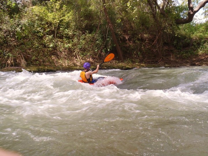
This section is a great run for whitewater beginners. It generally has more rapids than the upper stretch, although none of the rapids are difficult. There is a large stretch of flat water above Martindale Dam. Because the San Marcos River is spring-fed, it tends to be one of the few rivers that is runnable during periods of drought. The river can be run below 200 cfs, but it tends to be scrapey.
Distances and gradient measured using GIS tools in 2015.
WARNING: Sieve Hazard at Cottonseed
In 2008, gravel washed out from under part of the former concrete dam structure at river left, causing water to rush underneath it and create a potentially deadly sieve. Paddlers report, as of early 2018, that the sieve is still active when the river is running relatively low. Stay right to avoid it. Do not swim into the river left eddy ('Suburban eddy') above the dam.
River Features
CR 101/Old Bastrop Road Bridge (Westerfield Crossing)
Access PointDistance: 0 mi

Limited parking is available along the road easement on the river left upstream side of the bridge.
San Marcos River Retreat
Access PointDistance: 0.64 mi
To avoid the parking hassles at Westerfield Crossing, many paddlers use San Marcos River Retreat (a private campground at river left) as an alternate put-in for this run. A small fee is required. Note also that San Marcos River Retreat does not allow alcohol on its premises.
Old Mill
OtherClass: IIDistance: 0.76 mi
Class II- rapid created by the remnants of a broken dam and mill structure. At 250-400 cfs, this is a good place to work on attainments (it should be possible to attain the entire rapid.)
Broken Bone
OtherClass: IIDistance: 1.82 mi
The river turns right, then narrows as it turns left again. This rapid tends to form a surfable wave at low-to-moderate flows (generally below 350 cfs) and a wave train at higher flows.
Cottonseed
OtherClass: IIDistance: 3.27 mi
An old mill dam was blown up in the 1940's, leaving concrete slabs and rocks in the river that create a rapid of some consequence for beginners and recreational boaters (primarily due to the sieve described below.) Stay right. The rapid can be portaged at river right.
At lower flows (< 300 cfs), Cottonseed forms a surfable wave at river center. At 700-800 cfs, a surfable wave is reportedly formed by water flowing over the concrete wall at river left.
WARNING: Sieve Hazard at Cottonseed
In 2008, gravel washed out from under part of the former concrete dam structure at river left, causing water to rush underneath it and create a potentially deadly sieve. Paddlers report, as of early 2018, that the sieve is still active when the river is running relatively low. Stay right to avoid it. Do not swim into the river left eddy ('Suburban eddy') above the dam.
CR 246/Scull Rd Bridge (Scull's Crossing)
Access PointDistance: 3.74 mi
Low bridge may pose a hazard at higher flows (portage at river right if necessary.) Parking is available up the hill at river left along the CR 103 easement (at the intersection of CR 103 and Skull Rd.)
Many whitewater boaters choose to take out here to avoid the one mile of flat water above Martindale Dam.
Take out on the gravel bar at river right upstream of the road. This takeout is on a spit of land that is part of the natural riverbed (after the Halloween 2015 Flood, the river even sought a new course on the other side of that spit of land, washing out Sculls Rd in the process.) However, the landowners at river right have, in the past, claimed that boaters were trespassing on their property by taking out here. They previously erected a barbed wire fence that intruded upon the right-of-way of the public road, making it difficult to take out. This fence is now gone, due to the 2015 floods, but in general, do not linger here, and do not engage the landowners if they attempt to harass you.
Martindale Dam
OtherDistance: 4.85 mi
A sloping dam that can generally be run near the center by whitewater paddlers. A portage trail exists on river right.
NOTE: Do not hang out on the dam structure. Either run it or portage it, then keep paddling. The cops will show up if you linger here for too long.
Martindale Dam is reported to take on a Class IV character at high flows (thousands of cfs), forming a 'stopper wave' that can hold a boat but which is not, despite appearances, terminal. Mistaking the stopper wave for a terminal hydraulic led, indirectly, to the death of an experienced paddler via a failed rescue in 1992.
CR 262/Deviney Rd Bridge
OtherDistance: 4.94 mi
Low bridge could pose a hazard at higher flows.
FM 1979 Bridge
Access PointDistance: 5.53 mi
Public parking and access is available at river left via a dirt pull-out under the bridge.
Shady Grove Campground
Access PointDistance: 5.57 mi
Many paddlers use Shady Grove Campground (a private campground at river right, just downstream of the bridge) as an alternate takeout for this run. A small fee is required.