Crapo Creek
Off-trail Put-in to Salmon River

| Difficulty | IV-V |
| Length | 3.8 mi |
| Avg Gradient | 367 fpm |
| Gauge | Salmon R a Somes Bar Ca |
| Flow Rate as of 49 minutes | 265 cfsbelow recommended |
| Reach Info Last Updated | July 12, 2023 |
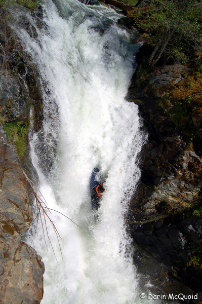
Overshadowed because of its location near the legendary Bridge Creek, Crapo Creek holds its own as a low volume steep creek, although it is a chore to get in and the run can be quite brushy and wood-filled. This creek is steep: average gradient is 368 feet/mile and it exceeds 470 feet/mile in sections. It is not a classic run by any means, although it enjoyed a brief heyday in the early to mid-2000s among young kayakers who were exploring new runs in the area. It has likely not been run much, if at all, since that era.
After a backroad drive on dirt road, a steep one mile off-trail hike leads to the small, steep creek. It is pronounced cray-poh and due to its high country meadows and abundant springs, it flows with greater volume than its watershed size suggests, particularly in summer.
The creek alternates between steep rocky sections and bedrock slides. With sufficient flows--but not too much--both are fun. Be prepared to scout and portage and also run some blind drops. Be aware that there is a 30-foot vertical drop in the lower reaches of the creek, and few would choose to run it (this is the only section of the creek that flows through private property).
Wood moves every year in Crapo Creek, making it one of its most significant hazards. Recent fires in 2008 and 2017 have worsened the the wood and brush situation.
Even more than other runs in the Salmon watershed, you're out there in a place where nobody ever goes. It is quite remote and hiking out would be a challenge with steep slopes, dense brush, and tons of poison oak. Take everything you need to be safe and fully self-sufficient, including the gear, skills, mindset, and an inReach or other satellite communicator.
Although only four miles long, running Crapo Creek is a very long day, so start early.
Logistics
Put-in
To get to the put-in from the take-out at Nordheimer River Access, drive upriver on Salmon River Road to For
...There's no one spot that's the put-in for this run: it's wherever your off-trail bushwhack brings you to the creek.
Drive as far as possible on the 40N51D spur road into the Crapo Creek drainage, then walk to the end of the road to a large landing. Go straight downhill through the brush and poison oak to reach the creek about 400 vertical feet below.
Take out at the Nordheimer River Access on the Salmon River, about 3/4 mile downstream of the Crapo Creek confluence. The river access is located in the back of Nordheimer Campground. If there are trip cards available at the info board at the take-out, please fill one out with info on your trip. This helps provide info to river managers, and they have no idea that people run Crapo Creek.