Trip Reports
Log in to add a reportAF
Less-Lazy Float: 6 Packrafts at 440 cfs - Aldo Fernandez
Aug 18, 2024
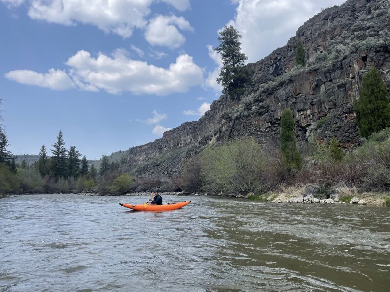
On 8/18/2024 a group of 6 Packrafters floated this section. This report is written from the perspective of a packrafter (draft around 4-6 in and beam around 3 ft) At the time of this writing, the gauge below the dam at Blackfoot Reservoir was not reporting; a gauge further downstream (USGS 13066000 BLACKFOOT RIVER NR SHELLEY ID) was referenced for flows. It should be noted that between the dam and this downstream gauge, there are at least a few small streams that may contribute to flows recorded there that would not be contributing to flow rates higher up, closer to the dam. At 440 cfs, this rafter finds the river to be unsuitable for any vessel larger than a single or double occupancy small raft. Drift Boats, larger rafts, and even canoes may have great difficulty with the shallow/rocky river bottom in some areas and narrow passages between boulders/trees etc.
This stretch is mostly lazy with a couple short class II/III rapid sections in the last few miles around 43°06'20.2'N 111°53'47.1'W. Here the river narrows and picks up speed, there are boulders and trees on either side but a straight shot down the middle seems to be the best (and most fun) route. Another couple hundred feet downstream is another short rapid section of similar magnitude and approach as the first.
Apart from the above mentioned rapid sections, there were several areas that were shallow enough that multiple party members had to get out of the boats and walk them for 20-30 ft at a time. Many more areas could be floated with some bottom-scraping, but not requiring exiting the boats. There are many opportunities for camping along this river, both dispersed and in established fee-free BLM campgrounds equipped with picnic tables, fire rings, and pit toilets. Several bald eagles were seen along this route as well as other raptors and water birds (cormorants, ducks, and herons). Several muskrats were seen surfacing in the river. A bear was also seen from the river in one spot and bear scat in another location while scouting the river (keep a clean and secured camp).
GH
Morgan to Trail bridge 1200 cfs @ Shelly gage - Garrett Hill
May 20, 2024
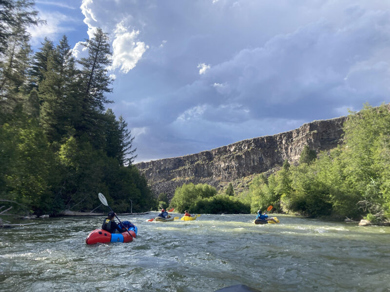
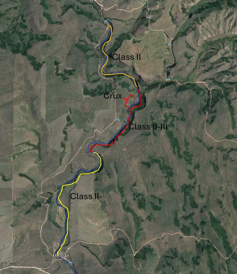
This is a fun intermediate run that is a little easier that some of the other offereing in the area (like Fall River and Grays River). We floated in kayaks from Morgan Bridge to Trail Creek Bridge which was about 7.5 miles and it took us 2 hrs to float. The first 3.25 miles are class I or II-, then the start of the rapids is a place where the river gets wide and shallow, this would be the hardest part if taking a raft because there are lots of rocks that are not far under the water. After this you get into the canyon and there is about 2 miles of calss II+ (III) that is easy to read and run but gets progressivly more difficult (but never that hard). The crux rapid is a couple of biggish holes on the right bank of a left hand corner that can easily be avoided on by staying river right. After that, the canyon opens back up and is very senic with another 2.25 miles of easy class II- till you get to the bridge. This run is perfect progression for someone that is comfortable moving through water, catching eddies and has a good brace but is not ready to tackle some bigger class III. I took my brother in an inflateable kayak, he has some experience rowing a raft in Salmon and on the Alpine section but has limited time kayaking and he did great. I would put this as an overall difficulty similar to the Alpine section of the Snake but shallower and rockier, not a great place for roll practice. The shuttle was straightforward but would not be great on a bicycle as it is kind of hilly. If you wanted to add another 1.5 miles some more class II- , you could put in at Graves Creek Campground.
CD
Good but Bony Run at Low Flow - Coury Dorn
May 22, 2023
We ran this on 05/20/2023 at 480 cfs (Gage: Blackfoot NR Shelley). Lots of exposed rocks between Morgan Bridge and Graves Creek Campground, so we put in at Morgan Bridge. At this flow, there were two, super bony sections a few miles in. As the canyon constricts flow, it evolved into a fun, splashy Class III descent with a couple of great drops. A fairly technical boulder dodging run but chill for the most part.