| Difficulty | III-IV |
| Length | 16 mi |
| Avg Gradient | n/a |
| Gauge | Sf Boise River at Anderson Ranch Dam Id |
| Flow Rate as of 1 hour | 1590 cfsrunnable |
| Reach Info Last Updated | April 25, 2023 |
River Description
This is a long, challenging run that cuts through a deep, roadless canyon. There is no cell phone coverage, and given the sheer rhyolite cliffs, evacuation on foot to the canyon rim is often impossible. Therefore, anyone attempting this section should be highly skilled and likewise fully prepared for any and all contingencies.
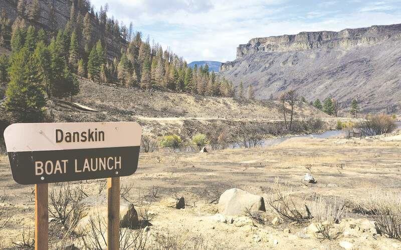
The first five miles downstream from Danskin bridge are characterized by swift-moving water through majestic landscapes punctuated by two pastoral ranches, which are located on river-left.
Beyond the second ranch, look for a conical rock formation high on the river-left ridge. This is the Witch's Hat, and it roughly marks the entrance to the canyon proper.
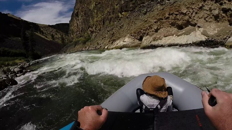
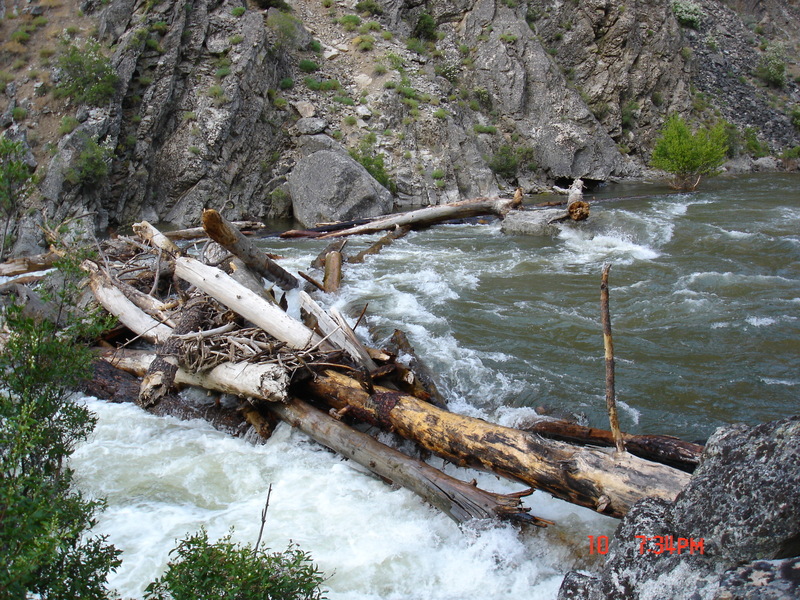
The section that follows is a series of Class II and III, read and run rapids that require some basic moves between holes, rocks, and strainers. The exceptions to this are Raspberry (Class III), Buffalo Creek (Class IV), and Fiddler (Class III). Each of the aforementioned rapids have the possibility of dangerous strainers and/or pin hazards. Scouting is recommended and achievable for all via trails located on river-left.
Be advised: a swim on any of these rapids is potentially deadly – they are long, shallow, and have known pin hazards. Likewise, with Anderson Ranch Dam being bottom-released, the water in the canyon stays very cold throughout the summer months.
The shuttle through Prairie is approximately one hour. Local shuttle service is available.
River Features
Raspberry
OtherClass: IIIDistance: 7 mi
Raspberry (first of three named rapids) is a fairly straight forward Class III. Easily scoutable from pool on river left.
Enter center then move left (at 1200CFS)
Wood is always a possible hazard, be aware.
Buffalo Creek
OtherClass: IVDistance: 10 mi
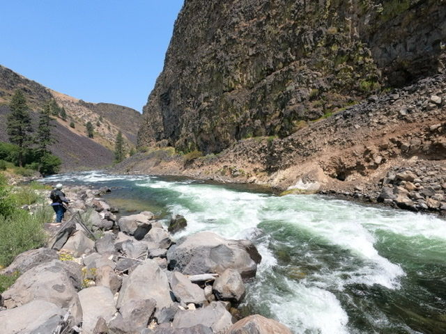
Buffalo Creek (second of three named rapids) is a Class IV due to the length of the rapid. A failed roll at the entrance would result in a long and rocky swim with possible pin hazards.
Enter center/left, catch the eddy on river left after the first couple of moderate hits, then continue down the left side, picking your way between holes and rocks (1200 CFS).
Easily scoutable from pool on river left. Also a good place for lunch.
Always look for wood on this section.
Fiddler (aka b***ches brew)
OtherClass: IIIDistance: 14 mi
Straight forward Class III (third of three named rapids).
Enter far right move to center.
Easily scoutable from pool on river left.
Wood is always a risk on this section.
Take Out
Access PointDistance: 16 mi
Take out on river left just before Neal Bridge on Black's Creek Road.