Brushy Fork (Lochsa trib)
Off Elk Meadows Road to Crooked Creek (HWY 12)
Sep 28, 2006
Nope I never ran it, nor claimed to. Had you looked closely, called reading, at the book you would have seen the Brushy Fork description was written by Doug Ammons. I have no doubt that Doug ran this -- seen the photos and there is no question of his or my honesty. As for your jumping to conclusions, who knows what your agenda is?
Jan 16, 2006
The following is correspondence from a friend and fellow paddler on this trip and is very well versed on the area. The opinions are of the writer and should not be considered that of AW.
'Nice write-up. I would go so far as to say that Grant Amaral never actually came close to running the Brushy Fork (his description of the run is so far off I don't think there is any way he could have run it). I also feel that providing a description of a run you've never actually done is irresponsible at best. Even considering the quantity of wood I would classify the Brushy Fork as a III-IV run (not class V), although I know how rating rapids goes. As far as the quality of the run goes, I remember
there being very little runnable whitewater on the run, and considering the quantity of wood, I would not recommend the run to anybody, especially
considering the amount of quality runs nearby. (Not that I had a bad
time doing the run, but let's face it, it's no classic). I think its great
that you did a write-up, but mainly because I think the run is so
misrepresented in Grant Amaral's book (he makes the run sound very appealing in my opinion)that a good description of the run will keep people from running it
when they could be running something else.
Anyway, nice to hear from you, and thanks for sharing that write-up.
Hopefully I'll see you on the Spokane in a couple of months! Nos
vemos.'
-Natty
Jun 15, 2004
This was taken the day before we ran the Brushy Fk. We hiked the lower three miles to scout as best as possible. There is a trail of sorts along the north bank.
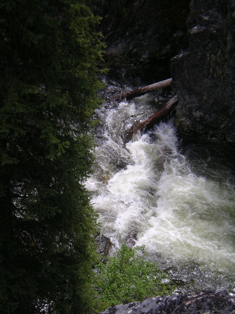
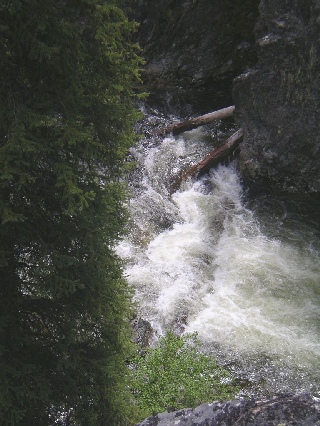
This was taken while on scout/hike of the lower 3 miles. There are two such cliffs to view some of the action below. This is from about 100 feet above the river and the riverwide ledge is in fact a log. From take-out on river right, there is a decent trail of sorts to hike up the Brushy Fk to scout the lower 2-3+ miles to see if you like what you see.
Jun 15, 2004
This is unfortunately alot of what you encounter while on this run.
This visual read for Brushy Fk is just upstream from the road bridge over Brushy Fk.
Jun 1, 2004
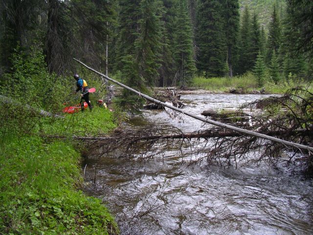
This pic shows what we saw when we ran this little known/paddled trib of Lochsa. Much less and the river is likely to be more of a hike fest than paddlefest. Much higher and the many logjams will come much too quickly leaving little room to get out in a few of the steep log filled drops.
Jan 1, 1900
Required a crossing of Pack Cr while hike scouting the lower 3 miles of Brushy Fk.
This was not the longest portage due to logs, but one of the most impressive for its' height. Good time to chat with your paddling pals.
More of the same on the Brushy Fk. Happy to meet our pals from the Lochsa on this trip.
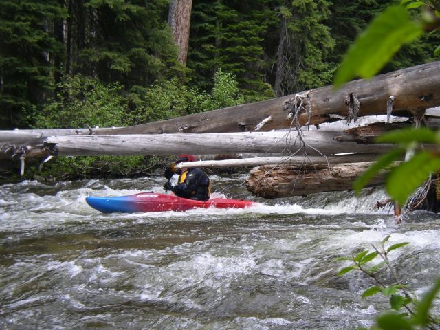
One of the few drops that had logs that could be run, albeit with a bit of limbo action. Happy not to do yet another portage.
Taken from cliffside while hiking the lower 3 miles. This looked like a beauty and it was! One of the few on this run not blocked by logs.
HB flying into a landing pre scout yet another logjam just downstream!
Spent more time scouting and hiking around logjams than running the river. Lovely scenery however.
JCP coming into the parking space for another scout.
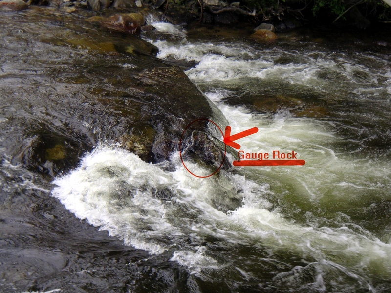
This is the bridge at the take-out. Scout from this side, just upstream from bridge to look at gauge rocks.
This baby elk was with mommy (couldn't get camera out in time for her) seen while we portaged a small logjam early in the run.