Thunder Creek
Trail mile 4.1 to Colonial creek campground
| Difficulty | IV-V |
| Length | 4.2 mi |
| Avg Gradient | 85 fpm |
| Gauge | Thunder Creek Near Newhalem, Wa |
| Flow Rate as of 41 minutes | 1100 cfsrunnable |
| Reach Info Last Updated | September 11, 2019 |
Optimal flows are found between 700-1000 cfs. Below 700 cfs most of the rapids are a notch easier but some rapids will become manky. Thunder creek has been run as high as 1200 cfs and at the time was not considered too high.
THE RIVER
Thunder creek is just one more reason Washingtonians are lucky to live in the land of Cascadia. Thunder creek lies deep in the north cascades and provides boaters with runnable flows from rain events and snowmelt between April and September of just about any year. The beauty of the Thunder creek trail and of the river are not easily rivaled. A new classic?!
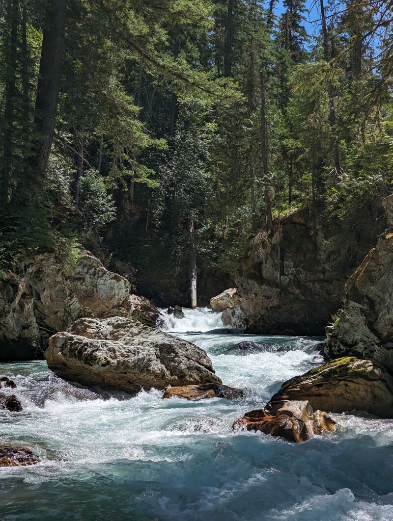
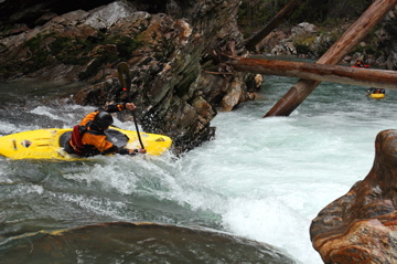
The character of Thunder creek is one of swift moving cold water and a boulders on bedrock type streambed. This makes for a pool drop style creek with lots of great 4-8 foot ledges and clean boulder gardens. But be wary at higher flows, the pools will disappear and rapids will start to blend into one another.
After putting on paddlers will encounter a few class III-IV flume style rapids before the river bends to the right and disappears over a big horizon line called Trial falls. Catch a eddy on river left to scout or portage the falls. Trial falls has a unobliging lead-in to a near vertical 17 cascade.
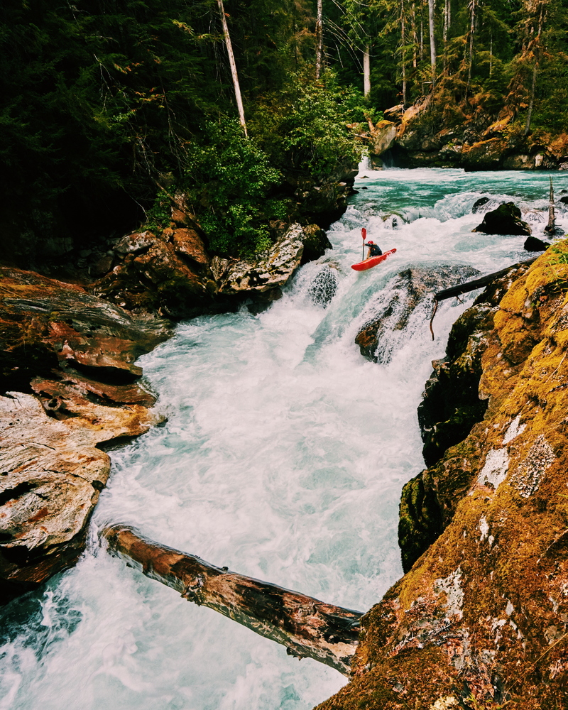
From the eddy below the falls you will see a mess of old growth trees chocked between the canyon walls above Chopsticks. Here the river pours over a river wide V-shaped ledge forming the best crosscurrent boof on the run. Maybe even best in the state?
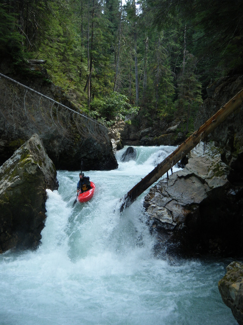
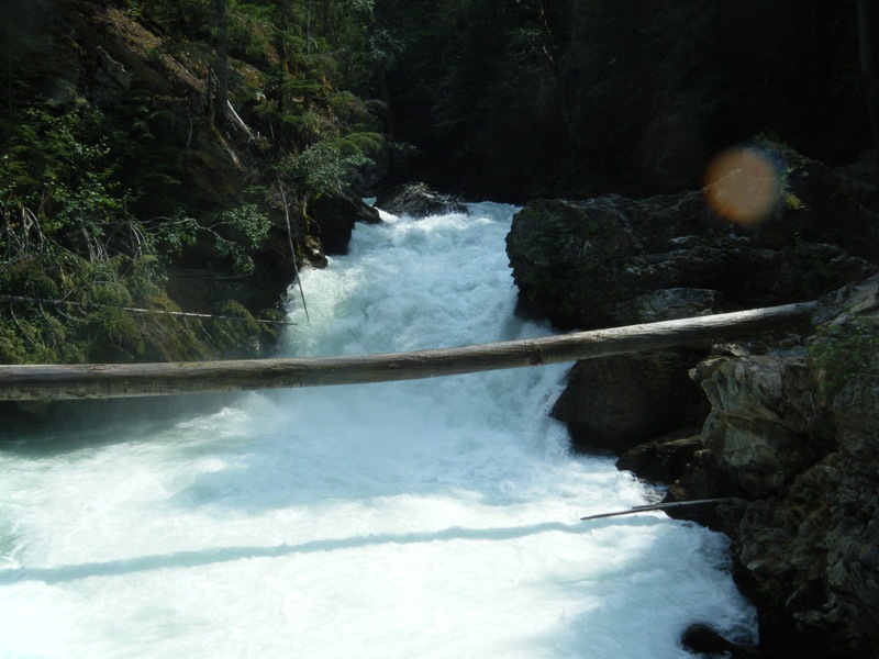
The next 1/3 mile is full of great read-and-run class IV, but stay on your toes and spread out, there is one rapid with a log spanning the exit of the drop, it has been run but only at the highest and lowest flows. We have been catching the last river right eddy above it then ferrying across the creek and portaging on river left.
The very next rapid Dim Sum may be the highlight of the trip at medium to high flows. Two back-to-back perfect 8-10 footers with ample recovery pools between and bel
...Jul 2, 2023
The wood situation is largely the same as in 2022; keep an eye out. It seems that something shifted in Manadrin Palace between the two ledges. I pitoned above the last ledge (on what was previously the correct line) and melted into the hole. The rest of the group portaged. It might not be a factor at high flows, but scout accordingly. The photo shows a bit of a bulge river center.
Sep 30, 2017
First part of Dim Sum. The bottom can be weird.
Aug 12, 2009
River is on the rise but at a high level