Clearwater, N. Fork
Kelly Creek to Aquarius Campground
| Difficulty | III+(V) |
| Length | 45 mi |
| Avg Gradient | n/a |
| Gauge | Nf Clearwater River Nr Canyon Ranger Station Id |
| Flow Rate as of 43 minutes | 1700 cfsbelow recommended |
| Reach Info Last Updated | March 2, 2023 |
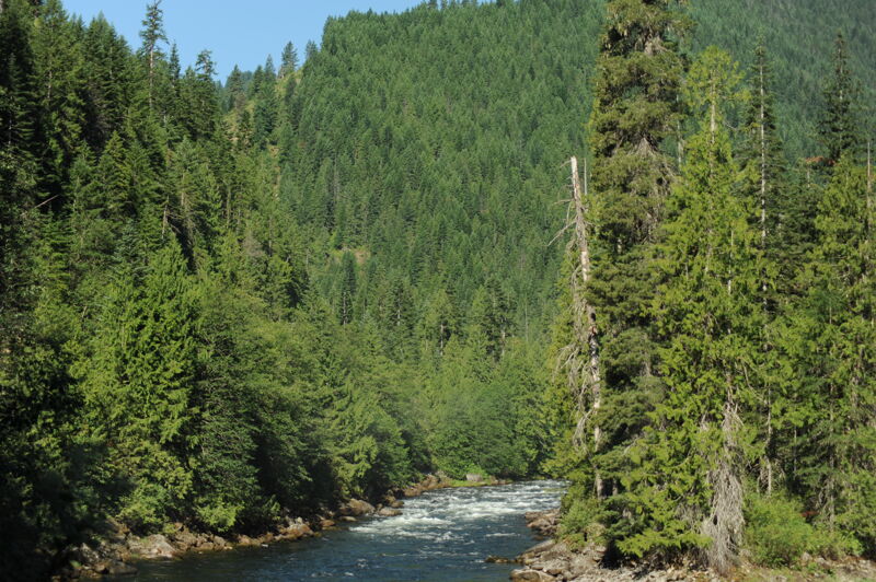
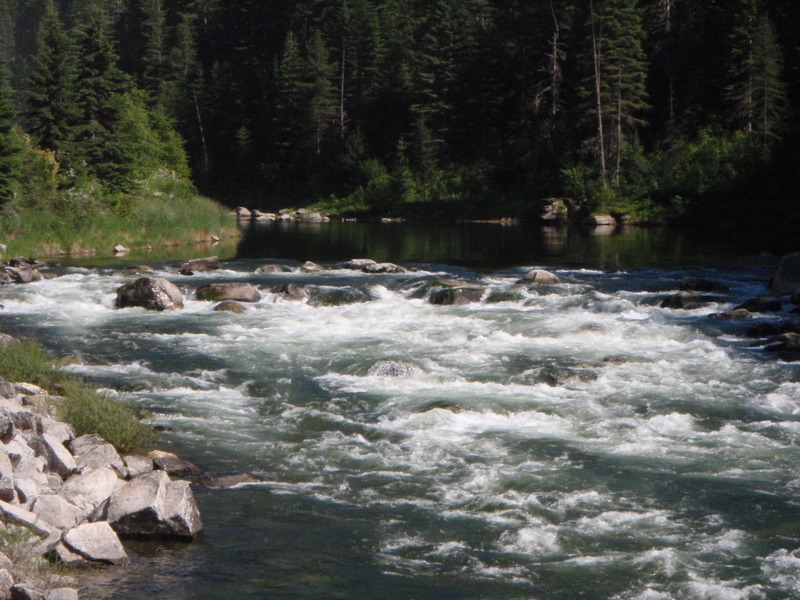
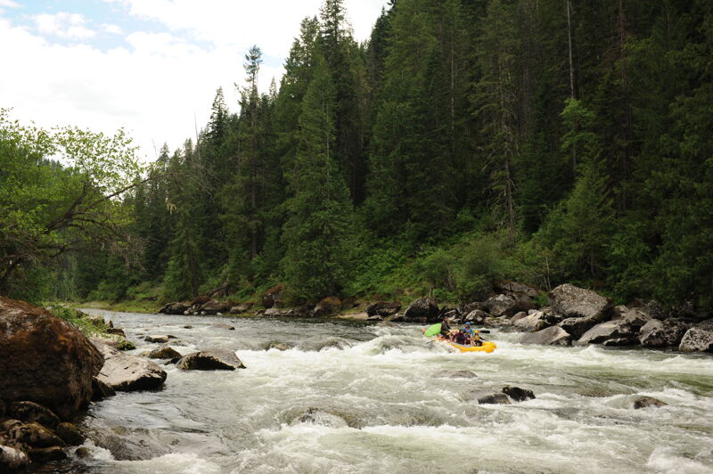
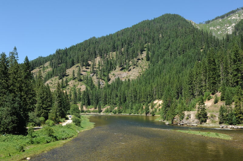
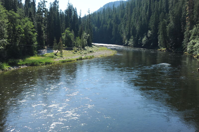
This stretch of the North Fork Clearwater is in a remote and secluded region of Idaho. Moore and McClaran describe the river in their guidebook Idaho Whitewater as pristine with crystal-clear waters, giant blond boulders of granite highlighted with green mosses, and bordered by primordial stands of western red cedar. The whitewater was pioneered by Oz Hawksley before Dworshak Dam was completed in 1973; the massive 717' wall of concrete has cut this river off from the Clearwater resulting in the loss of one of the Snake River watershed's great steelhead runs. Those who venture into this remote country can still find some great whitewater with multiple access points offering several options to paddle different segments of this 44 mile section of wild river. The guidebooks Western Whitewater, Idaho the Whitewater State, and Idaho Whitewater all include descriptions of the section from Kelly Creek to Aquarius Campground that can be split up in various ways depending on which access points you use; the North Fork Clearwater Road (Forest Road 247 and Forest Road 250) follows the river along river right making scouting and shuttles easy. A multi-day trip down this river is also possible with some great camps on river left, the opposite side of the river from the road.
Kelly Creek to Weitas Campground, class II/III, 14 miles
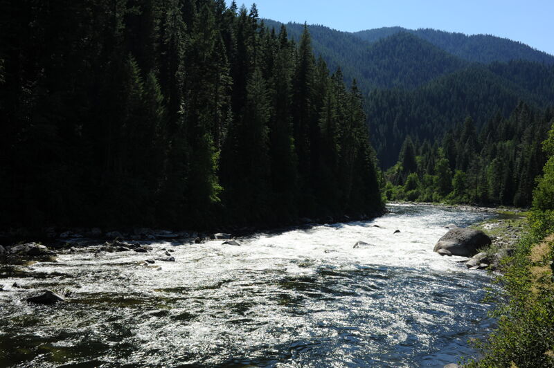
The river flows swiftly in this lightly-used section. Paddlers need to stay alert for potential wood hazards.
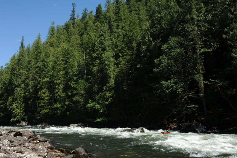
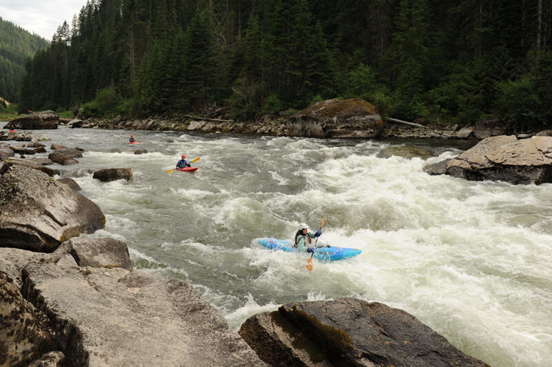
Weitas Campground to Washington Creek Campground, Upper Bungalow Run, class III+, 10 miles
The first half of the Bungalow Run has two significant rapids, at Spray Creek and Whitefish Rapid just above the bridge Oregrande Creek where you will find a great surf wave in the run out. You can take-out at Washington Creek or continue downstream if you plan to run Irish Railroad.
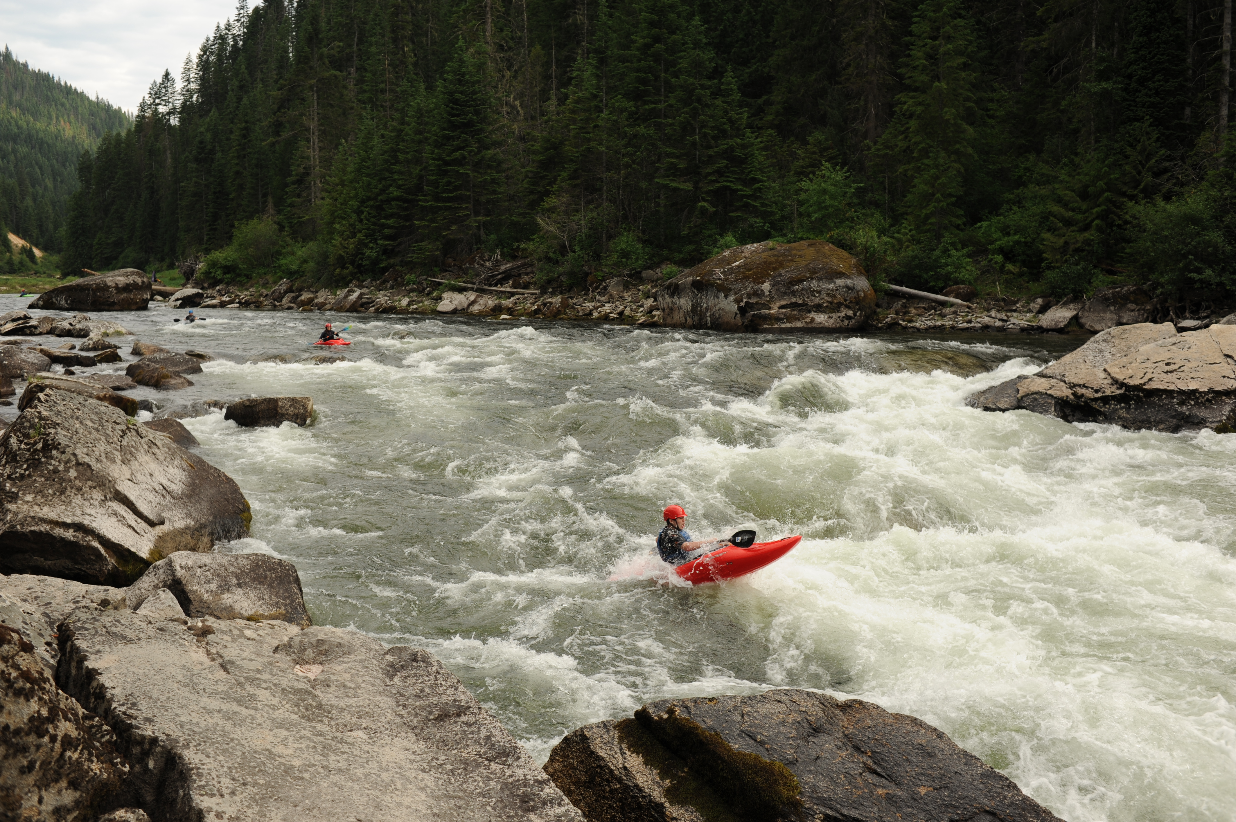
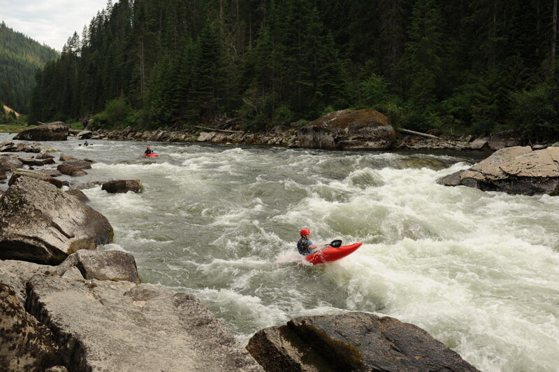
Washington Creek Campground to Quartz Creek, Lower Bungalow Run, class III+(V), 11 miles
The second half of the B
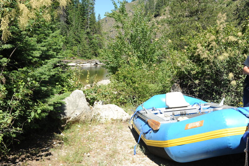
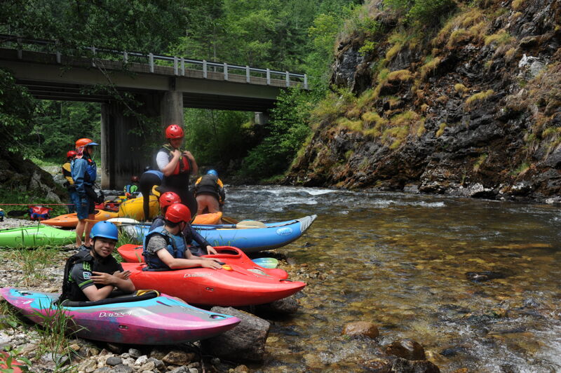
...Kelly Creek joins the North Fork Clearwater at Kelly Forks. A campground is on river left and a Forest Service work center is on river right with a historic 1930's cabin available for rent. The campground has 14 individual fee sites, a group area, campground host and is available on a first-come, first-serve basis.
Fair access at the bridge to Weitas Creek Campground on the upstream river left side (requires hiking through a camp site). It’s possible to get a raft down but not easy. The campground has six sites available with no fee on a first-come, first-serve basis.
Located at Forest Road 250 mile 30.2 at a pull out with a short trail down to a good beach on river right. With a short carry rafts can use this access about half a mile upstream of Whitefish Rock (the prominent rock outcrop between the road and the river) and a mile upstream of Bungalow Bridge.
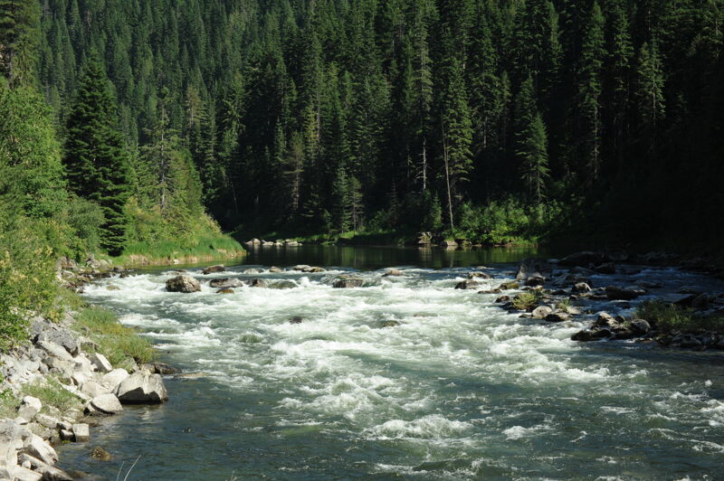
Visible from Forest Road 250 mile 30.0, this is the first of three good rapids that come in sequence upstream of the Bungalow Bridge. This rapid has lines down left, right, and center depending on flows.
Visible from Forest Road 250 mile 29.8 where a prominent rock outcrop, Whitefish Rock, stands between the road and the river, this drop has some fun waves.
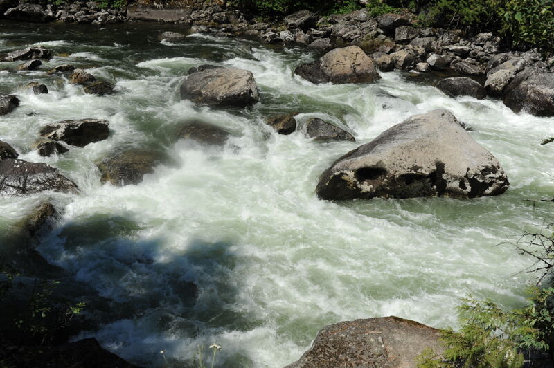
Visible from Forest Road 250 mile 29.5, this rapid is a jumble of rocks and ledges. Scout from the road or the river and choose a line depending on flows.
Located at the junction of Forest Road 247 (mile 48.9) and Forest Road 250 (mile 29.3) on river right and upstream of the bridge across the river from the Orogrande Creek confluence and the Bungalow Ranger Station. An emergency call box is located at this junction. This access is in the pool below the class III rapids just upstream at a popular swimming beach.
Visible through the trees at Forest Road 247 mile 43.8 this rapid has a few options depending on flows.
Visible from Forest Road 250 mile 43.1, this rapid a short distance upstream of the Snoden Creek confluence has a fun line starting center and then down the right around a hole at the bottom.
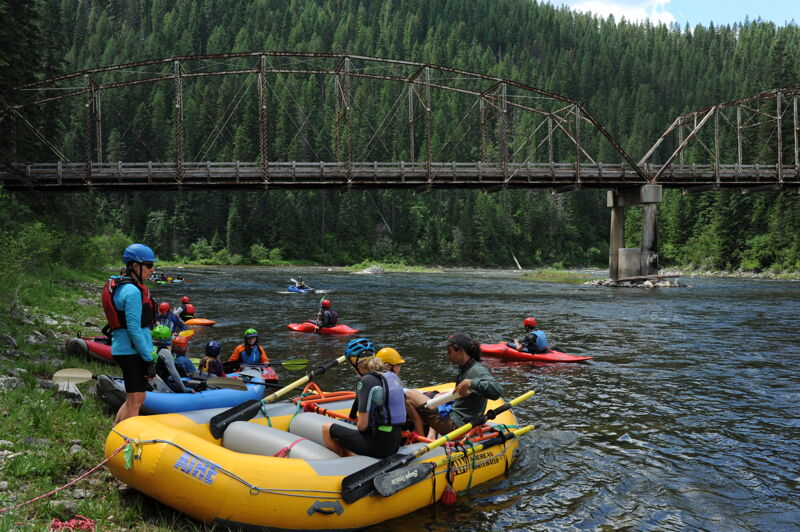
Located at Forest Road 247 mile 42.7. This is the access that can be used as a takeout for those who don't want to run Irish Railroad or a put-in for those who have this as their objective. The access is on the upstream river right side of the bridge to Washington Creek Campground. The campground also provides good access on river left for those who are staying here. The campground offers one host site and 23 fee campsites (including one group site). About half the sites are along the river and the other half are back in the forest.
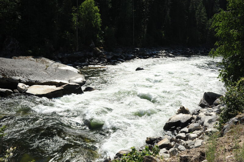
Visible from Forest Road 247 mile 39.0. At high flows a massive hole forms in the center of the rapid. The standard line is the sneak down the right. Kayakers looking to portage should take-out early as the rapid first comes into view as a horizon line downstream (scouting a good take-out from the road is recommended). A portage along the road is then possible. A kayaker trail at the downstream end of the rapid provides access to the pool at the end of the rapid. Portaging a raft would be much more challenging.
Located at Forest Road 247 mile 36.8 just upstream of Ermine Creek. High clearance spur down to the river providing an access point for those seeking a class III experience down to Aquarius Campground.
Located at Forest Road 247 36.3. Camping area with half a dozen sites along the river.
Located at Forest Road 247 mile 32.0. The traditional put-in for the Quartz Creek run down to Aquarius Campground. A fair access point on river right where Quartz Creek joins the North Fork Clearwater. The dispersed campsite on the upstream river left side of the Quartz Creek bridge has a trail down to the creek. You can also scramble down at the bridge. Getting a raft in at this site is cumbersome but possible.
The final rapid at the campground with some good surfing.
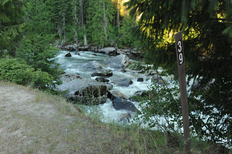
Located at Forest Road 247 mile 23.2. This campground is on river right and has 9 developed fee sites (upstream of the bridge) and 2 group campsites (Purple Beach; downstream of the bridge) on the bank of the scenic North Fork of the Clearwater. These sites are available on a first-come, first-serve basis. Forest Road 247 is paved all the way from Headquarters, although narrow and lumpy in spots, but the pavement ends 6 miles upstream of the campground. Kayakers can take out on river right downstream of the bridge at Purple Beach. This access requires a short climb up the trail to the dispersed camping area and picnic site where parking is available.
Located on river right along Forest Road 700 at a point 0.8 mile downstream of the bridge that crosses the river at Aquarius. This access provides easy low bank access at the mouth of Isabella Creek and is the recommended access for rafts. A short distance downstream of this access point the river encounters the slackwater of Dworshak Reservoir that floods over 50 miles of the river below this point.
Jun 29, 2021
With flows dropping and groups rolling for 4th of July weekend, we set out for our next destination with one final road scout of the section downstream of Washington Creek Campground.
Jun 28, 2021
The kids enjoyed this run so we went back for a third helping on day 4 of our trip to the North Fork Clearwater paddling from Whitefish Rock to Washington Creek Campground. It was again about a 3 hour run that allowed for plenty of time to enjoy our riverside accommodations at the campground.
Jun 27, 2021
We were on the water by noon for a trip of approximately 3 hours from the Whitefish Rock Access, just above three fun class III rapids, to Washington Creek Campground. This allowed for a leisurely departure from camp and lots of afternoon waterplay and fun enjoying the late afternoon sun at Washington Creek Campground.
Jun 26, 2021
Run with a big group including kayaks and a raft. We had lots of kids along for the adventure. We launched around noon and were loading up the raft around 6pm with a lunch stop along the way. This was day 2 of four days of fun along the North Fork based out of Washington Creek Campground.
Jun 25, 2021
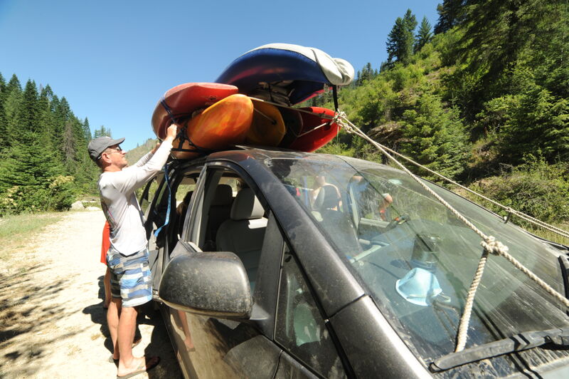
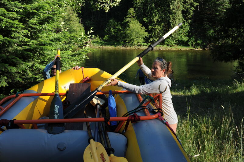
We launched from Weitas Creek Campground at 1pm and proceeded downstream to Washington Creek Campground and finished the run around 5:30pm. This was day 1 of a great family trip on the NF Clearwater 6/25-6/28 with flows dropping from 3200 to 2800 over 4 days with kayaks, IKs, and a raft. Washington Creek Campground proved to be a great base of operations for day trips to enjoy boating, fishing, and swimming. Many of the campgrounds and dispersed camping areas along the river were full but we found riverside sites at Washington Creek Campground arriving mid-day on Thursday. Kids did a few laps on the Bungalow run (Weitas Creek or Whitefish Rock Access to Washington Creek Campground). The weather was hot but we enjoyed swimming in the river after our runs. We also had a good day enjoying Quartz Creek to Aquarius. A couple people enjoyed the run from Washington Creek Campground to Quartz Creek.