| Difficulty | I-II |
| Length | 34.3 mi |
| Avg Gradient | n/a |
| Reach Info Last Updated | April 12, 2001 |
River Description
Lat/Longitude data are very approximate.
River Features
Put In
Access PointDistance: 0 mi
Take Out
Access PointDistance: 39 mi
Trip Reports
Log in to add a reportAS
Deep Creek (Mud Flat to Crutcher Crossing) - aaron sety
May 21, 2025
Deep Creek
_______________
Dave and I planned to drive and launch on April 25, 2025. This would be less than 24 hours after I had landed back from a 16-day trip to New Zealand. The quick turnaround had me a bit spun and that night back, and just barely prior to our trip, I wasn’t very sharp. Dave had talked about the weather moving in and we both were considering the gooey desert roads after rain. I pushed that night and said we go. At 7am the next day and the weather had not improved but inched up in rain quantity, I called Dave and asked to reschedule. I was worried he would not have the time off but was wrong, so we set a new drive and launch date of Monday the 28th of April. Our plan was to leave Donnelly, Idaho at 6am, drive to the takeout at Crutcher crossing, leave my truck, then drive back to the put in and hopefully float a few miles that night. Little , so little did I know!
________________
A timeline will help, so would a map!
________________
We left Donnelly, Idaho at 6:15 am. A few stops in Boise and Mtn Home for lug nut wrenches. Passed Bruneau at 10am ish… Made it to Owyhee (photo right) and headed west on roads that very quickly turned to mud maybe around 1130 am. As we start down the road, my notes say , “ very questionable choice!” It was muddy.
_______________
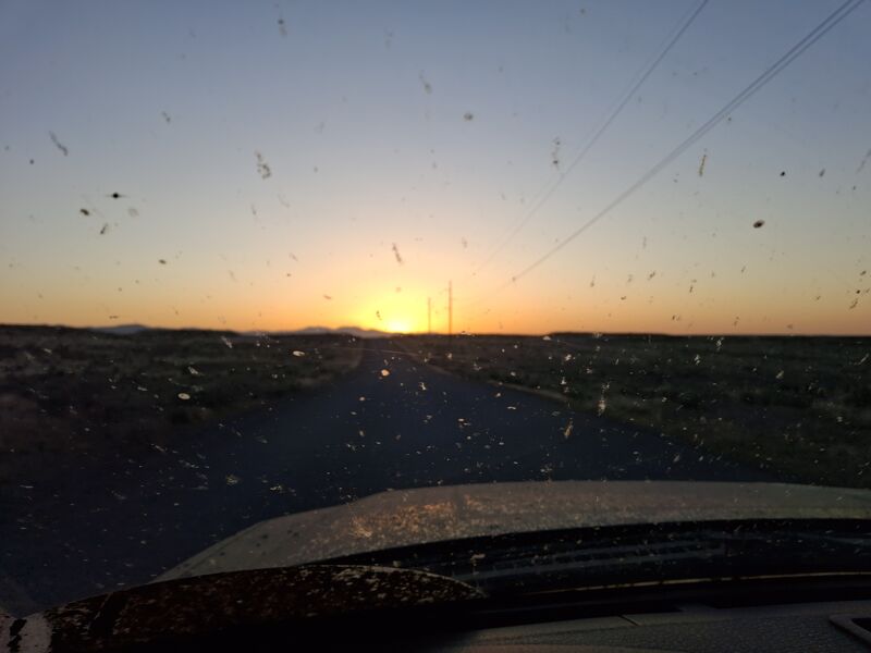
From Owyhee to Crutcher crossing canyon rim was 5 hours including a wrong turn I made and a Prius tow! We towed the Prius, not the other way. We made it, canyon rim, back to Owyhee in 3 hrs. It had rained .38” the day before our trip. At Owyhee we found nothing open and the sun setting with many hours left to go. We made it to Deep Creek crossing at the Mud Flat rd at 1030 pm. That amounted to a 16-hour drive! Slept well. The photo left is Deep Creek at Mud Flat rd.
_____________
Started down Deep Creek at 9:30 am. And the willow bashing began. We had a small portage at watermelon seed. (Photo right) I went over the top of it while Dave went around the right side of it. We also encountered 1 other larger boulder that Dave ran right of and I missed and had to lift the boat over. Willows were VERY challenging . I would guess we were out of the ik at least 100 times over the first 20 miles. That 100 could easily be 200, but who knows. Somewhere around mile 12 a willow hit Dave in the eye and caused a laceration to his eye lid and cornea as well. We stopped and quickly decided to keep moving as there was little to do about the injury. His vision didn’t seem affected, and he didn’t complain of any pain. It has since healed after antibiotics, 2 rounds. Do not underestimate the willows! Solid class 4 flat water. Willows alone would have been ok but the beaver activity leaving sharp spears everywhere was problematic and dangerous. I remember thinking someone has been through here with a machete as 1” diameter willows sheared off cleanly were very frequent. At some point one got my Ik and I had to patch it.
______________
We made our first camp around 21 miles down from Mud Flat. It took about 9 hours to make that mileage. (That 21 was from gps tracking. With so many goose necks it could be + or -). We were both pretty spent by then. We had stopped just a half mile up stream and considered camping there, but the lure of morning sun early pushed us on and thankfully it rewarded our decision. That was a very long day on top of 16 hours of driving . Dave’s drysuit was leaking some and drying time was appreciated.
__________________
Whew, that first 2 days of our trip were kind of wild. We made it and now had a pretty good plan for the rest of the trip including the weather that was threatening our exit strategy. We hoped to make it to Crutcher before the road down from the rim got wet.
__________________
We left camp 1 at 11:15 and arrived at the confluence at 7:30pm. Sun set was fast to follow but not before we had a dehy dinner and a bit of a rest in chairs. On our second day we stopped at Dick Shooter Creek (photo left) for some water and lunch then another stop at a slot canyon for a bit of exploring. In the narrow canyon the frogs were very loud until they heard us, then, not a sound. Pretty cool!
_____________
We camped that night at the confluence of the east fork and deep creek. In the morning, I repaired the leak in my ik and we packed up leaving camp close to 11:45 am.
___________
The East fork moved right along, and the willow bashing was over! We passed Rickard crossing before I recognized it. Funny what 20 years can do to the memories. I would want a pin and gps if I needed to take out there. Ran Bolder Jam rapid (photo right), down the right side. We stopped once looking for the portage trail to Owyhee Falls before bumping down a bit further and taking out at gravel bar on the left. The portage, right, over the big rocks looked doable to, we chose the trail. The trail was easily visible in many places but not all. It didn’t show any recent sign of use. Dave spotted otters in the pool below the falls and that lifted spirits in between portage laps. The portage took 2.5 hours, de rigging to paddling again. Definitely kicked my butt. I have heard it is a quarter mile and 400 feet of elevation and that seems reasonable to me. I weighed all my gear when I got home and think I had to portage at the falls, 130lbs. That includes the ik, 35lbs, paddle, life vest, 1.5 gallons water, drysuit, and all the rest. We did pack chairs but not much else for luxury. We camped a bit further down the river, on river rt maybe a mile up stream of Thread the Needle, my best guess. I didn’t record our arrival time, but we did have a bit more camp time than the past two nights.
__________
I am not sure when we left camp but photo info says we made it to Thread the Needle by 11am. We portaged on river rt carrying our gear across a ramp cut into the cliff and lined the empty Ik’s down close to the big boulders. The flow at Crutcher crossing was 600 cfs and with more water, sneaking between the boulders might go too. While scouting the portage we saw a goose swim the right side of the sieve and floated out the other side, face down. A good reminder to stay away from the sieves. The portage went well and was less work than the first. I think it was around 2 hours. The photo left is looking down river at the right side showing the ramp we used to portage. The giant boulders are just out of the frame to the left.
_____________
The photo to the right is taken from the ramp looking down river, showing the lining of the iks. We saw otters in the pool above the sieve, always fun to see. With the day slipping away it was time to make some miles, if we had any intention to make it home that day. We still took the time to enjoy the very impressive Lambert Gorge. Words and pictures just don’t do it justice. (photo below)
____________
We landed at Cruther Crossing between 3:30 and 4. By 4:15 I left Dave to de rig the boats and started the hike to the canyon rim to retrieve the truck. I hit the rim just after 5 and made it back down to load up the boats pretty quick. There was a bit of a wash out at the first switchback but it wasn’t too hard, thankfully it was dry.
_____________
Once we hit the rim, we sped off hoping for cold Coke and gas station food. I believe we made it from Crutcher to Owyhee in 2 hours, which I would consider very fast time. Owyhee was locked up tight and we just pushed on to go retrieve Dave’s truck back at the put in. The photo is sunset on the Shoe fly cut off rd before the hour plus drive down the Mud Flat road. The time was 8:40. We made it to his truck and began the road home leaving Deep Creek a bit before 10. Dave made it home to McCall by 2:30 am and I stopped in Boise midnight or so.
______________
It was a epic trip and will be well remembered. I will do it again but might have to avoid the top 20 miles of willows. The incredible canyon of those first 20 miles might not be worth fighting the willows again. I don’t regret doing it, but it was daunting and clearly, dangerous. Much of what made this trip so special is the sheer remoteness and difficulty getting there. Going to places like this requires we control and manage the risks whenever possible, down to a level to be considered reasonably safe. Thinking back, I don’t know how we could have prevented the injury Dave received or how we weren’t further injured. It’s that difficulty in managing the risk that gives me pause as to doing the top 20 miles again. Dave has said googles are a must for anyone coming off the top. Even with googles I would still be worried. All that said, I did love this trip and I owe a lot to Dave for doing the research, showing up, mapping, and bringing a great attitude. I learned a lot paddling with him.
___________
Other mentionable notes, I would strongly not recommend any kind of pack raft for the top. They simply would not take the constant beaver punji stick strikes. I had a brand-new Aire ik and still put a hole in it. (An excellent patch kit is advisable). I would also not recommend a hard shell just for the sheer need to get out of the boat so often. A paddle board would be a hard no, due to the many “willow tunnels” 3 feet tall at best. A few of them I laid on my back as I drifted through. All of the above would likely be fine if launching from Brace crossing, but you will still see willows, just not as bad. We believe we hit the flow just right as much more and the willows would come at you that much faster. We covered a lot of water, 58-60 miles or so, in just 4 days. I believe the mileage from Mud Flat to the East Fork Owyhee to be 38-40 miles. It’s difficult to be precise with so many meanders. That was pushing pretty hard. I would try to spend 6 days in the future or 5 days skipping the top. Maybe even 6 skipping the top too. There is just so much that we didn’t do or better said, so much that I wanted to stop and look at. We only chose to come off the top as the access to Brace crossing is across private property. I have asked the landowner for the past 3 years for permission to cross and he has said no. I have heard that last year a group was told no and went anyway. The landowner was rightly upset and simply won’t give access. I believe his primary concern is the damage that will likely occur if people drive in when the roads are wet. These are not gravel roads but just dirt. Before calling him in the future I would call and ask the BLM about his current position. Unfortunately, when there is good water the roads are likely wet too.
___________
Aaron Sety
May 19, 2025
edit: photos are in reverse order. Maybe the admin could easily reverse them.
TT
Thomas Turiano
May 1, 2006
Ran Deep Creek April 25-30, 2006 with a group of seven in Alpacka Rafts. The Owyhee gauge at Rome dropped from 7800 to 6600 cfs during this period.
We spent April 25 driving from Jackson, WY to a camp where Mud Flat Road crosses Deep Creek (or Hurry Back Creek on some maps). We arrived in late afternoon, and sent two vehicles, a Dodge van and a Toyota pickup, to run a shuttle to Rickard Crossing. At about 10pm, a beat-up 1970 pickup dropped off our members covered in mud and exhausted. They had gotten both cars hopelessly stuck in the mud just south of Mud Flat Road. They learned that all of the roads south of Mud Flat Road are private with no trespassing allowed. The main left turn off Mud Flat Road was heavily posted, so they went a few hundred yards farther and turned down a rough road where they got stuck.
The rancher Mike Stanford and his friends happened upon our group toiling in the mud and tried to help them unsuccessfully. Mike told us to call him to obtain permission next time. He said he needs to know who is down on his property and grazing allotments because some of his facilities have been getting looted and vandalized. He kindly drove our shuttle members the 12 miles back to our camp at Deep Creek. Mike Stanford's phone number is: 208-583-2442
In the morning of April 26, three of our group took our one remaining vehicle to Mountain Home, Idaho to purchase a come-along, stand-up jack, shovel, cable, extra gas, and tow straps. They returned at about 1:30pm. While we waited, three of us ran the upper gorge of Deep Creek from Mud Flat Road to the confluence with Current Creek. This stretch is gorgeous, fun, and worth doing, but it is extremely brushy and not recommended except in Alpacka Rafts or small IKs. It was class II and took us at least two hours to run. There is one barbed wire fence near where the gorge opens up just above the confluence with Current Creek. We then deflated the boats and hiked back along Mud Flat Road to our camp at Deep Creek.
When the group returned from Mountain Home, several of us drove to the stuck vehicles and spent the rest of that day extricating them. At 8pm, two of us drove one vehicle back to camp at Deep Creek, while three of us took the two remaining vehicles to attempt the shuttle to the take out. Mike the rancher told us that we would be unable to get our vehicles to Rickard Crossing and that we would have to park at his southernmost ranch outpost about 8 miles north of Rickard Crossing. He said that they only had been taking ATVs down to Rickard Crossing so far this year.
This team successfully placed a vehicle at the southernmost ranch outpost at about 10:30pm, and began their drive back to camp at Deep Creek. Just before the main ranch outpost on upper Castle Creek, our men got the car stuck in a mud hole. Two shivered in the truck in the dark, while Derek rode our one mountain bike 1.5 hours back south in the dark to the car at the southernmost outpost. He drove it back north, picked up the two, and drove back to camp at Deep Creek battered. Our shuttle still had not been completed.
In the morning, four of us drove back over to the stuck Nissan pickup and spent two hours extricating it by jacking up the front and rear and then using the come along to drag it out. Determined not to give up, we finally placed the shuttle, and rejoined our team at Current Creek put in at 3:30pm. The members not running the shuttle had moved all our gear over to Current Creek to save time and avoid the brush thrashing in the upper gorge of Deep Creek.
Geared up, we carried boats almost a mile down Current Creek and put in when the creek seemed clear of brush at about 5pm. This fine creek winds gradually down through meadows and joins with Deep Creek (Hurry Back Creek) with no problem, no brush. The confluence was not even noticeable, Deep Creek entirely obscured by brush. Now a much larger stream (~400cfs), we entered the middle gorge of Deep Creek and made one portage over a barbed wire fence. The gorge was broad at first and the river wound calmly through tight brush for a mile or so. Suddenly, we entered a very steep-walled gorge, the current increased, and the brush seemed to be done. No such luck.
After a couple of scenic bends with no brush, the river bed became choked with gnarly alders with current and rapids running swiftly through them. We had to be extremely careful in picking channels as the water had become more pushy. Several of us flipped, swam, and were dangerously pushed into large alder bushes. There also were several class II rapids, including the 'Watermelon Seed,' near the beginning of the middle gorge, which was a fun drop over a short fall. None of the rapids were difficult or dangerous, except that they typically led directly and dangerously into a web of alder brush. At 8pm, we took out in a tight gorge and set up camp.
In the morning, the river continued its rapid course through the brush. Several of us swam within the first few hundred yards of camp and fought to keep from being pinned in the brush. Every bend brought a new challenge of rapid water and brush. In places, fast current or rapids would carry us through narrow and long brush tunnels, and we wouldn't know what lay at the end. In other places, we had to thrash our way through stands of spider-infested brush while the fast current threatened to flip us. We stopped for one long break to patch a boat and go for a hike up a side canyon past pools and falls to the featureless plateau above.
Finally, at the confluence of Nickel Creek, the river changed character entirely as we left the andesite gorge and entered a broader valley of basaltic lava, juniper forest, and low canyon walls. The river had increased to as much as 800 cfs and reminded us of the mountain rivers of the Greater Yellowstone area, with large bends, rocky banks, consistent current, and wonderful class II rapids. After having averaged about a quarter mile per hour on the upper stretches, we were now covering well over 2 miles an hour.
At Castle Creek, the river reverted to class I for a couple of miles with some short class II rapids. We investigated some petroglyphs and enjoyed the relaxing float after such a stressful morning. At about 6pm, we reached the road crossing above the lower gorge and took out. Having spent so much time muddling with our shuttle, we sadly did not have enough time to continue our trip down the lower gorge to Rickard Crossing. As the sun set and storm clouds rolled in, Derek and Amy ran five miles to the ranch outpost to retrieve the car. Unable to drive it to our location on the river bank, that pair parked on the dry side of a large bog and hiked back two miles to get the rest of us. We carried all of our gear to the car, and then drove successfully back to the other cars at Current Creek, arriving at 11pm.
In the morning, with only a little bit of gas left in each car, we made it to Grand View, where we discovered a great Mexican restaurant, Salinas, and feasted in celebration. Although this river is rated class I/II, it is not recommended for beginner paddlers.
Thomas Turiano, 5/1/06