Jacques-Cartier
6) Shannon – Sainte-Catherine
| Difficulty | II-V |
| Length | 6.5 mi |
| Avg Gradient | n/a |
| Reach Info Last Updated | August 14, 2017 |
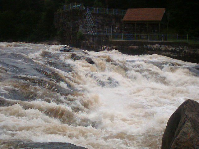
The Saint Catherine section of the Jacques Cartier, while not at popular as the other sections of the river, offers something for everyone. For the expert paddler, the class IV and V rapids are incredible. For the intermediate paddler, there is enough class II and III rapids to make the trip interesting, while the more difficult sections are easily portaged.
Put in near the Valcartier bridge in the town on Shannon by the first class V rapid. The gage is near here. Below that it is a 3.5 mile flatwater paddle to the lower (and more common) put-in.
Regional Map – Rivers of the Provincial Capitol (Quebec City) Area
_Des rivières de la région de la Capitale-Nationale (Région administrative 03)_Map by Ministère du Développement durable, de l'Environnement et des Parcs
Put in elevation........ 'Take out elevation...... 'Total drop.............. 'Average drop/mile....... 'Maximum drop/mile....... 'River profile type...... Discontinuous, Mixed easy and difficult rapids with quickwater and several lakesDistance................ 6.5 milesDuration................ 2-4 hoursShuttle length.......... 6.5 milesPortages................ 0–3River width average..... 50-1000'River geology...........River water quality.....Drainage area........... 799 sq milesScenery................. Surburban houses, woods, farms.Wildlife................Distance from Quebec.... 39 milesDistance from Montreal.. 142 milesBoréal Design Saint-Augustin-de-Desmaures (Quebec) 418-878-3099Full service paddling shop for both whitewater and sea kayaking.Camping Juneau (Paddlers' Favorite) St-Augustin-de-Desmaures418-871-9090. Full service campground l
Le King (the french use the english word) is a wild class V below the bridge. Avoid the left edge as it's full of debris. Take the center route in low water, and the right-edge in high water.
Most boaters put-on here since there is only flatwater between the class V 'The King' and this put-in. Put on where the road is next to the river. A public dock and stairs leads down to river-level. Note: There are homes along the river and privacy is limited in this area so be prepared
No trip reports yet.