Marble Creek (Tributary of St. Joe River)
Camp 3 to St. Joe Confluence
| Difficulty | III-IV |
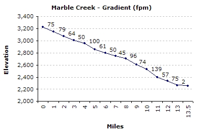
| Length | 13.9 mi |
| Avg Gradient | 64 fpm |
| Gauge | Marble Creek (estimated) |
| Flow Rate as of 31 minutes | 118 cfsbelow recommended |
| Reach Info Last Updated | March 20, 2011 |
Overview:
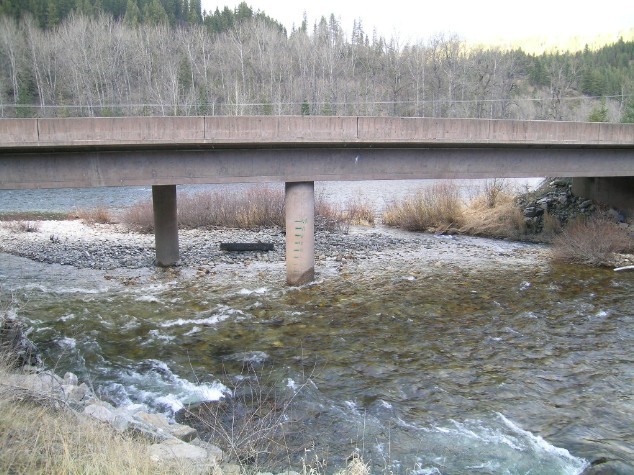
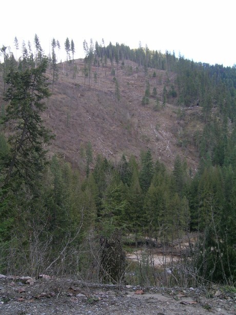
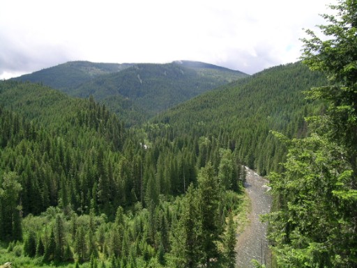
Marble Creek can be run all the way from Camp 3 to the confluence with the St. Joe for a 15+ mile day trip; However, the most commonly run section is from the bridge at mile marker 9, to the Marble Creek interpretive center at the confluence. For a condensed version of Marble with nearly non-stop whitewater, put in at Marble Creek Campground (near mile 4 or 5) and take out at the Boulder Creek Bridge. The upper most section of the creek above 9 Mile Bridge is mostly class II-III swift water, with one possible portage around the remains of an old splash dam. While not as exciting as the section below 9 mile, the road is well above the canyon on this stretch, giving it a wild character.
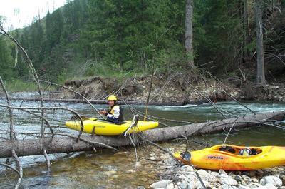
Marble Creek is very continuous, read and run class III+ with a few standout class IV rapids that should always be carefully scouted for wood. Logs are always a serious hazard on the entire run and can shift around frequently so be extremely vigilant. Swims can be long and painful on this run due to the high gradient, scarcity of eddies and relatively shallow stream bed. Keep your group tight. Most of the run below 9 mile bridge can be easily road scouted. This run is great for those contemplating stepping up to more serious class IV North Idaho creeking.
Maps:
The following US Forest Service maps are highly recommended: St. Joe National Forest / Coeur d' Alene National Forest. Most Forest Service offices in the Inland Northwest carry them.
Logistics:
Exit Interstate 90, at the Wallace, Idaho visitor's center. Work your way south through town following Placer Creek up a small canyon to road 456. Take 456 over Moon Pass (4,931') and down the N. Fork of the St. Joe to the town of Avery. From Avery, go roughly 15 miles down river to the take out at Marble Creek interpretive site.
To get to the put in, head south on road 321, up Marble Creek for approximately 9 miles, (continue on 321
...May 2, 2004
re-entry log Marble