Mokelumne
4. Ponderosa Way to Electra Picnic area
| Difficulty | II-III |
| Length | 3.1 mi |
| Avg Gradient | 30 fpm |
| Gauge | Nf Mokelumne R Bl Electra Diversion |
| Flow Rate as of 21 days | 202 cfsstale data |
| Reach Info Last Updated | October 30, 2023 |
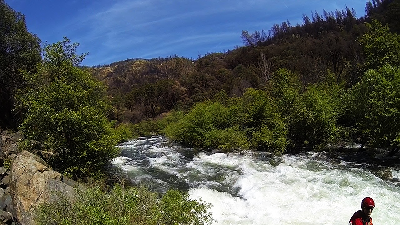
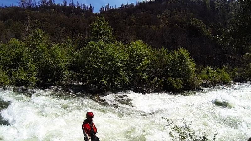
When this section has water, it makes a great addition to the Electra Run downstream, though with several class 3 rapids. The biggest rapid is the very first one. Because of the lack of regular high flows, trees and brush grow thick along the bank and sometimes out into the river bed. At 1,500 cfs the river flows through trees on the side in many locations.
PG&E diverts most of the flow around this section so it will seldom have boatable flows. Spring in wet years is the best time to check this section out. There is also one weekend day per year of scheduled release for whitewater recreation in June of non spill years.
Other Information Sources:
Charles Martin describes this run in his 1974 guidebook, Sierra Whitewater. He says the run is a good class 3.
FERC information:
The entire upper Mokelumne Watershed PG&E hydroelectric system is under a single FERC license, number P-137 A new license was issued on October 11, 2001 and will expire in 30 years from that date.
Text of whitewater boating monitoring plan.
During Below Normal, Above Normal, and Wet water years, the stated fows of at least 900 cfs (700 cfs in BN years) will be released beginning two weeks prior
to Memorial Day weekend and ending June 15 and prior to the start of spill at Salt Springs Reservoir Dam.
The Ponderosa Way whitewater boating put-in will only have releases scheduled for one weekend day between 10 AM and 2 PM (see Attachment B: Condition 28). The River Rangers will conduct the surveys each day the flows are released. During Dry and Critically Dry years, flows will be released according to the Below Normal year req
...
The online gauge for this reach is immediately below the diversion dam, so it only measures spills and required fish flows. Flows at Ponderosa Way could be somewhat to much higher than this reading. The middle fork confluence is below this gauge, but above Ponderosa Way.
The middle fork confluence is upstream of the Ponderosa Way put in, so flows on this run will be increased by whatever flow is in the Middle Fork Moke. Unfortunately, real time gauge information for the Middle Fork is not publicly available.
As of May 25, 2024, you definitely want a high clearance vehicle to get down Ponderosa Way from Hwy 26 south of the Mokelumne. Default directions from Dreamflows/AW say you could alternatively come down from north of the river, but the road there was completely covered in grass, like no one had driven it for years, and appears to go through private land (Google says something like 'restricted'). The bridge is broken/impassable to vehicles.
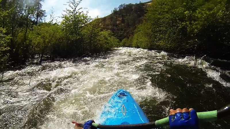
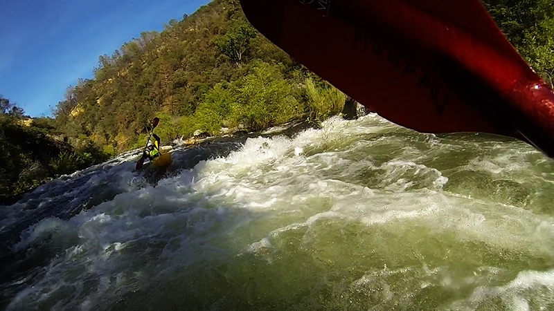
This is a two part rapid that starts about 100 yards after the put in. The entrance was easy with a few moves throughout. We entered left moving center and exited left around a middle rock that have flipped both of my buddies, both sides of the middle rock are a go. Then some boogie water moving into the last drop. The last drop you can boof the hole on the left or a rock on the right. An easier route down the middle tongue is also an option. Nice recovery pool following this 2 part rapid However, a swim at the entrance will be long and bumpy. Scout right.
This rapid starts when the river turns sharply to the left.
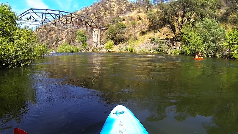
After a stretch of flatwater, the river turns to the right, then splits around an island. The right hand channel appears to be wider.
The powerhouse is on river right and will add about 800 cfs.
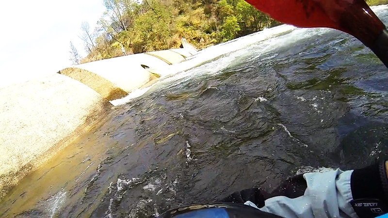
The dam looks easiest to portage on river right. Some boaters will run one of the slots, but the openings are very narrow.
Nov 9, 2018
First time on this thanks to a shuttle from a local dude who lived out of his car. Refugees from the Paradise fire at the put-in told some harrowing stories. I wouldn't do this in any boat again at this level; 500 would probably be a better minimum.
Jun 8, 2016
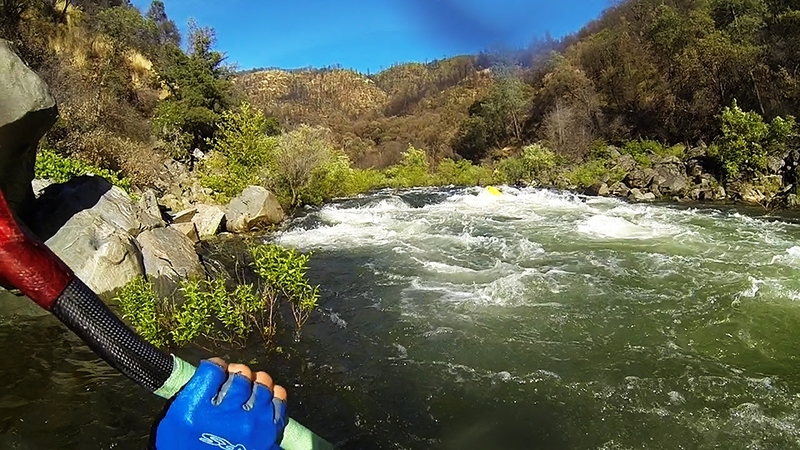
With no real description of rapids or what lied downstream other than whats mentioned above from the 70's, we headed for the river. This turned out to be an excellent day with flows around 1,150 cfs as well as a great addition to the Electra Run below the powerhouse. Myself and my buddy Daniel had fun on this 3 mile section of the Mokelumne. The run served lots of great boof opportunities and a handful of fun class III rapids. This is a great intro to Tiger Creek just upstream. Maybe Tiger Creeks cub haha! The first and last rapids were the hardest. We scouted the first rapid but nothing else. Scouting was possible on everything but not without a hike through the brush.
Note: Due to water diversion of this run there were trees growing into the river bottom and extremely bushy river banks making swims hazardous. At our flow the water was in the trees. Class III boater with solid roll required.
I highly recommend this run if your heading to the Electra section below. Put in was easy with a high clearance vehicle.
Jun 8, 2016
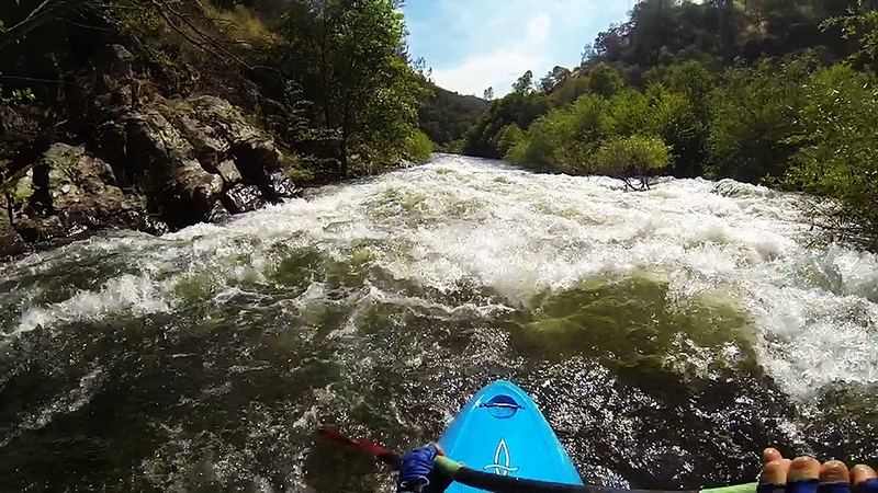
Blind Island (III) 1.1 mile, The river bends around both sides of an island neither of which you could see the other side and scouting would be an ordeal. The left channel takes you through lots of brush and then cascades were it eventually ties back into the right channel. The right channel had the most water moving through it making route selection easy. The right channel bends left through some fast splashy water and then the second part was dropping through a boulder garden. We ran center through the right channel. The second drop we ran left of the middle rock and zig zag through the rest. You can also boof middle rock. Scout right.
Jun 8, 2016
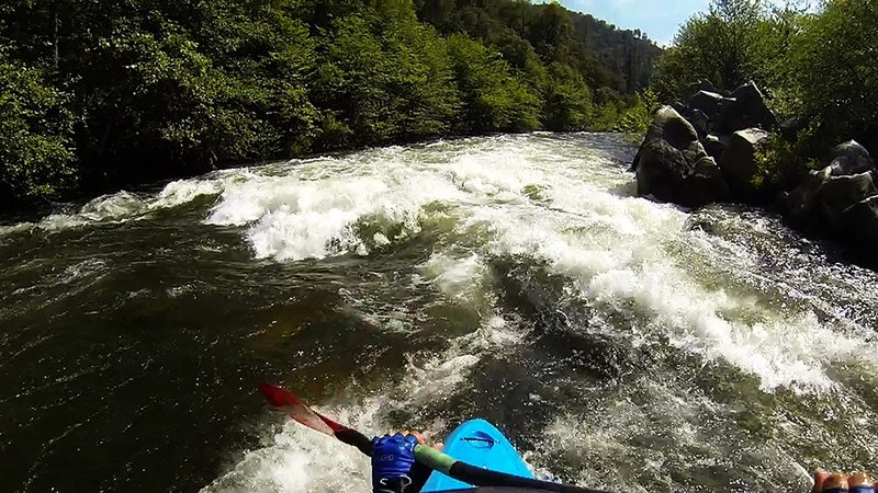
Chute (III) Rapid 3 .4 mile, Lots of brush in the river making route selection a bit nerve racking. Shallow with some gradient making a swim here painful. We took the left channel straight down the middle and through the splashy fun wave train at the bottom. Recovery pool below but next rapid is in short order. Scout left.
Jun 8, 2016
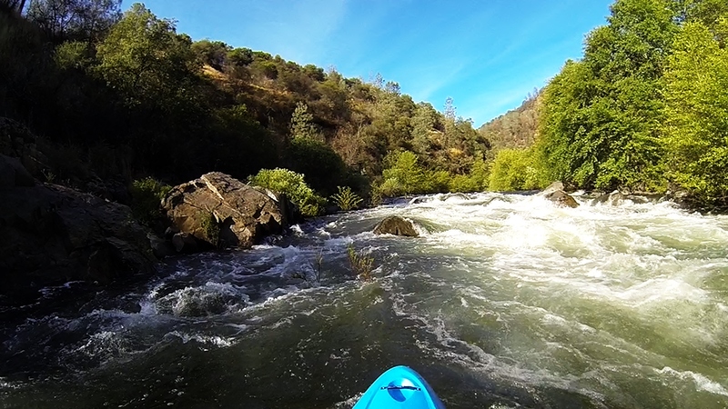
4th rapid (III) .5 mile, This rapid came in two parts, the first part was down the middle through a few holes. It then veered to the left slightly with a pour over on the far left creating a decent size hole. The right side pushed water up against a rock. We took center all the way down. Recovery pool below but next rapid is in short order. Scout right.