Owyhee
2. Crutcher's Crossing to Three Forks(Upper Owyhee/East Fork Owyhee)
| Difficulty | II-III+(V) |
| Length | 38.1 mi |
| Avg Gradient | n/a |
| Permit | Self issue permit can be downloaded from BLM website. |
| Gauge | Owyhee River Nr Rome or |
| Flow Rate as of 27 minutes | 78 cfsbelow recommended |
| Reach Info Last Updated | August 3, 2024 |
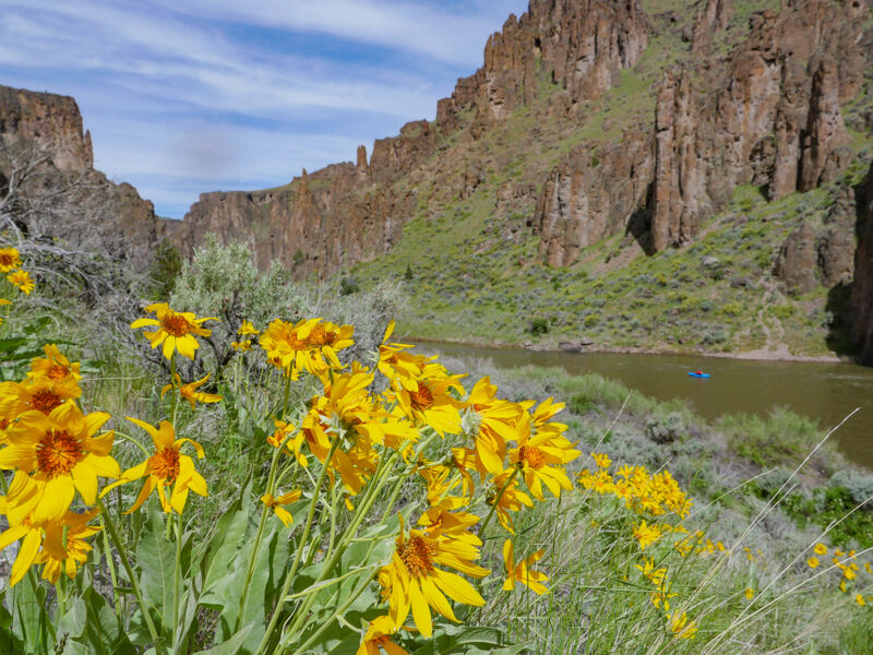
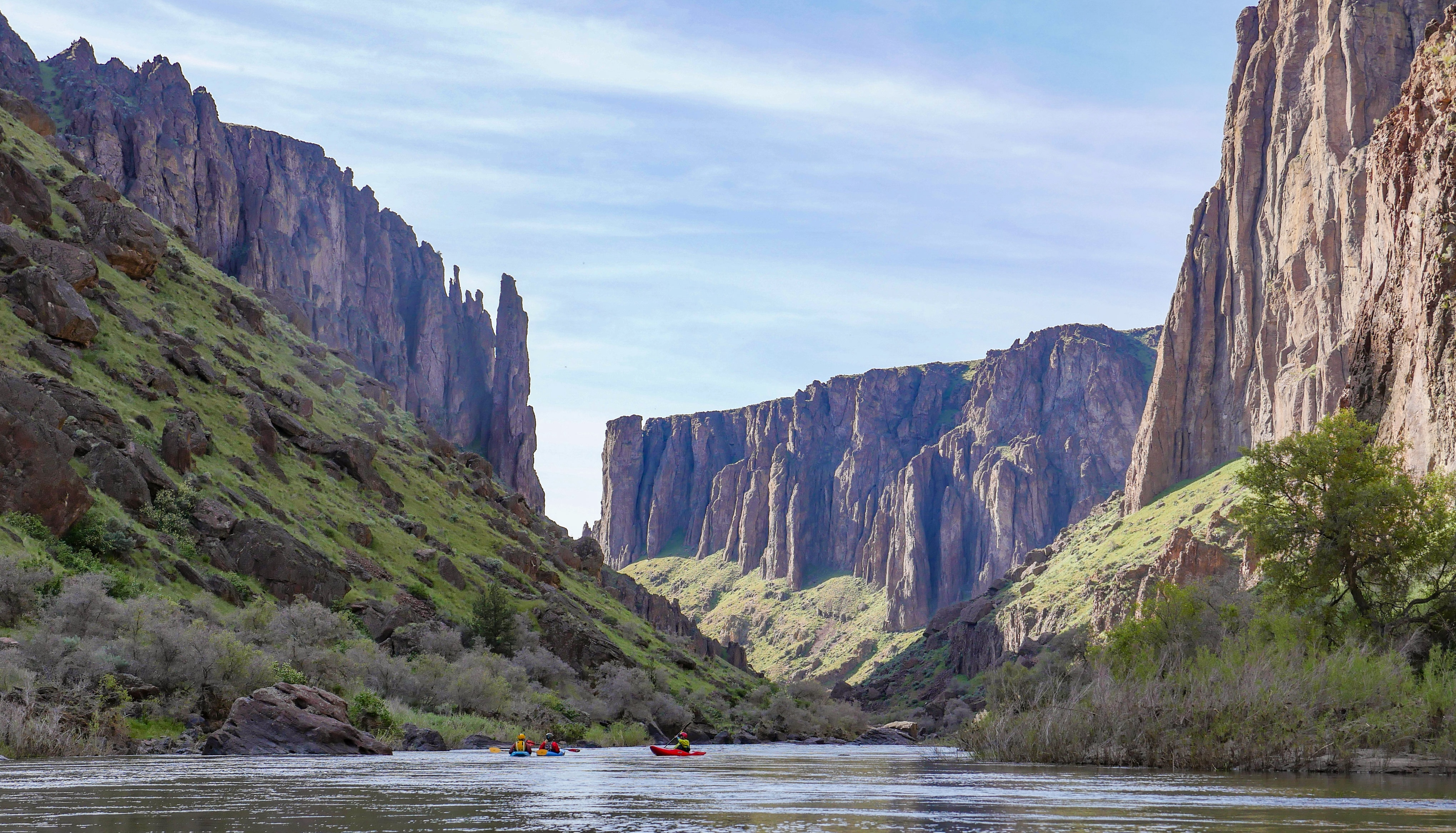
The Owyhee River, protected as a Wild and Scenic River, is renowned among river runners as one of the region’s most spectacular multi-day spring trips. Three distinct sections of the mainstem can be paddled as separate adventures or combined into one extended journey. In addition, the river’s side canyons [...]Read More
The Upper Owyhee begins where the flow converges from Duck Valley in Idaho and continues in to Oregon. The 36 mile trip below Crutcher typically takes 2 to 3 days to Three Forks or you may continue on downstream to Rome or farther. The canyon is magnificent. Most of the run is a float trip but there are a few class III rapids and a couple of more challenging rapids: Cabin and Cable.
Cabin Rapid is approximately 1/2 mile long and if you plan to scout you will want to do it in stages. It is easily recognized by the stone cabin on river right, followed by a right bend. At the top of the rapid, run left of the giant boulder that splits the current, because the right side leads to narrow slots between huge boulders. The flow combines beyond the giant boulders into a class III-IV big water section, then a brief slowdown at lower flows, then the river splits again around a cobble island and the whitewater continues. Either side can be run, but at 1100 at Crutcher the left entrance, then cutting to the right below the island, had eddies for boat scouting.
There are three relatively easy class III rapids in the space between Cabin and Cable.
Cable Rapid is easily recognized by its increased gradient leading toward a line of boulders with no obvious passage. Eddy right to scout. There is a cable affixed to boulders on river right that has been used by fishermen to portage their boats. The right channel leads to an impassable sieve. The center slot may be runnable by a kayak. The far left slot looks runnable however the move to get left is class V in difficulty and hazard, at least at 1100cfs. I'm told the rapid is easily runnable in canoes at very low water, and it probably develops into hellishly big holes at high water, though a left sneak may open up.
Logistics:
Hiring a shuttle is recommended for this run.
Put-in: Crutcher Crossing, Idaho
Crutcher Crossing is located three miles upstream of the East Fork’s confluence
...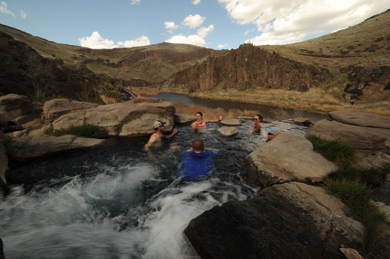
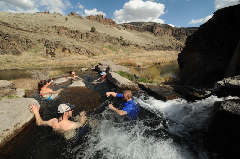
The hot spring is located on river left close to the take-out. Flows permitting you may be able to attain up from Three Forks if you are running the section from Three Forks down and want to check out the hot spring.
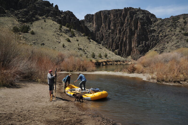
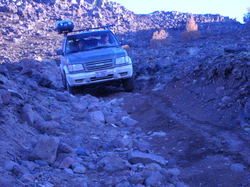
It's a long gravel road to the take-out at Three Forks. The last descent into the canyon is the toughest. High clearance is highly recommended although two-wheel drive vehicles have made it down if they proceed very carefully and are lightly loaded--and most have made it back up but it is not recommended. If a storm comes through however all bets are off and conditions can deterioriate to a point where even all-wheel drive is insufficient. Self support kayakers can hike up to the rim but it can be a long walk particularly if it is a hot sunny day. Hiking up to the rim would be a relatively easy option for pack rafters.
Aug 3, 2024
We were on this section May 14-16, 2024 at a level of around 1,100 cfs. We thought this was an excellent flow, and a remarkable section of river. There is not much whitewater, but the whitewater that is there is quality. Planning out where to grab clear water is important if you don't want to filter directly from the river itself.
Trip Report:
Apr 22, 2021
With low flows we elected not to boat the Owyhee but instead set up a base camp at Three Forks and explored the area with colleagues from Friends of the Owyhee, American Whitewater, Oregon Naturual Desert Association, and Conservation Lands Foundation. We did a couple trips up to the hotspring both hiking up and attaining up and floating back down.